Merens nr. Agen / Mérens / Pont-du-Casse
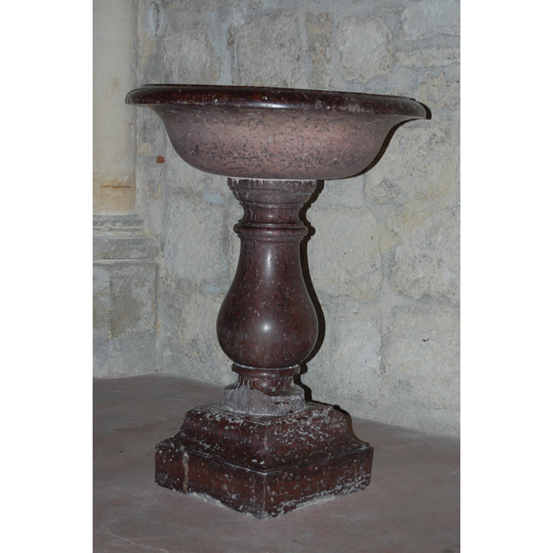
Image copyright © [in the public domain]
Entrepôt de données publiques [http://visites.aquitaine.fr/donnees-publiques] [accessed 24 November 2013]
Results: 2 records
view of font
Scene Description: the modern font of ca. 1864-1865
Copyright Statement: Image copyright © [in the public domain]
Image Source: digital photograph in http://visites.aquitaine.fr/IMG/jpg/72_47209_7_ed99a.jpg [accessed 24 November 2013]
Copyright Instructions: Entrepôt de données publiques [http://visites.aquitaine.fr/donnees-publiques] [accessed 24 November 2013]
view of church exterior - west view

Scene Description: the modern church of 1864-1865
Copyright Statement: Image copyright © [in the public domain]
Image Source: digital photograph in http://visites.aquitaine.fr/IMG/jpg/47209_003jpge7d2.jpg [accessed 24 November 2013]
Copyright Instructions: Entrepôt de données publiques [http://visites.aquitaine.fr/donnees-publiques] [accessed 24 November 2013]
INFORMATION
Font ID: 18804MER
Object Type: Baptismal Font1
Font Century and Period/Style: 13th century, Medieval
Church / Chapel Name: Église Saint-Pierre-ès-Liens de Mérens
Font Location in Church: [disappeared?]
Church Patron Saint(s): St. Peter ad vincula
Church Notes: original 13thC church demolished in 1863; new church started in 1864, consecrated in 1865 [source: http://catholique-agen.cef.fr/site/1808.html [accessed 24 November 2013]]
Church Address: 1 Route de Mérens, 47480 Pont-du-Casse, France
Site Location: Lot-et-Garonne, Nouvelle-Aquitaine, France, Europe
Directions to Site: Located off the D656. just SE of Pont-du-Casse, 7 km NE of Agen
Ecclesiastic Region: Diocèse d'Agen
Additional Comments: disappeared font? (the one from the 13thC church here]
Font Notes:
Click to view
The present font is noted and illustrated in Visites Aquitaine [http://visites.aquitaine.fr/fonds-baptismaux-de-l-eglise-saint-pierre-es] [accessed 24 November 2013]. The font is made of red marble and consists of a shallow round basin raised on a moulded round baluster pedestal base and a quadrangular lower base. It probably dates from the building of the new church in 1864-1865. [NB: we have no information on the font of the demolished 13th-century church here].
COORDINATES
UTM: 31T 315000 4900132
Latitude & Longitude (Decimal): 44.23093, 0.68354
Latitude & Longitude (DMS): 44° 13′ 51.35″ N, 0° 41′ 0.74″ E