Castle Acre No. 2 / Acre / Castleacre [disappeared?]
![Main image for Castle Acre No. 2 / Acre / Castleacre [disappeared?]](/static-50478a99ec6f36a15d6234548c59f63da52304e5/compressed/1131115015_compressed.png)
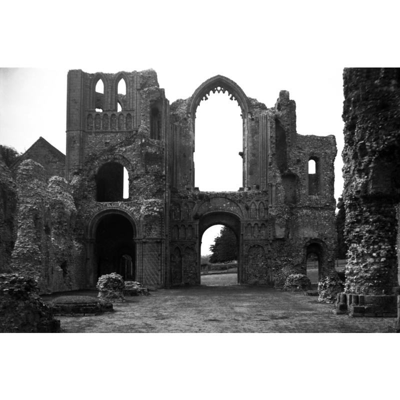
Image copyright © Simon Knott, 2005
Standing permission
Results: 7 records
view of church exterior - west portal
Copyright Statement: Image copyright © Simon Knott, 2005
Image Source: digital photograph May 2005 taken by Simon Knott [www.norfolkchurches.co.uk/castleacrepriory/castleacrepriory.htm] [accessed 12 November 2013]
Copyright Instructions: Standing permission
view of church exterior - west end
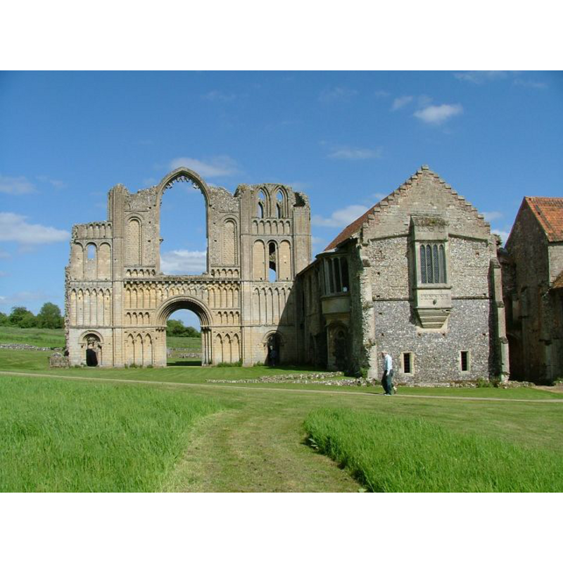
Copyright Statement: Image copyright © Simon Knott, 2005
Image Source: digital photograph May 2005 taken by Simon Knott [www.norfolkchurches.co.uk/castleacrepriory/castleacrepriory.htm] [accessed 12 November 2013]
Copyright Instructions: Standing permission
view of church exterior - cloister
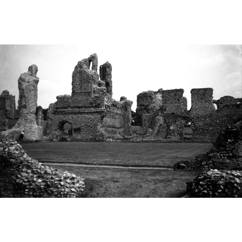
Copyright Statement: Image copyright © George Plunkett, 2013
Image Source: B&W photograph taken 16 August 1935 by George Plunkett [www.georgeplunkett.co.uk/Norfolk/C/Castle Acre Priory cloister view east [0724] 1935-08-16.jpg] [accessed 12 November 2013]
Copyright Instructions: Standing permission by Jonathan Plunkett
view of church exterior - west portal
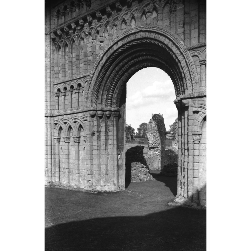
Scene Description: the great Norman portal
Copyright Statement: Image copyright © George Plunkett, 2013
Image Source: B&W photograph taken 15 September 1946 by George Plunkett [www.georgeplunkett.co.uk/Norfolk/C/Castle Acre Priory Norman W door nave [3637] 1946-09-15.jpg] [accessed 12 November 2013]
Copyright Instructions: Standing permission by Jonathan Plunkett
view of church exterior - west façade
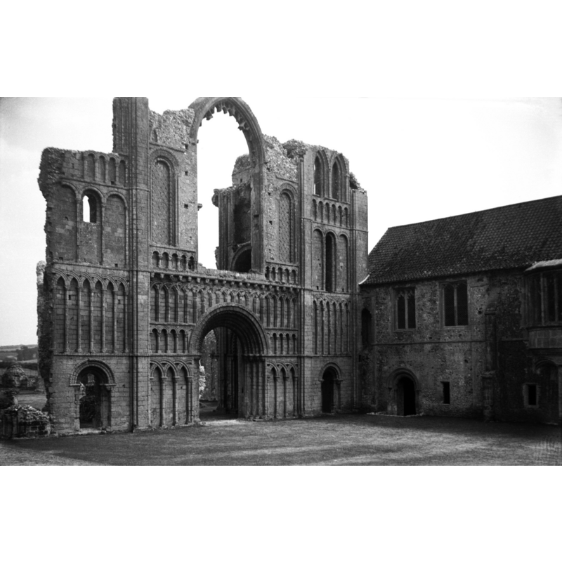
Scene Description: seen from the northwest
Copyright Statement: Image copyright © George Plunkett, 2013
Image Source: B&W photograph taken 16 August 1935 by George Plunkett [www.georgeplunkett.co.uk/Norfolk/C/Castle Acre Priory church west front ext [0722] 1935-08-16.jpg] [accessed 12 November 2013]
Copyright Instructions: Standing permission by Jonathan Plunkett
view of church exterior in context - southeast view

Copyright Statement: Image copyright © George Plunkett, 2013
Image Source: B&W photograph taken 16 August 1935 by George Plunkett [www.georgeplunkett.co.uk/Norfolk/C/Castle Acre Priory from SE [0719] 1935-08-16.jpg] [accessed 12 November 2013]
Copyright Instructions: Standing permission by Jonathan Plunkett
view of church interior - west end
Scene Description: seen from the nave, looking west
Copyright Statement: Image copyright © George Plunkett, 2013
Image Source: B&W photograph taken 16 August 1935 by George Plunkett [www.georgeplunkett.co.uk/Norfolk/C/Castle Acre Priory church west front int [0727] 1935-08-16.jpg] [accessed 12 November 2013]
Copyright Instructions: Standing permission by Jonathan Plunkett
INFORMATION
Font ID: 18772CAS
Object Type: Baptismal Font1?
Font Date: ca. 1089?
Font Century and Period/Style: 11th century (late?), Norman
Church / Chapel Name: Priory Church [in ruins]
Church Notes: priory church consecrated between 1146 and 1148; the whole is now under the care of Emglish Heritage
Church Address: Stocks Green, Castle Acre, King's Lynn, Norfolk PE32 2XD,
Site Location: Norfolk, East Anglia, England, United Kingdom
Ecclesiastic Region: [Diocese of Norwich]
Historical Region: Hundred and half of Freebridge
Additional Comments: disappeared font? (the possible font from the priory church here)
Font Notes:
Click to view
Blomefield (1805-1810) notes the many burials at this priory church but does not mention whether or not the church had also a baptismal function and font at a particular period of its history. The castle itself is reported with its own chapel, again, without mention of the extent of its function: "in this castle was a chapel with monks therein, before the death of the first Earl Warren in 1089", and thr priory church, "The site of the priory-church lies west of the castle, was a venerable large Gothic pile, of free stone flint, &c. and built in a cathederal or conventual manner; great part of the front or west end of it is still remaining, where the principal entrance was through a great arch, over which was a stately window; on each side of the great door were doors to enter into the north and south aisles, under the tower, as the grand door served for an entrance into the nave or body; at the north and south ends of this front or west end, stood 2 towers supported by strong arches and pillars; the nave or body had 12 great pillars, making 7 arches on each side, the lowest joining to the towers; on the east end of the nave stood the grand tower, supported by four great pillars, through which was the entrance into the choir; on the south and north side of this tower were 2 cross isles or transepts; and at the end of the north transept there seems to have been a chapel or vestiary; the choir was of equal breadth with the nave and isles, but much shorter, and, at the east end of it, was in form of a chapel, and here stood the high altar, as I take it. The cloister was on the south side of the church, and had an entrance into it, at the west end of the south isle near to the tower, and another at the east end of the said isle near the grand tower; the chapter-house seems to have joined to the east side of the cloister, and the dormitory to have been over the west part of the cloister. West of the cloister, and adjoining was the prior's apartment, now converted into a farm-house". Of the founding of the priory at Castle Acre Bolmefield (ibid.) notes that William Earl Warren, from Normandy, had received from William the Conqueror the lands that had been in the hands of the Saxon thane Toche before the Conquest; the earl, who died in 1089, "had frequently his residence in this town, where he built a castle, and begun the foundation of the priory, [...] a short time before his death." There is practically no trace left of the castle chapel today, there are abundant ruins left of the old priory.
Credit and Acknowledgements: We are grateful to Simon Knott, of Norfolk Churches [www.norfolkchurches.co.uk], for his photographs of this church; we are also grateful to Jonathan Plunkett for the photographs of this priory church taken by his father, George Plunkett, in 1935 and 1946
COORDINATES
UTM: 31U 343480 5841475
Latitude & Longitude (Decimal): 52.700528, 0.683556
Latitude & Longitude (DMS): 52° 42′ 1.9″ N, 0° 41′ 0.8″ E
REFERENCES
- Blomefield, Francis, An essay towards a topographical history of Norfolk, 1805-1810, vol. 8: 356-377 / [www.british-history.ac.uk/report.aspx?compid=78480] [accessed 12 November 2013]