Wood Norton No. 2 / Nortuna / Woodnorton
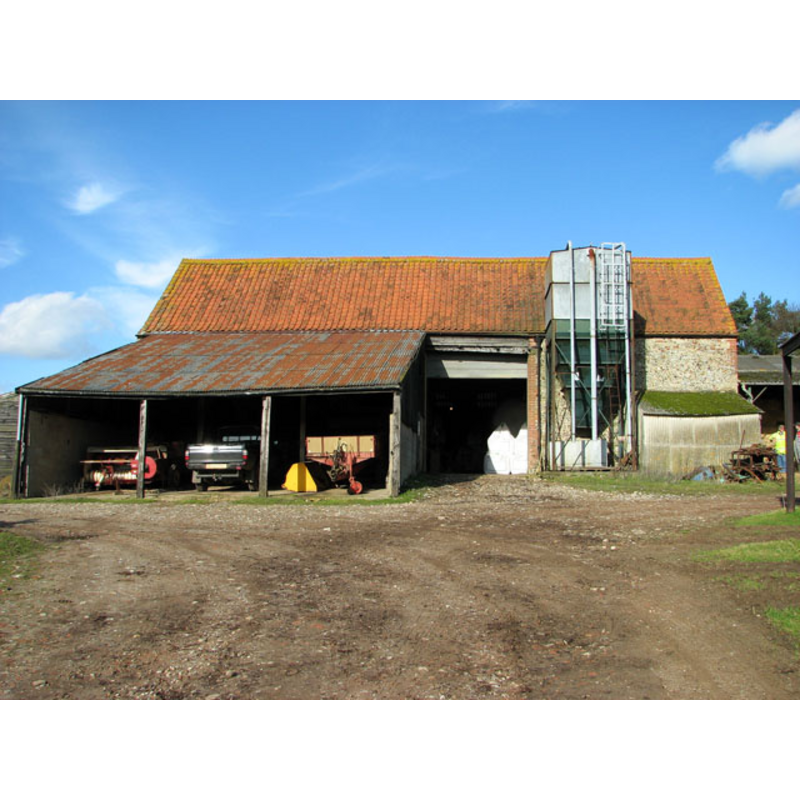
Image copyright © Evelyn Simak, 2011
CC-BY-SA-3.0
Results: 3 records
view of church exterior
Scene Description: the building behind the open garage is what remains of the former church of St. Peter
Copyright Statement: Image copyright © Evelyn Simak, 2011
Image Source: digital photograph taken 14 February 2011 by Evelyn Simak [www.geograph.org.uk/photo/2270396] [accessed 5 November 2013]
Copyright Instructions: CC-BY-SA-3.0
view of church interior - southwest side
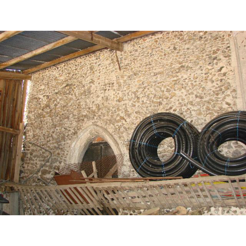
Scene Description: the west end of the south wall of the former church of St. Peter
Copyright Statement: Image copyright © Adrian S Pye, 2009
Image Source: digital photograph taken 29 June 2009 by Adrian S Pye [www.geograph.org.uk/photo/1860584] [accessed 5 November 2013]
Copyright Instructions: CC-BY-SA-3.0
view of church interior - detail
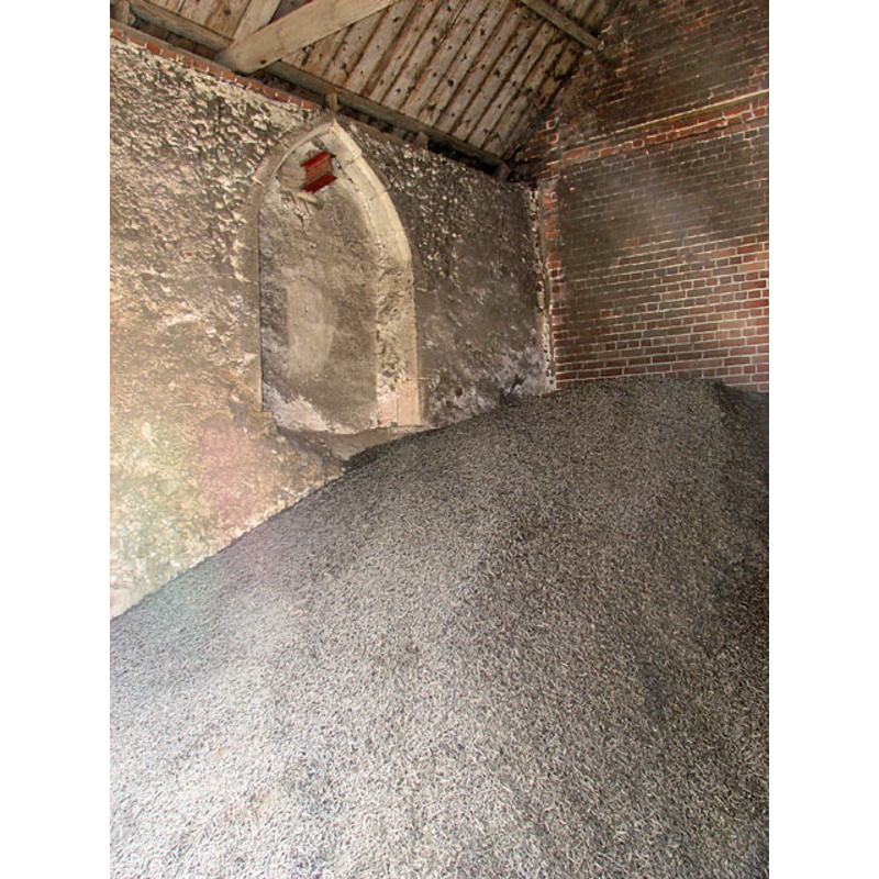
Scene Description: the former church of St. Peter
Copyright Statement: Image copyright © Evelyn Simak, 2011
Image Source: digital photograph taken 14 February 2011 by Evelyn Simak [www.geograph.org.uk/photo/2270402] [accessed 5 November 2013]
Copyright Instructions: CC-BY-SA-3.0
INFORMATION
Font ID: 18755WOO
Object Type: Baptismal Font1?
Font Date: ca. 1200?
Font Century and Period/Style: 12th - 13th century, Medieval
Church / Chapel Name: Parish Church of St. Peter [cf. FontNotes]
Church Wikidata: https://www.wikidata.org/wiki/Q26446072
Church Patron Saint(s): St. Peter
Church Address: Wood Norton, Norfolk NR20 5BD
Site Location: Norfolk, East Anglia, England, United Kingdom
Directions to Site: Located near Norton Hall [cf. FontNotes], 10 km ESE of Fakenham
Ecclesiastic Region: [Diocese of Norwich -- formerly Diocese of Thetford]
Historical Region: Hundred of Eynford
Additional Comments: disappeared font? (the one from the ca.1200 church here)
Font Notes:
Click to view
Of the four entries for "Nortuna" found in the Domesday survey, only one mentions a third part of church in this 'beruita' that belonged to the bishops of Thetford. Blomefield (1805-1810) writes: "There were two churches standing in this town in the 5th of Henry V.[i.e., 1418] [...]; AllSaints [and] St. Peter's [...] but St. Peter's has been dilapidated long since, and consolidated with AllSaints [...] All-Saints church has no steeple, but a frame for bells in the churchyard." Blomefield (ibid.) also mentions presentations to these churches at different dates, the earliest to St. Peter's, in 1308, the next to All Saints', in 1310. White's Directory of 1854 (p. 450-451) notes: "There was anciently another church here, dedicated to St. Peter, some portions of which are now converted into a barn." The British Listed buildings [www.britishlistedbuildings.co.uk/en-224031-manor-farm-barn-former-church-of-st-pete] [accessed 5 November 2013] notes: "Farm barn, former church of St. Peter. Nave only with c.1200 to c.1500 evidence. Flint with brick dressings. C20 pantiled roof. West gable with blocked gable lancet c.1200, south west corner with conglomerate quoins above suggesting yet earlier beginnings; south side with Decorated/Perpendicular door arch, blocked 2 light Perpendicular window with tracery head surviving, central cart doors, cut stone lancet. Chancel demolished, brick east gable. North side with Perpendicular 2-light windows and blocked Decorated window embrasure to east. C20 roof and lean-to additions to north, not of special interest." [NB: we have no information on the font from the original church here]
COORDINATES
Latitude & Longitude (Decimal): 52.80538, 0.98570
Latitude & Longitude (DMS): 52° 48′ 19.37″ N, 0° 59′ 8.52″ E