Lyng nr. East Dereham No. 2 / Ling
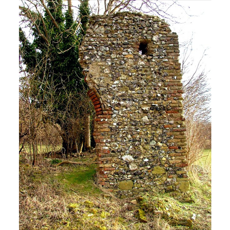
Image copyright © Simon Knott, 2006
Standing permission
Results: 2 records
view of church exterior - detail
Copyright Statement: Image copyright © Simon Knott, 2006
Image Source: digital photpgraph April 2006 taken by Simon Knott [www.norfolkchurches.co.uk/lyngedmund/lyngedmund.htm] [accessed 9 October 2013]
Copyright Instructions: Standing permission
view of church exterior in context
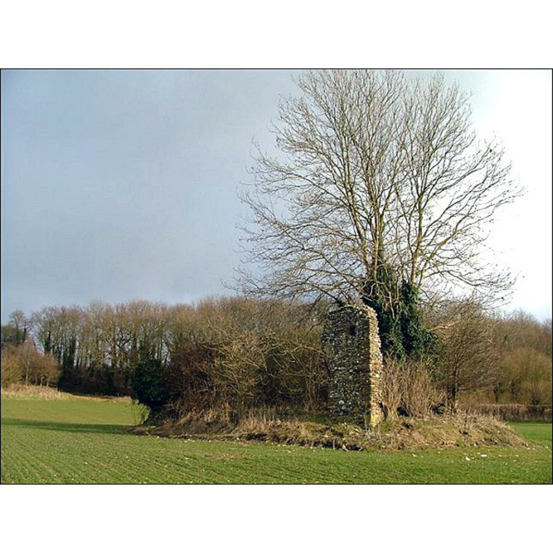
Scene Description: the ruins of old St. Edmund
Copyright Statement: Image copyright © Simon Knott, 2006
Image Source: digital photpgraph April 2006 taken by Simon Knott [www.norfolkchurches.co.uk/lyngedmund/lyngedmund.htm] [accessed 9 October 2013]
Copyright Instructions: Standing permission
INFORMATION
Font ID: 18723LYN
Object Type: Baptismal Font1?
Font Century and Period/Style: Medieval
Church / Chapel Name: Chapel of St. Edmund / [aka Priory Church of St. Edmund] [in ruins]
Church Patron Saint(s): St. Edmund the Martyr [aka Edmund of East Anglia]
Church Address: Easthaugh Road, Lyng, Norfolk NR9 5LL
Site Location: Norfolk, East Anglia, England, United Kingdom
Directions to Site: The ruins are located in a field off Easthaugh Road, just E of Lyng
Ecclesiastic Region: [Diocese of Norwich]
Historical Region: Hundred of Eynford
Additional Comments: disappeared font? (the one from the former chapel which appears to have had parochial functions after the nuns left in the 12thC)
Font Notes:
Click to view
The Domesday entry for "Ling" reports neither church nor cleric in it. Blomefield (1805-1810) writes: "Here was in ancient days, a religious house or nunnery, which is said to have been removed to Thetford, about 1176 [...] St. Edmund's chapel, belonging to the late nunnery, with several lands here". A quote from the Memorials of St Edmund’s Abbey, Vol III (London, 1896: p. 327-35) and reference to a "ascinating glimpse of the chapel preserved in the Bodleian MS 240" appear in a Wikipedia article [http://en.wikipedia.org/wiki/St._Edmund%27s_Chapel,_Lyng] [accessed 9 October 2013] that notes: "The chapel was formerly part of a Benedictine nunnery. It is unknown when the chapel was built, but the nuns moved away to Thetford in 1176", which matches Blomefield [cf. supra]. Several local sources date most of the visible ruins to the 15th century. Knott (2006) writes: "If there was ever a surviving arch, it has gone now. It must have been the north doorway, because the red-brick outline of the western side survives in an outcrop of flint wall about three metres tall. It is directly behind the tree, and must be invisible in Summer. Just beyond the surviving fragment of archway, to the west, is a brick corner, and so I think that this must have been a towerless church. [...] Hardly anything survives of Lyng's former second church."
Credit and Acknowledgements: We are gratefult to Simon Knott, of Norfolk Churches [www.norfolkchurches.co.uk], for his photographs of the ruins of this church
COORDINATES
UTM: 31U 370136 5842201
Latitude & Longitude (Decimal): 52.7141, 1.0775
Latitude & Longitude (DMS): 52° 42′ 50.76″ N, 1° 4′ 39″ E