Caputh nr. Dunkeld
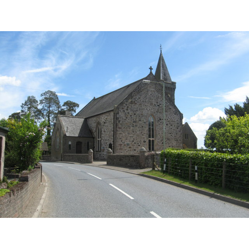
Image copyright © Liz 'n' Jim, 2010
CC-BY-SA-3.0
Results: 2 records
view of church exterior - southeast view
Copyright Statement: Image copyright © Liz 'n' Jim, 2010
Image Source: digital photograph taken 3 June 2010 by Liz 'n' Jim [www.geograph.org.uk/photo/1901154] [accessed 22 September 2013]
Copyright Instructions: CC-BY-SA-3.0
view of church exterior in context - southeast view
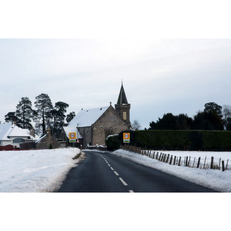
Copyright Statement: Image copyright © Mike Pennington, 2009
Image Source: digital photograph taken 29 December 2009 by Mike Pennington [www.geograph.org.uk/photo/1645549] [accessed 22 September 2013]
Copyright Instructions: CC-BY-SA-3.0
INFORMATION
Font ID: 18703CAP
Object Type: Baptismal Font1
Font Date: ca. 1500?
Font Century and Period/Style: 15th - 16th century, Late Medieval
Church / Chapel Name: Parish Church
Church Notes: church here since the 9thC; present church built in 1798 with 19thC and 20thC additions
Church Address: Caputh, Perth and Kinross PH1 4JQ
Site Location: Perth & Kinross, Scotland, United Kingdom
Directions to Site: Located on the A984 [aka Old Military Road], 7 km E of Dunkeld
Ecclesiastic Region: Diocese of Dunkeld
Historical Region: Perthshire, partly in Forfarshire
Additional Comments: disappeared font? (the one from the late medieval church here)
Font Notes:
Click to view
Lewis' Topographical Dictionary of Scotland of 1846 notes: "Caputh is mentioned in Mylne's Lives of the Bishops of Dunkeld, as originally forming a portion of the parish of Little Dunkeld, and as having been erected into a distinct parish, in the year 1500, by Bishop Brown, who built, at his own cost, a quire, with painted ceiling and glazed windows, and gave, for the support of the minister, a vicarage which had been formerly united to his see, four acres of glebe land, and some rising ground, called the Mute-hill, for the erection of a church. This author also informs us, that the parish of Dowally was once a part of Caputh, and that the same bishop built and endowed a church in honour of St. Anne, among the woods of the church lands of that district, in consequence of having heard that the Irish language was spoken in the Highland parts of Caputh. [...] The church, built in 1798, is a plain commodious edifice, situated on an eminence near the southern border, and contains sittings for 800 persons; it has lately been extensively repaired, and improved by the erection of a new porch at each end." [NB: we have no information on the font from the original church here]
COORDINATES
UTM: 30V 470190 6266635
Latitude & Longitude (DMS): 56° 32' 37.47" N, N 3° 29' 3.58" W