Whitland / Eglwys Fair Glyn-taf / Eglwys-Vair-Lan-Tâf / Hendy-gwyn ar Daf / Hendy Gwyn âr Daf
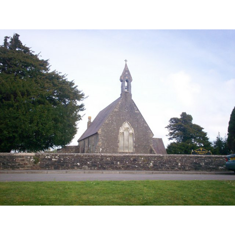
Image copyright © welshbabe, 2009
CC-BY-SA-3.0
Results: 1 records
view of church exterior - northwest view
Copyright Statement: Image copyright © welshbabe, 2009
Image Source: digital photograph taken 7 April 2009 by welshbabe [www.geograph.org.uk/photo/1298523] [accessed 21 September 2013]
Copyright Instructions: CC-BY-SA-3.0
INFORMATION
Font ID: 18700WHI
Object Type: Baptismal Font1?
Church / Chapel Name: Parish Church of St. Mary / Eglwys Fair Glyn-taf [formerly Capel Mair ar Glannau Dâf]
Church Patron Saint(s): St. Mary the Virgin
Church Notes: Whitland Abbey [aka Albalanda] was founded by Bernard, bishop of St. David's (1115-1148), and remained under episcopal patronage until its suppression. [NB: as John Davies points out in his 'A Visit to St Mary's Parishon the Banks[...]' (Fforwm Cerrig Cymru, 2010:8ff), the abbey was not at the river "Tâf at Whitland but on it’s northern tributary, the little River Gronw, approximately 2 km north of the Tâf. [...] The correct name for Whitland is Hendy Gwyn âr Daf - The Old White House on the Tâf." -- church rebuilt in 1853
Church Address: Whitland, Dyfed SA34 0QE
Site Location: Carmarthenshire, Dyfed, Wales, United Kingdom
Directions to Site: Located on the A40, W of St. Clears
Ecclesiastic Region: Diocese of St. David's
Additional Comments: disappeared font? (the one from the original church here)
Font Notes:
Click to view
Lewis (1844) writes: "In the hamlet of Regwm, in the parish [of Llanboidy], is a chapel dedicated to St. David, called Eglwys-Vair-Lan-Tâf [...] on the border of Pembrokeshire: the living is a perpetual curacy". Davies (2010) writes: "The correct name for Whitland is Hendy Gwyn âr Daf - The Old White House on the Tâf. [...] The present town of Whitland [...] has no buildings older than the mid C19th and was built around the C18th turnpike road and the railway. Therefore, the name must refer to something much older, even older than the abbey itself. The monks referred to Whitland as Hendy Gwyn - the ‘Old’ White House - but the Laws refer to Ty Gwyn ar Dâf , just the ‘White House’. On the banks of the river Tâf, at the crossing point, stands the Victorian church of St Mary’s [...] It used to be called Capel Mair ar Glannau Dâf (St Mary’s Chapel on the banks of the Tâf) and its location warranted further study. The church was rebuilt in 1850 -1853 [...] The site of St Mary’s churchyard is a platform
slightly raised above the flood-plain of the river Tâf, upstream from the mouth of the River Gronw, which drains Whitland Abbey lands. It is an ovalshaped Llan of classical form, probably built on an earlier island. This would suggest that this is the site of a British church dating from as early as the C6th. The site has another peculiarity - it once had a wet moat around it - which makes it a very unusual ecclesiastical setting." Davies (ibid.) argues that "there is some evidence of a pre-existing church provided by two exotic blocks of stone, one loose and one actually forming part of the foundation of the eastern chancel wall". [NB: we have no information on the font of the original church here].
slightly raised above the flood-plain of the river Tâf, upstream from the mouth of the River Gronw, which drains Whitland Abbey lands. It is an ovalshaped Llan of classical form, probably built on an earlier island. This would suggest that this is the site of a British church dating from as early as the C6th. The site has another peculiarity - it once had a wet moat around it - which makes it a very unusual ecclesiastical setting." Davies (ibid.) argues that "there is some evidence of a pre-existing church provided by two exotic blocks of stone, one loose and one actually forming part of the foundation of the eastern chancel wall". [NB: we have no information on the font of the original church here].
COORDINATES
UTM: 30U 388910 5741744
Latitude & Longitude (Decimal): 51.815482, -4.611631
Latitude & Longitude (DMS): 51° 48′ 55.73″ N, 4° 36′ 41.87″ W
REFERENCES
- Davies, John, "A Visit to St Mary’s Parish on the Banks of the Tâf River At Whitland - Questions Raised", 7 (February 2010), Fforwm Cerrig Cymru / Welsh Stone Forum, 2010, pp. 8-11; p. 8ff
- Lewis, Samuel, A Topographical Dictionary of England, Comprising the Several Counties, Cities, Boroughs, Corporate and Market Towns, Parishes, Chapelries, and Townships, and the Islands of Guernsy, Jersey, and Man, with Historical and Statistical Descriptions [...], London: S. Lewis, 1848-1849, [transcribed in www.genuki.org.uk/big/wal/CMN/EglwysFairGwynTaf/ [accessed 21 September 2013]