San Cebrian de Mazote No. 2 / San Cebrián de Mazote
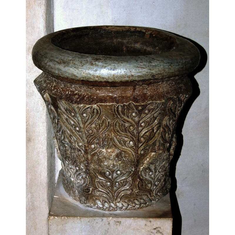
Image copyright © Francisco José García Gómez, 2011
Image and permission received from the author (e-mail of 23 August 2013)
Results: 7 records
design element - motifs - roll moulding
Copyright Statement: Image copyright © Francisco José García Gómez, 2011
Image Source: digital photograph taken 9 June 2011 by Francisco José García Gómez
Copyright Instructions: Image and permission received from the author (e-mail of 23 August 2013)
design element - motifs - floral and foliage
Copyright Statement: Image copyright © Francisco José García Gómez, 2011
Image Source: digital photograph taken 9 June 2011 by Francisco José García Gómez
Copyright Instructions: Image and permission received from the author (e-mail of 23 August 2013)
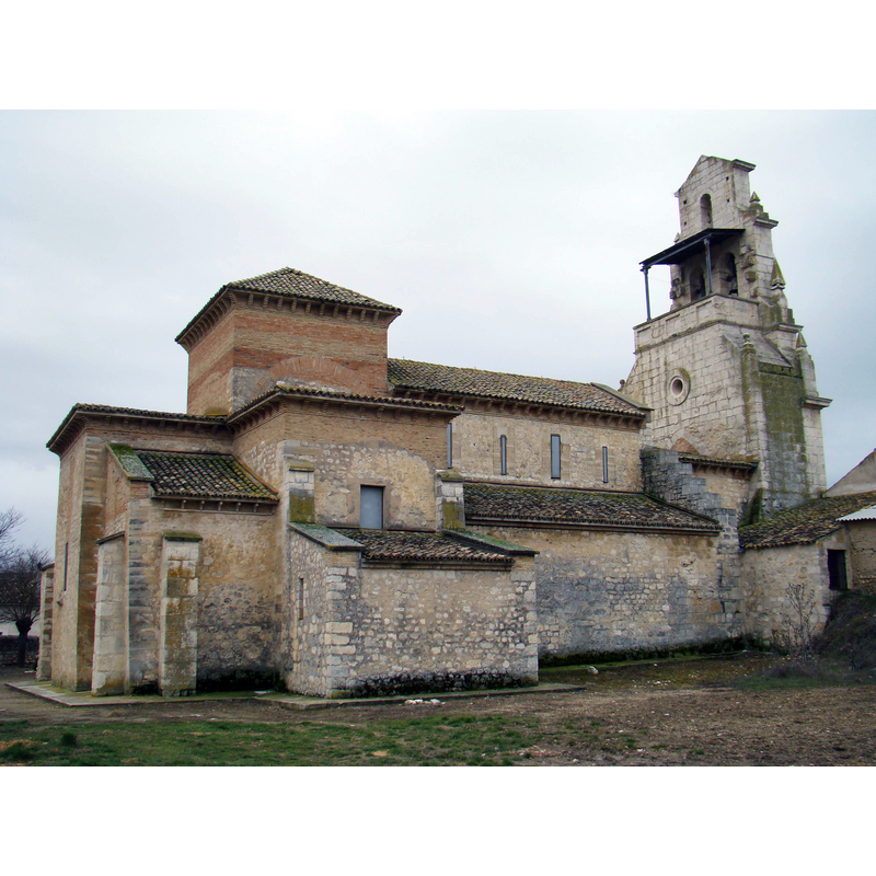
view of church exterior - northeast view
Copyright Statement: Image copyright © Nicolás Pérez, 2011
Image Source: digital photograph taken 20 February 2011 by Nicolás Pérez [http://commons.wikimedia.org/wiki/File:San_Cebrián_de_Mazote_iglesia_mozarabe_ni.jpg] [accessed 25 August 2013]
Copyright Instructions: CC-BY-SA-3.0
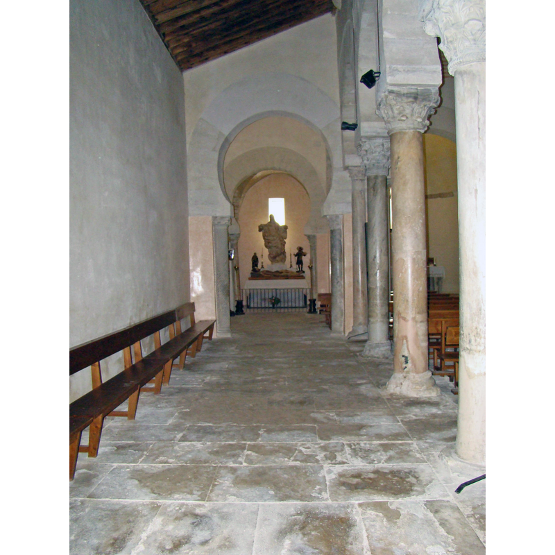
view of church interior - north aisle - looking east
Copyright Statement: Image copyright © Nicolás Pérez, 2011
Image Source: digital photograph taken 20 February 2011 by Nicolás Pérez [http://commons.wikimedia.org/wiki/File:San_Cebrián_de_Mazote_iglesia_mozarabe_nave_evangelio_ni.jpg] [accessed 25 August 2013]
Copyright Instructions: CC-BY-SA-3.0
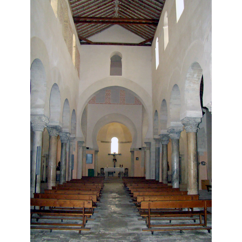
view of church interior - nave - arcade
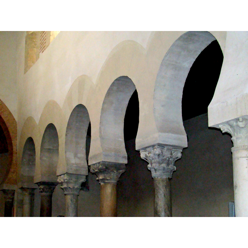
Scene Description: the Mozarabic arches and capitals of the arcade between the nave and the north aisle
Copyright Statement: Image copyright © Nicolás Pérez, 2011
Image Source: digital photograph taken 20 February 2011 by Nicolás Pérez [http://commons.wikimedia.org/wiki/File:San_Cebrián_de_Mazote_iglesia_arcos_mozarabes_ni.jpg] [accessed 25 August 2013]
Copyright Instructions: CC-BY-SA-3.0
view of church interior - nave - looking east
Copyright Statement: Image copyright © Nicolás Pérez, 2011
Image Source: digital photograph taken 20 February 2011 by Nicolás Pérez [http://commons.wikimedia.org/wiki/File:San_Cebrián_de_Mazote_iglesia_mozarabe_nave_central_ni.jpg] [accessed 25 August 2013]
Copyright Instructions: CC-BY-SA-3.0
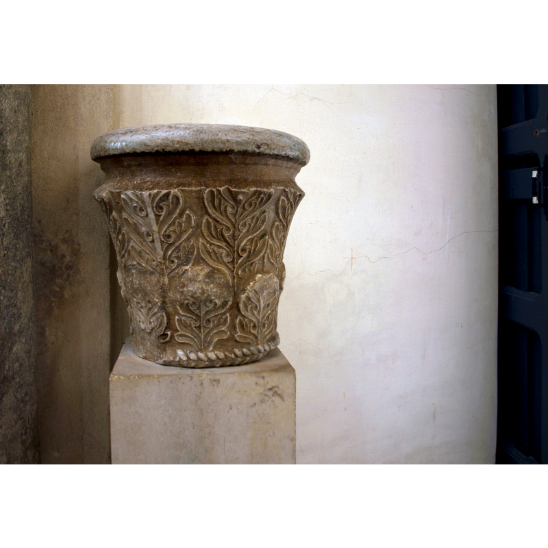
view of stoup
INFORMATION
Font ID: 18627MAZ
Object Type: Stoup
Font Century and Period/Style: 10th - 11th century, Mozarabic? / Early Romanesque?
Church / Chapel Name: Iglesia de San Cipriano [aka San Cebrián]
Font Location in Church: [cf. FontNotes]
Church Patron Saint(s): St. Ciprian
Church Notes: "Su origen se debe a una comunidad religiosa creada por cristianos mozárabes que escapaban de Al Andalus a finales del siglo IX, aprovechando el impulso dado a la reconquista por Alfonso III. Se tienen noticias de que la comunidad ya estaba completamente formada en el año 915, alrededor de un monasterio mozárabe del que se conserva su iglesia, una de las más importantes que aún existen del siglo X en España" [http://es.wikipedia.org/wiki/San_Cebrián_de_Mazote] [accessed 24 August 2013] -- a Visigothic church may have existed here prior to the arrival of the Mozarabic community
Church Address: 47129 San Cebrián de Mazote, Valladolid, Spain
Site Location: Valladolid, Castilla y León, Spain, Europe
Directions to Site: Located in the municipality of San Cebrián de Mazote, 63 km from Valladolid capital
Ecclesiastic Region: Diócesis de Valladolid
Historical Region: Montes Torozos
Additional Comments: re-cycled capital
Font Notes:
Click to view
A former Mozarabic capital decorated with a thick roll moulding at the upper rim, and floral and foliage pattern all around the sides; stands on a square pedestal colum.
Credit and Acknowledgements: We are grateful to Francisco José García Gómez for his photograph of this object
COORDINATES
UTM: 30T 321316 4616575
Latitude & Longitude (Decimal): 41.6809, -5.146814
Latitude & Longitude (DMS): 41° 40′ 51.24″ N, 5° 8′ 48.53″ W
MEDIUM AND MEASUREMENTS
Material: stone
Font Shape: other (capital)
Basin Interior Shape: round
Basin Exterior Shape: round