South Runcton / Runcton Holme / Runghetuna / Rungton / Rungton Holme / South Rungton
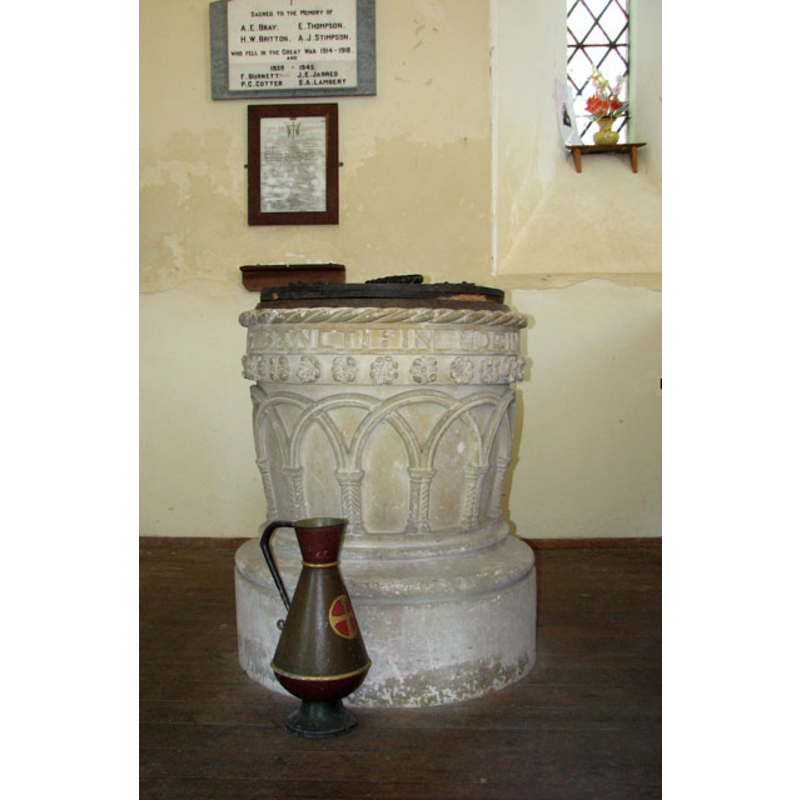
Image copyright © Evelyn Simak, 2010
CC-BY-SA-3.0
Results: 6 records
view of font and cover
Scene Description: the modern font [cf. FontNotes]
Copyright Statement: Image copyright © Evelyn Simak, 2010
Image Source: digital photograph taken 6 May 2010 by Evelyn Simak [www.geograph.org.uk/photo/1847441] [accessed 22 August 2013]
Copyright Instructions: CC-BY-SA-3.0
view of church exterior - west view
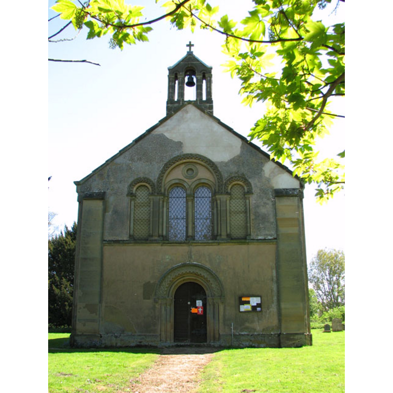
Copyright Statement: Image copyright © Evelyn Simak, 2010
Image Source: digital photograph taken 6 May 2010 by Evelyn Simak [www.geograph.org.uk/photo/1847406] [accessed 22 August 2013]
Copyright Instructions: CC-BY-SA-3.0
view of church exterior - southeast view
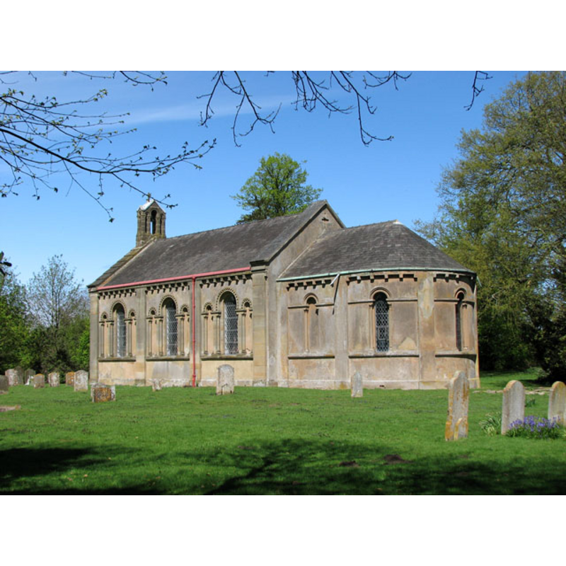
Copyright Statement: Image copyright © Evelyn Simak, 2010
Image Source: digital photograph taken 6 May 2010 by Evelyn Simak [www.geograph.org.uk/photo/1847391] [accessed 22 August 2013]
Copyright Instructions: CC-BY-SA-3.0
view of church exterior - southeast view
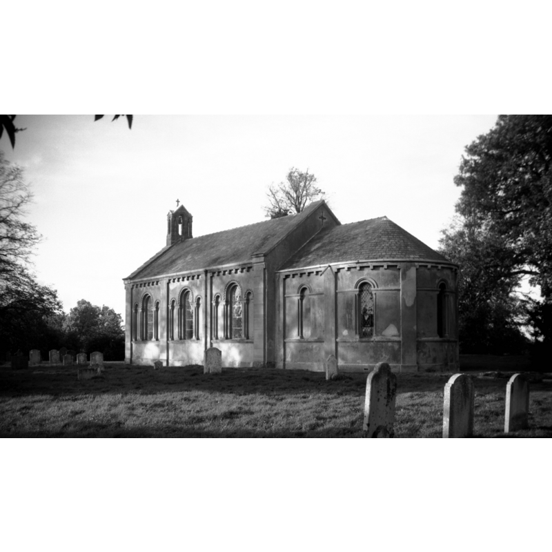
Scene Description: in 1995
Copyright Statement: Image copyright © George Plunkett, 2013
Image Source: B&W photograph taken 28 October 1995 by George Plunkett [www.georgeplunkett.co.uk/Norfolk/S/S Runcton St Andrew's church from SE [7283] 1995-10-28.jpg] [accessed 22 August 2013]
Copyright Instructions: Standing permission by Jonathan Plunkett
view of church interior - nave - looking west
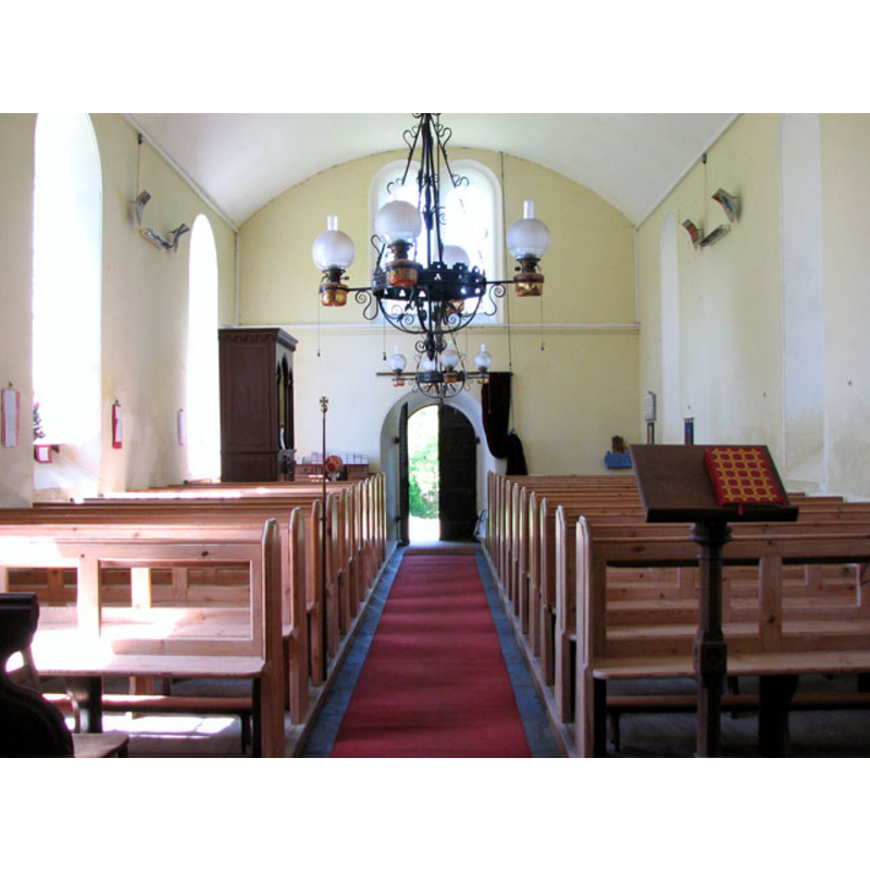
Copyright Statement: Image copyright © Evelyn Simak, 2010
Image Source: digital photograph taken 6 May 2010 by Evelyn Simak [www.geograph.org.uk/photo/1847439] [accessed 22 August 2013]
Copyright Instructions: CC-BY-SA-3.0
view of church interior - nave - looking east
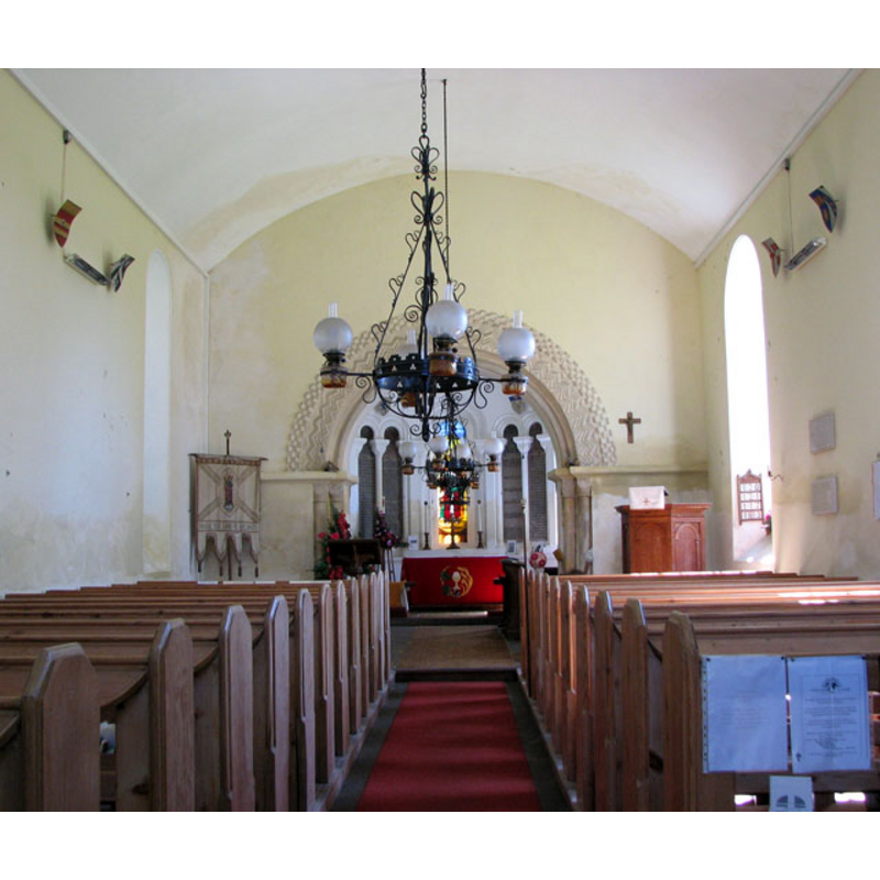
Copyright Statement: Image copyright © Evelyn Simak, 2010
Image Source: digital photograph taken 6 May 2010 by Evelyn Simak [www.geograph.org.uk/photo/1847429] [accessed 22 August 2013]
Copyright Instructions: CC-BY-SA-3.0
INFORMATION
Font ID: 18626RUN
Object Type: Baptismal Font1?
Font Century and Period/Style: 10th - 12th century, Pre-Conquest? / Norman?
Church / Chapel Name: Parish Church of St. Andrew
Church Wikidata: https://www.wikidata.org/wiki/Q17555539
Church Patron Saint(s): St. Andrew
Church Address: Lynn Road, Runcton Holme, Norfolk PE33 0EW
Site Location: Norfolk, East Anglia, England, United Kingdom
Directions to Site: Located 7 km NNW of Downham Market
Ecclesiastic Region: Diocese of Ely
Historical Region: Hundred and half of Clackclose
Additional Comments: disappeared font? (the one from the medieval church here)
Font Notes:
Click to view
There are two entries for "Runcton [Holme] and [South] Runcton" in the Domesday survey [https://opendomesday.org/place/XX0000/runcton-holme-and-south-runcton/] [accessed 26 August 2023], neither of which mentios priest or church in it. Blomefield (1805-1810) writes: "The Church of Rungton is dedicated to St. Andrew, and was a rectory in the patronage of the abbot of Bury, given to that abbey with the manor, by Alfrick Bishop of Elmham [NB: there were three Ælfric who held the episcopal chair at Elmham, the last in the early 11th century] The church appears to be a very antique pile, built of rag-stone, &c. dug in the neighbourhood, and lately repaired with brick in many places: it consists of a nave and a chancel covered with reed; the nave is in length about 47 feet, and in breadth about 21; at the west end near a window of the gable (here being no tower) hangs a small bell. [...] 1301, Robert de Ereswell, presented by the abbot and convent of Bury". Knott (2009) notes the present church here as built in 1839 by architect John Brown "replacing a genuine Norman church on the same site, and actually retained the lower part of the chancel arch". The present font here is modern, probably of the date of the re-building, in a neo-Norman style. [NB: we have no information on the font from the medieval church here].
Credit and Acknowledgements: We are grateful to Jonathan Plunkett for the photograph of this church taken by his pather, George Plunkett, in 1995
COORDINATES
Latitude & Longitude (Decimal): 52.6535, 0.4160
Latitude & Longitude (DMS): 52° 39' 11.68" N, 0° 24' 59.14" E
REFERENCES
- White, William, History, gazetteer, and directory of Norfolk and the city and County of the city of Norwich [...], Sheffield: Robert Leader, 1845, [transcribed in http://www.origins.org.uk/genuki/NFK/places/r/runcton_south/white1845.shtml [accessed 26 August 2009]]