Beachamwell No. 2 / Beechamwell / Bicham / Bicham-Well / Bycham / Uuella / Wella
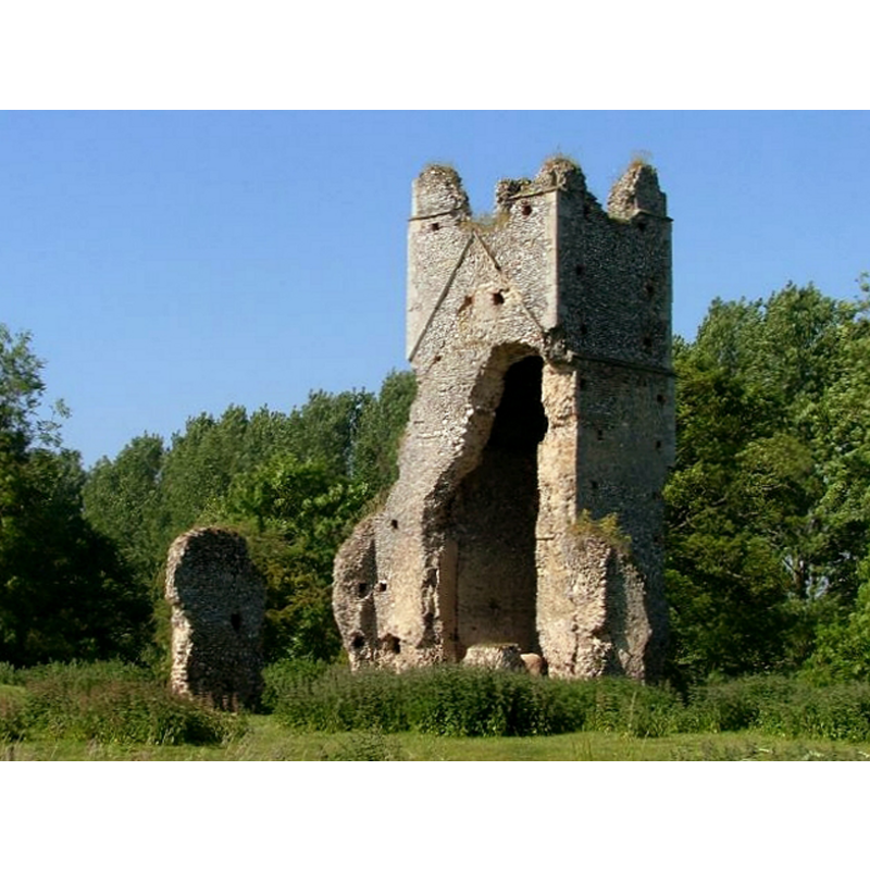
Image copyright © Simon Knot, 2006
Standing permission
Results: 1 records
view of church exterior - northeast view
Scene Description: the remains of St. John's church
Copyright Statement: Image copyright © Simon Knot, 2006
Image Source: digital photograph July 2006 taken by Simon Knott [www.norfolkchurches.co.uk/beachamwelljohn/beachamwelljohn.htm] [accessed 13 August 2013]
Copyright Instructions: Standing permission
INFORMATION
Font ID: 18599BEA
Object Type: Baptismal Font1?
Church / Chapel Name: Parish Church of St. John [in ruins by 1800]
Church Patron Saint(s): St. John
Church Address: Beachamwell, Norfolk PE37 8BE
Site Location: Norfolk, East Anglia, England, United Kingdom
Ecclesiastic Region: [Diocese of Ely]
Historical Region: Hundred and half of Clckclose
Additional Comments: disappeared font? (the one from the medieval church here)
Font Notes:
Click to view
Blomefield (1805-1810) writes: "B[icham]-W[ell], Though now looked upon, and accounted as one town, was, at the time of the grand survey, two distinct and separate towns, Well, and Bicham. Well was the most southern part [...] St. John. This church (which is now in ruins) stands on the northwest part of the township of Beecham-Wells; part of the north wall of the nave is standing, as is part of the four-square tower, as high as the sounding windows; which tower and church was built of flint, &c. The church, as appears from the foundation, was about 66 feet in length; and, on the site of the church some poor people have made themselves little cottages. The patronage of this church seems to have belonged always to the lords of Well-hall; and they who held that lordship of the capital lord, presented to it. Hugh de St. Philebert was patron about the beginning of Edward I.[i.e., ca. 1272] [...] 1304, Robert de Suthfeld to the 3d part of Becham, by Gregory de Felmingham. [...] It is a rectory, [...] together with the rectory of St. Mary, to which it was consolidated in 1686". [NB: we have no information on the font of the medieval church here].
COORDINATES
UTM: 31U 335788 5832942
Latitude & Longitude (Decimal): 52.6217, 0.5739
Latitude & Longitude (DMS): 52° 37' 15.68" N, 0° 34' 38.81" E
REFERENCES
- Blomefield, Francis, An essay towards a topographical history of Norfolk, 1805-1810, vol. 7: 286-298 [www.british-history.ac.uk/report.aspx?compid=78355] [accessed 13 August 2013]