Southwood / Sutuude
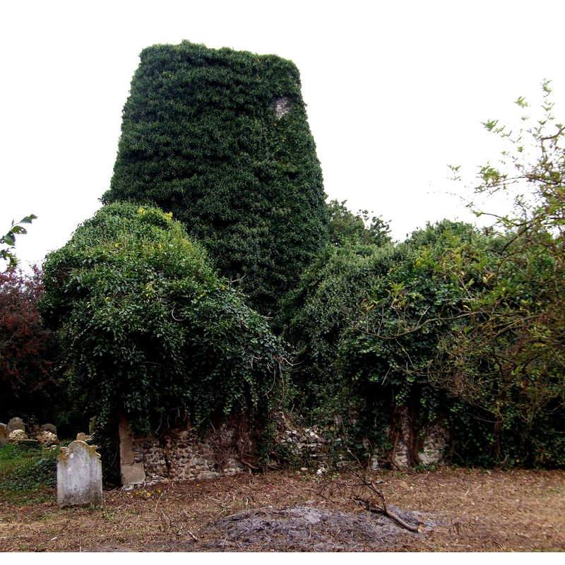
Image copyright © Simon Knott, 2007
Standing permission
Results: 2 records
view of church exterior
Scene Description: the ruins in 2007
Copyright Statement: Image copyright © Simon Knott, 2007
Image Source: digital photograph December 2007 taken by Simon Knott [www.norfolkchurches.co.uk/southwood/southwood.htm] [accessed 12 August 2013]
Copyright Instructions: Standing permission
view of church exterior - southeast view
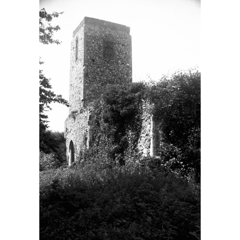
Scene Description: The church building in 1979. George Plmkett noted at the time: "Derelict since 1883 when part was in use as a mortuary chapel. It was absorbed into the parish of Limpenhoe."
Copyright Statement: Image copyright © George Plunkett, 2013
Image Source: B&W photograph taken 6 August 1979 by George Plunkett [www.georgeplunkett.co.uk/Norfolk/S/Southwood St Edmund's church ruin from SE [6027] 1979-08-06.jpg ] [accessed 16 August 2013]
Copyright Instructions: Standing permission by Jonathan Plunkett
INFORMATION
Font ID: 18596SOU
Object Type: Baptismal Font1
Church / Chapel Name: Parish Church of St. Edmund [in ruins]
Church Patron Saint(s): St. Edmund the Martyr [aka Edmund of East Anglia]
Church Address: Norwich Road, Cantley, Norfolk NR13 3L
Site Location: Norfolk, East Anglia, England, United Kingdom
Directions to Site: The ruins of this church are located on the Norwich Rd., near Cantley
Ecclesiastic Region: [Diocese of Norwich]
Historical Region: Hundred of Blofield
Additional Comments: moved font? [cf. Index entry for Limpenhoe]
Font Notes:
Click to view
Blomefield (1805-1810) notes: "The Church is a rectory, dedicated to St. Edmund", and names "John de Fleming" as first recorded rector here, in 1313; he names "John Waynhouse" as last recorded rector, after whuch he adds, "The church is consolidated to Limpenhow" [i.e., Limpenhoe]. [cf. Index entry for Limpenhoe].
Credit and Acknowledgements: We are grateful to Jonathan Plunkett for the photograph of this church taken by his father, George Plunkett, 6 August 1979; and to Simon Knott, of Norfolk Churches [www.norfolkchurches.co.uk], for his photograph of the ruins of St. Edmund's
COORDINATES
UTM: 31U 400358 5827996
Latitude & Longitude (Decimal): 52.592853, 1.529015
Latitude & Longitude (DMS): 52° 35′ 34.27″ N, 1° 31′ 44.45″ E
REFERENCES
- Blomefield, Francis, An essay towards a topographical history of Norfolk, 1805-1810, vol. 7: 253-254 / [www.british-history.ac.uk/report.aspx?compid=78349] [accessed 12 August 2013]