Burlingham St. Peter / B'lingeham / Birlingeham / North Birlingham / North Burligham
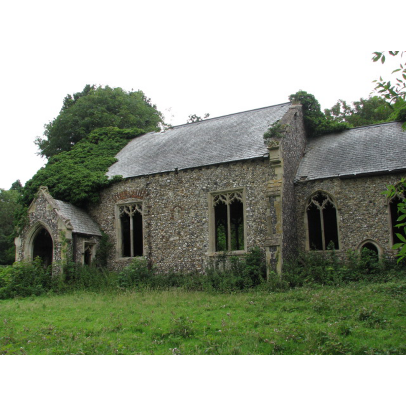
Image copyright © Evelyn Simak, 2007
CC-BY-SA-3.0
Results: 3 records
view of church exterior - south view
Scene Description: the ruins of St. Peter's church
Copyright Statement: Image copyright © Evelyn Simak, 2007
Image Source: digital photograph taken 13 July 2007 by Evelyn Simak [www.geograph.org.uk/photo/493655] [accessed 7 August 2013]
Copyright Instructions: CC-BY-SA-3.0
view of church interior - nave - looking west
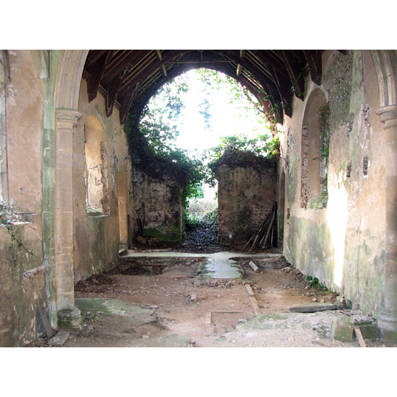
Scene Description: the ruins of St. Peter's church: the west end of the nave and the opening that originally would have led into the tower
Copyright Statement: Image copyright © Evelyn Simak, 2010
Image Source: digital photograph taken 20 January 2011 by Evelyn Simak [www.geograph.org.uk/photo/2239538] [accessed 7 August 2013]
Copyright Instructions: CC-BY-SA-3.0
view of church interior - nave - looking east
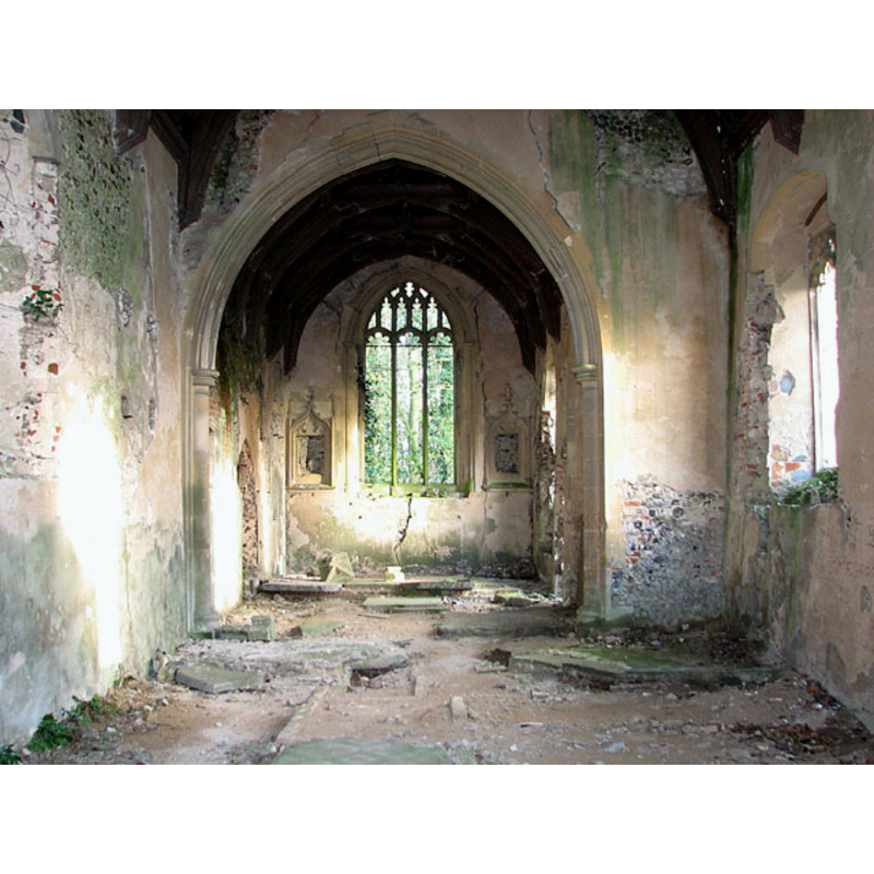
Scene Description: the ruins of St. Peter's church: the chancel arch and the east end of he nave
Copyright Statement: Image copyright © Evelyn Simak, 2010
Image Source: digital photograph taken 20 January 2011 by Evelyn Simak [www.geograph.org.uk/photo/2239536] [accessed 7 August 2013]
Copyright Instructions: CC-BY-SA-3.0
INFORMATION
Font ID: 18585BUR
Object Type: Baptismal Font1?
Font Century and Period/Style: 11th century, Pre-Conquest? / Norman
Church / Chapel Name: Parish Church of St. Peter [in ruins]
Church Patron Saint(s): St. Peter
Site Location: Norfolk, East Anglia, England, United Kingdom
Directions to Site: Located off the B1140, 10.5 km E of Norwich
Ecclesiastic Region: [Diocese of Norwich]
Additional Comments: disappeared font? / destroyed font?
Font Notes:
Click to view
There are two Domesday entries for "B'lingeham" noted in Blomefield (1805-1810), one with 40 acres of free land held by a Helias [="Helias. de lx. ac. terre libe. et xl. qu. p'tinent. cuida. Ecclie"] after the Conquest; the other was a church with 30 acres [="i. Ecclia. xxx. ac."] held by "15 freemen, under the commendation only of Bishop Almar". Both churches and their earliest recorded rectors are noted in Blomefield (ibid.): "The Church of St. Andrew, in North Birlingham, was a rectory [...] Richard de Runhale was rector in 10th of Richard I.[i.e., 1199] as appears from a fine then levied [...] In this town of North Birlingham was also the church of St. Peter, a rectory [...] John de Essex occurs rector, in 1287." Knott (2007) writes: "St Andrew, a couple of hundred yards to the west, is a big, late medieval building with a huge tower, but St Peter was more typical of the area, a smaller, older church with a round tower. It was the tower that led to the demise of the building. One night in 1906, it collapsed into the nave. At first, the gap was merely boarded up, but, not surprisingly, this was found to be unsatisfactory, and in 1936 the remains of the congregation finally decamped up the road to St Andrew. The building has been left to decay since then, pretty much, quietly returning back to nature. Ashes to ashes, dust to dust. It is hard to see beyond its restoration, but this must have been a little Norman church, perhaps with a 13th century chancel."
COORDINATES
UTM: 31U 398424 5832889
Latitude & Longitude (Decimal): 52.636467, 1.498969
Latitude & Longitude (DMS): 52° 38′ 11.28″ N, 1° 29′ 56.29″ E
REFERENCES
- Blomefield, Francis, An essay towards a topographical history of Norfolk, 1805-1810, vol. 7: 222-226 / [www.british-history.ac.uk/report.aspx?compid=78338] [accessed 7 August 2013]
- Knott, Simon, The Norfolk Churches Site, Simon Knott, 2004. [standing permission to reproduce images received from Simon (February 2005]. URL: www.norfolkchurches.co.uk.