Barton Bendish No. 2 / B'tuna / Bertun / Bertuna / Bettuna
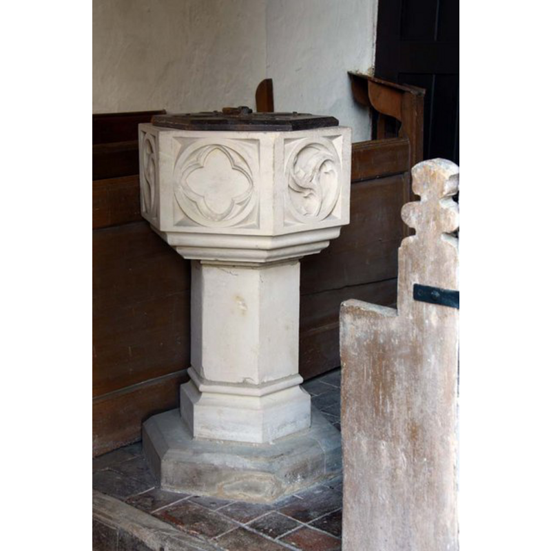
Image copyright © John Salmon, 2010
CC-BY-SA-3.0
Results: 8 records
view of font and cover
Scene Description: the modern font [cf. FontNotes]
Copyright Statement: Image copyright © John Salmon, 2010
Image Source: digital photograph taken 13 February 2010 by John Salmon [www.geograph.org.uk/photo/1708018] [accessed 13 August 2013]
Copyright Instructions: CC-BY-SA-3.0
view of church exterior - west portal
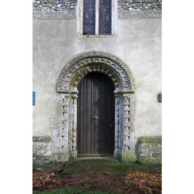
Scene Description: in 2010
Copyright Statement: Image copyright © John Salmon, 2010
Image Source: digital photograph taken 13 February 2010 by John Salmon [www.geograph.org.uk/photo/1707984] [accessed 13 August 2013]
Copyright Instructions: CC-BY-SA-3.0
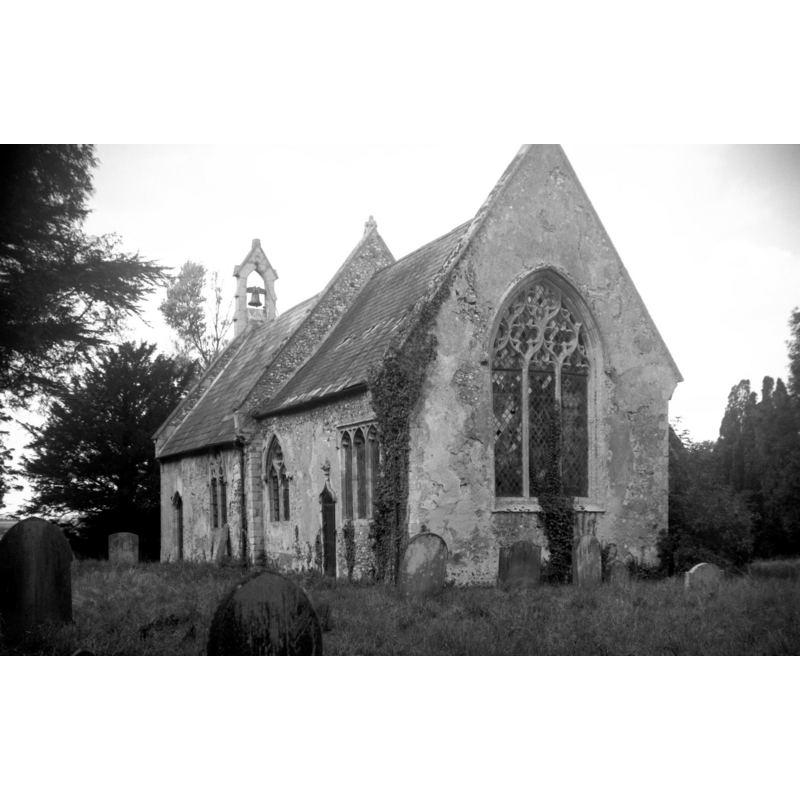
view of church exterior - southwest view
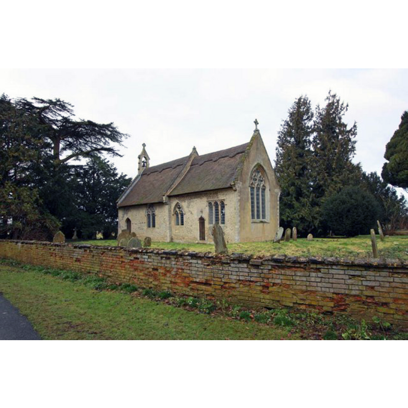
Scene Description: in 2010
Copyright Statement: Image copyright © John Salmon, 2010
Image Source: digital photograph taken 13 February 2010 by John Salmon [www.geograph.org.uk/photo/1707958] [accessed 13 August 2013]
Copyright Instructions: CC-BY-SA-3.0
view of church exterior - west portal
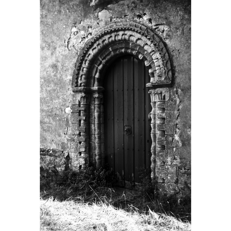
Scene Description: in 1975 -- the Norman west portal
Copyright Statement: Image copyright © George Plunkett, 2013
Image Source: B&W photograph taken 11 September 1975 by George Plunkett [www.georgeplunkett.co.uk/Norfolk/B/Barton Bendish St Mary's Norman west door [5468] 1975-09-11.jpg] [accessed 13 August 2013]
Copyright Instructions: Standing permission by Jonathan Plunkett
view of church exterior - southeast view
Scene Description: in 1977 -- "During re-thatching and general restoration"
Copyright Statement: Image copyright © George Plunkett, 2013
Image Source: B&W photograph taken 11 September 1975 by George Plunkett [www.georgeplunkett.co.uk/Norfolk/B/Barton Bendish St Mary's church from SE [5746] 1977-04-14.jpg] [accessed 13 August 2013]
Copyright Instructions: Standing permission by Jonathan Plunkett
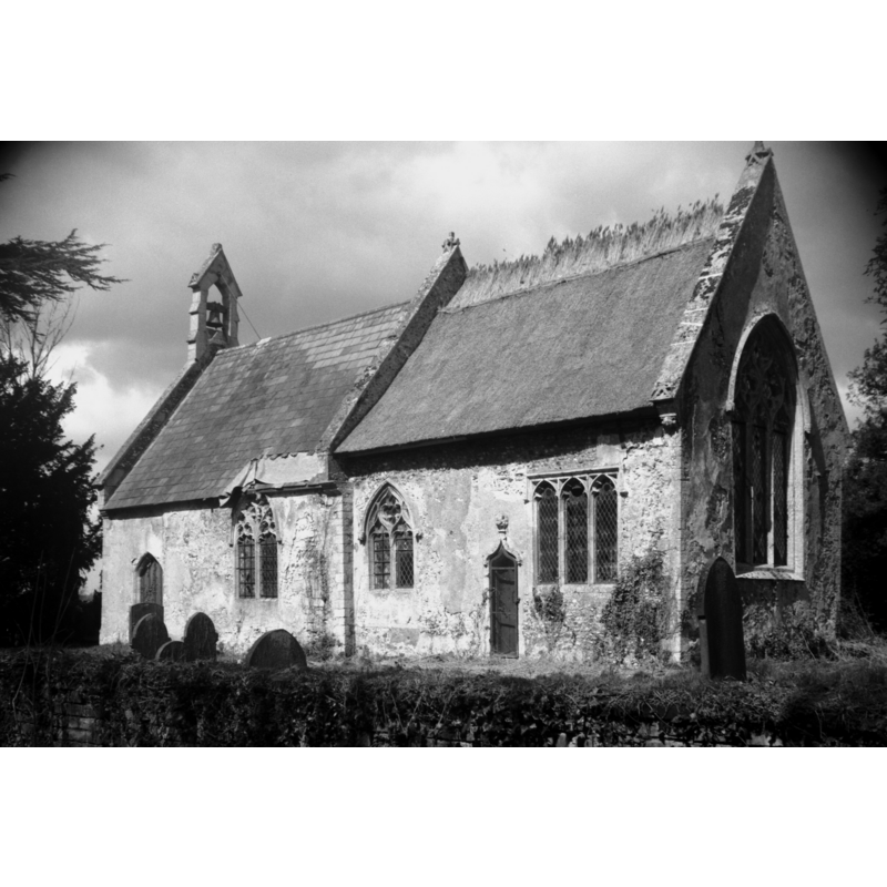
view of church exterior - southeast view
Scene Description: in 1975
Copyright Statement: Image copyright © George Plunkett, 2013
Image Source: B&W photograph taken 11 September 1975 by George Plunkett [www.georgeplunkett.co.uk/Norfolk/B/Barton Bendish St Mary's church from SE [5469] 1975-09-11.jpg] [accessed 13 August 2013]
Copyright Instructions: Standing permission by Jonathan Plunkett
view of church interior - nave - looking west
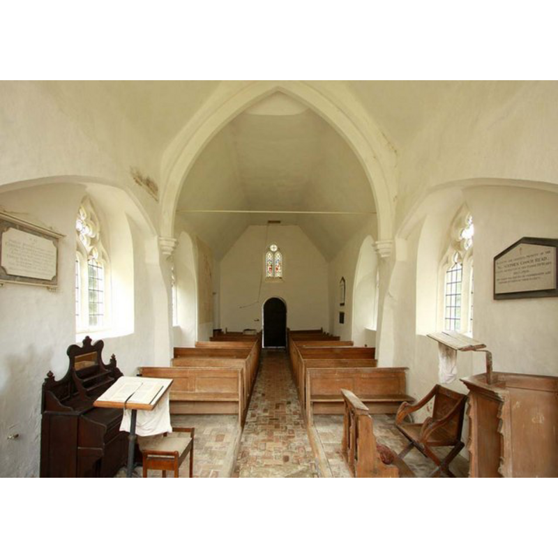
Scene Description: the modern font is partially visible at the back (west), behind the left (south) bank of pews
Copyright Statement: Image copyright © John Salmon, 2010
Image Source: digital photograph taken 13 February 2010 by John Salmon [www.geograph.org.uk/photo/1707995] [accessed 13 August 2013]
Copyright Instructions: CC-BY-SA-3.0
view of church interior - nave - looking east
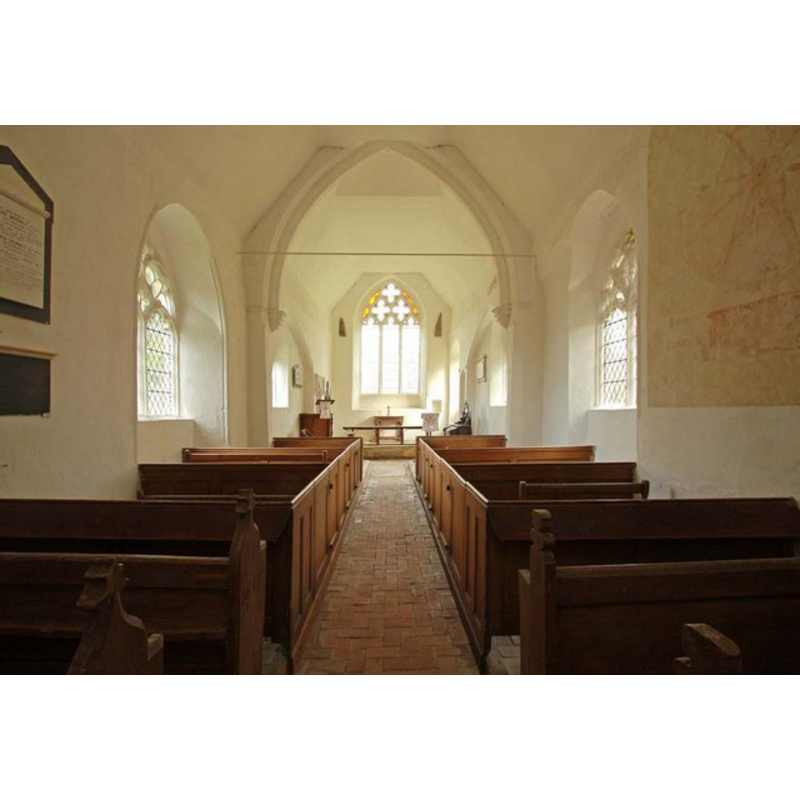
Copyright Statement: Image copyright © John Salmon, 2010
Image Source: digital photograph taken 13 February 2010 by John Salmon [www.geograph.org.uk/photo/1707989] [accessed 13 August 2013]
Copyright Instructions: CC-BY-SA-3.0
INFORMATION
Font ID: 18579BAR
Object Type: Baptismal Font1?
Church / Chapel Name: Parish Church of St. Mary [aka St. Mary with All Saints] [redundant]
Church Patron Saint(s): St. Mary the Virgin [with All Saints?]
Church Notes: this church is redundant but still consecrated, with some services being held every now and then
Church Address: Barton Bendish, Norfolk, England, PE33 9DP
Site Location: Norfolk, East Anglia, England, United Kingdom
Directions to Site: Located off the A122, 8 km N of Stoke Ferry, 10 km ENE of Downham Market
Ecclesiastic Region: Diocese of Ely
Historical Region: Hundred and a half of Clackclose
Additional Comments: disappeared font? (the one from the original church here)
Font Notes:
Click to view
The Domesday entry for "Bertuna" cited in Blomefiled (1802-1810) reports "a church endowed with 12 acres", and this author notes: "St. Mary's Church stands at the west end of the town, and was beat down by the fall of the tower, in the reign of Queen Anne [i.e., 1702-1714], and is rebuilt of the old materials; it is a single pile about 24 feet long, and 15 broad, covered with reed, as the chancel, which is about 22 feet long, and 14 broad, without any tower." White's Directory (1854: 623-624) notes: "Barton had formerly three CHURCHES, but that dedicated to All Saints has long been dilapidated, and its rectory consolidated with that of St. Mary, a small edifice, the tower of which fell down in the reign of Queen Anne [cf. supra] [...] St. Andrew's Church is a large thatched fabric, with a square tower and three bells. The Chancel has recently been refitted with oak seats, and a beautiful stained glass window added on the north side of the church. The chancel has a piscina and curious ornamental niche" [source: transciption by A.J. Carter in http://apling.freeservers.com/Villages/BartonBendish54.htm [accessed 13 August 2013]]. The present font is modern, probably 19th-century; it consists of an octagonal basin with traceried panels and a graded underbowl, raised on a plain octagonal pedestal base and a moulded lower base, also octagonal. Small polygonal plinth. The wooden cover is octagonal and flat, with metal ring handle; also Victorian. [NB: we have no information on the font from the medieval church here; perhaps destroyed when the tower fell don [cf. supra]].
Credit and Acknowledgements: We are grateful to Jonathan Plunkett for the photographs of this church taken by his father, George Plunkett, in 1975 and 1977
COORDINATES
UTM: 31U 332375 5832869
Latitude & Longitude (Decimal): 52.619907, 0.523734
Latitude & Longitude (DMS): 52° 37′ 11.66″ N, 0° 31′ 25.44″ E
REFERENCES
- Blomefield, Francis, An essay towards a topographical history of Norfolk, 1805-1810, vol. 7: 270-286 / [www.british-history.ac.uk/report.aspx?compid=78354] [accessed 13 August 2013]