Tremolat No. 1 / Temolaco / Temoulat / Themolaco / Tomolatum / Tremolac / Trémolat / Trémolat / Trémolhède / Trémolie / Trémoulet / Trémoulière
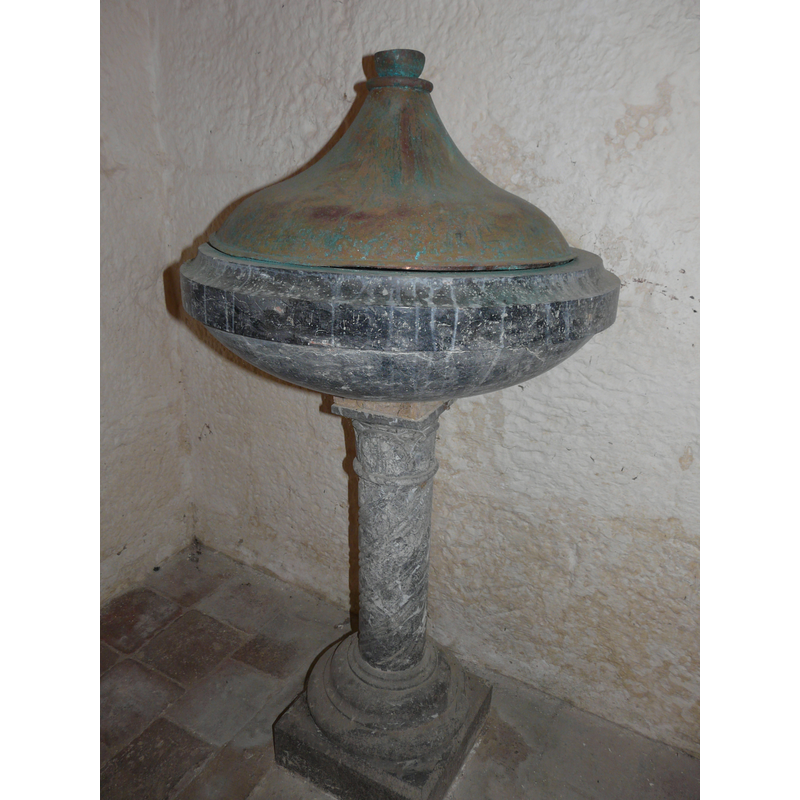
Image copyright © Père Igor, 2011
CC-BY-SA-3.0
Results: 9 records
view of font and cover
Copyright Statement: Image copyright © Père Igor, 2011
Image Source: digital photograph [edited] taken 2 October 2011 by Père Igor [http://commons.wikimedia.org/wiki/File:Trémolat_église_St_Nicolas_fonts.jpg] [accessed 28 July 2013]
Copyright Instructions: CC-BY-SA-3.0
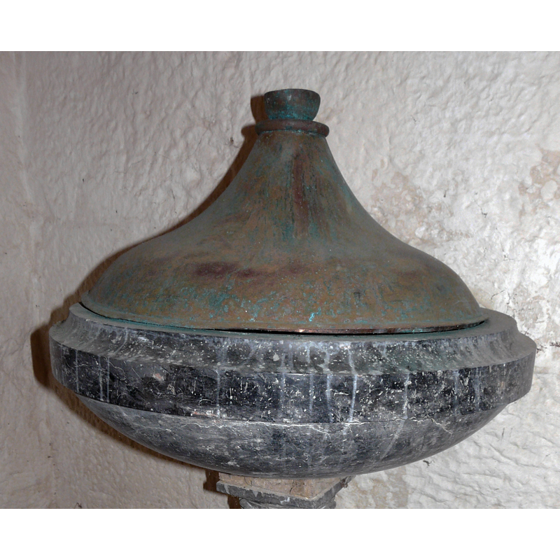
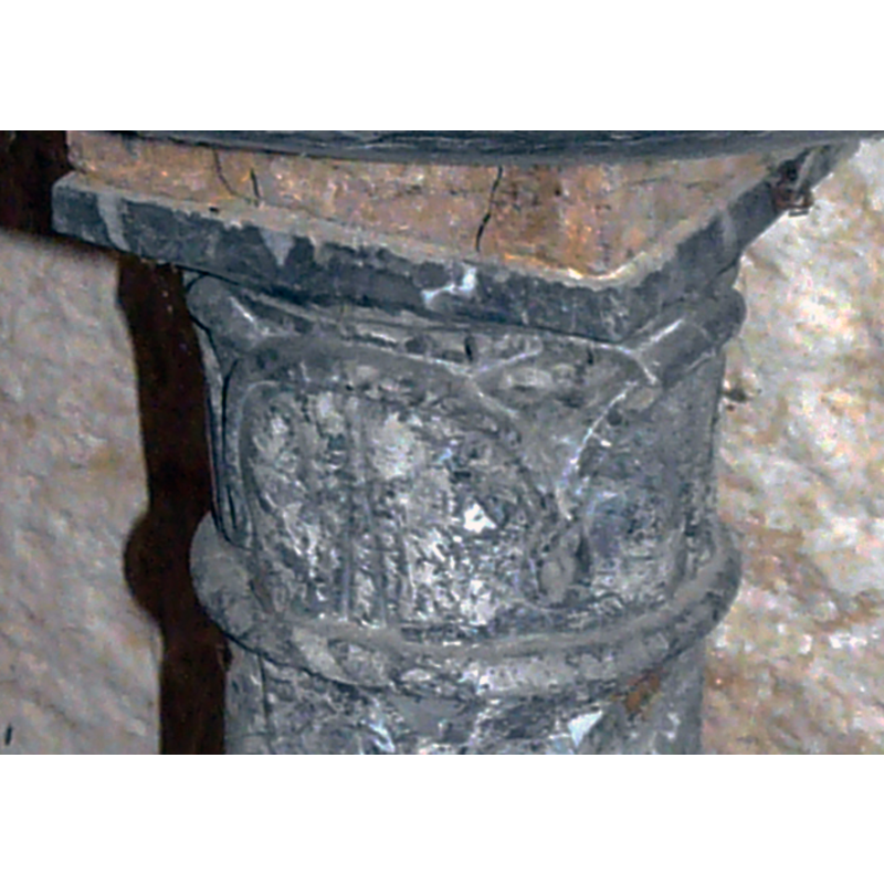
view of basin and cover
Copyright Statement: Image copyright © Père Igor, 2011
Image Source: detail of a digital photograph [edited] taken 2 October 2011 by Père Igor [http://commons.wikimedia.org/wiki/File:Trémolat_église_St_Nicolas_fonts.jpg] [accessed 28 July 2013]
Copyright Instructions: CC-BY-SA-3.0
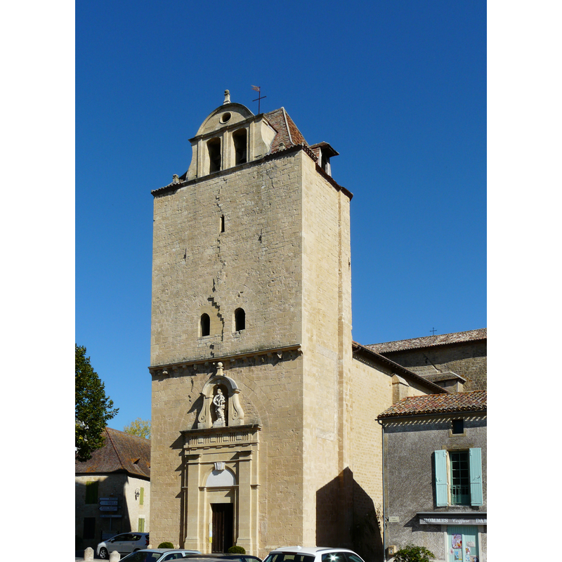
view of church exterior - southwest end
Copyright Statement: Image copyright © Père Igor, 2011
Image Source: digital photograph taken 2 October 2011 by Père Igor [http://commons.wikimedia.org/wiki/File:Trémolat_église_St_Nicolas_façade_ouest_(1).jpg] [accessed 28 July 2013]
Copyright Instructions: CC-BY-SA-3.0
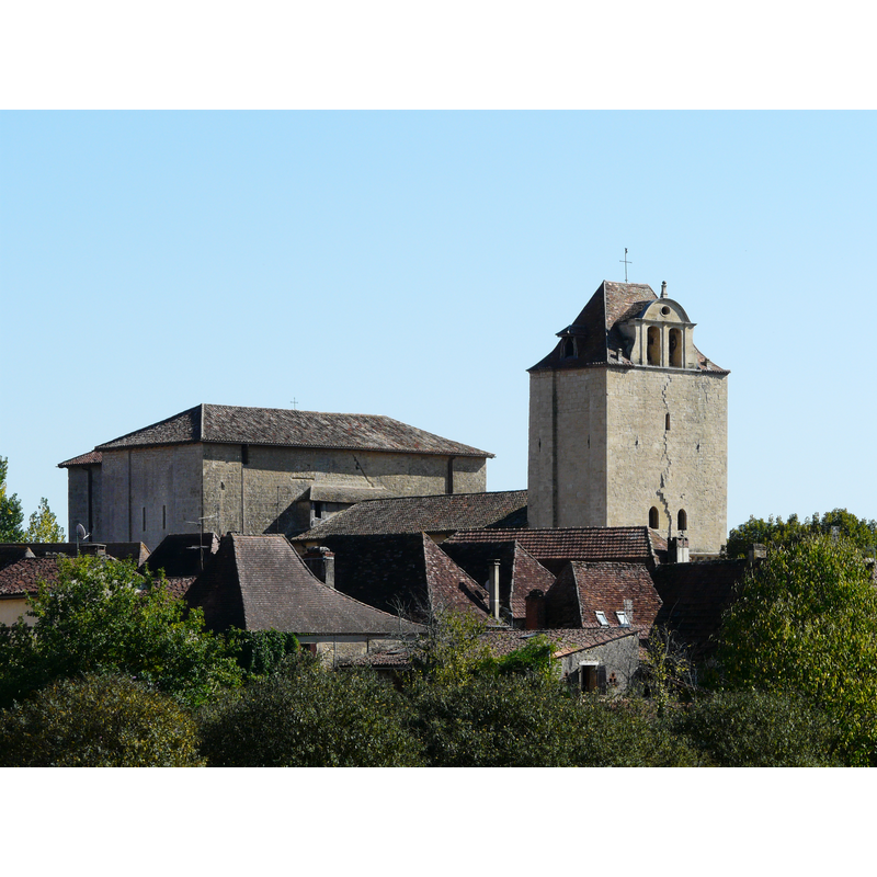
view of church exterior in context
Copyright Statement: Image copyright © Père Igor, 2011
Image Source: digital photograph taken 2 October 2011 by Père Igor [http://commons.wikimedia.org/wiki/File:Trémolat_église_St_Nicolas.jpg] [accessed 28 July 2013]
Copyright Instructions: CC-BY-SA-3.0
view of church interior - painting
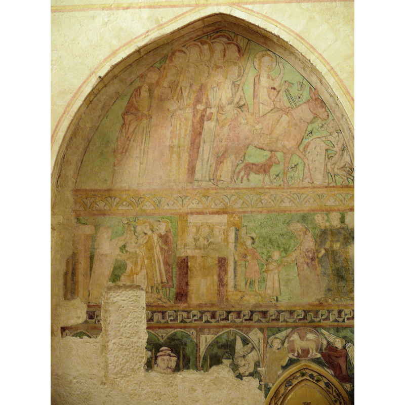
Scene Description: one of several frescoes on the apses -- at the top, the triumphal entry of Christ in Jerusalem
Copyright Statement: Image copyright © MOSSOT, 2010
Image Source: digital photograph taken 2 November 2010 by MOSSOT [http://commons.wikimedia.org/wiki/File:Trémolat_-_Eglise_Saint-Nicolas_-4.JPG] [accessed 28 July 2013]
Copyright Instructions: CC-BY-SA-3.0 Attribution 3.0 Unported
view of church interior - nave - looking west
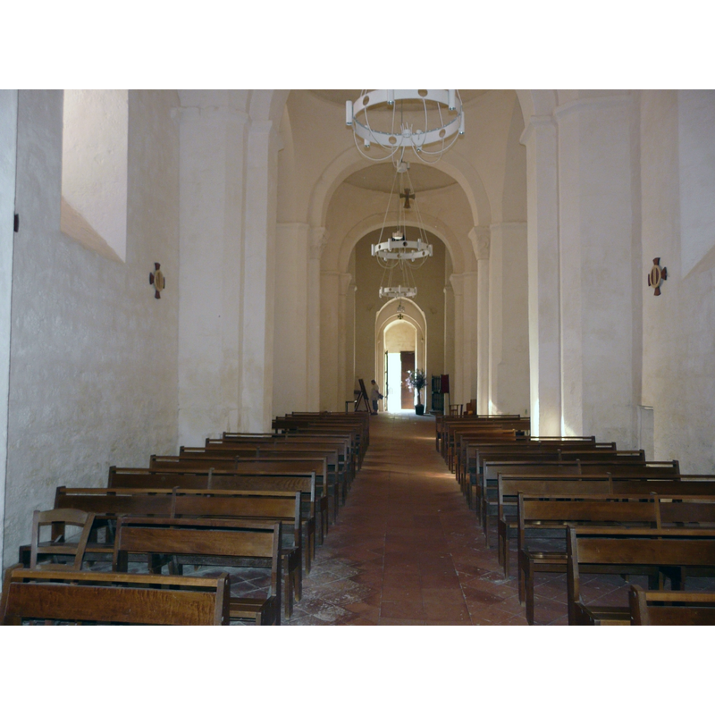
Copyright Statement: Image copyright © Père Igor, 2011
Image Source: digital photograph [edited] taken 2 October 2011 by Père Igor [http://commons.wikimedia.org/wiki/File:Trémolat_église_St_Nicolas_nef_(2).jpg] [accessed 28 July 2013]
Copyright Instructions: CC-BY-SA-3.0
view of church interior - nave - looking east
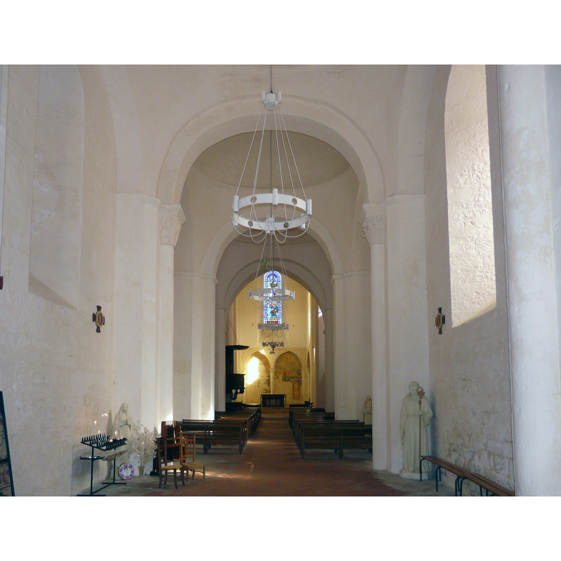
Copyright Statement: Image copyright © Père Igor, 2011
Image Source: digital photograph [edited] taken 2 October 2011 by Père Igor [http://commons.wikimedia.org/wiki/File:Trémolat_église_St_Nicolas_nef_(1).jpg] [accessed 28 July 2013]
Copyright Instructions: CC-BY-SA-3.0
Copyright Statement: Image copyright © Père Igor, 2011
Image Source: detail of a digital photograph [edited] taken 2 October 2011 by Père Igor [http://commons.wikimedia.org/wiki/File:Trémolat_église_St_Nicolas_fonts.jpg] [accessed 28 July 2013]
Copyright Instructions: CC-BY-SA-3.0
Copyright Statement: Image copyright © Père Igor, 2011
Image Source: detail of a digital photograph [edited] taken 2 October 2011 by Père Igor [http://commons.wikimedia.org/wiki/File:Trémolat_église_St_Nicolas_fonts.jpg] [accessed 28 July 2013]
Copyright Instructions: CC-BY-SA-3.0
INFORMATION
Font ID: 18560TRE
Object Type: Baptismal Font1
Font Century and Period/Style: 16th - 17th century
Church / Chapel Name: Église paroissiale Saint-Nicolas de Trémolat
Font Location in Church: Inside the church
Church Patron Saint(s): St. Nicholas of Myra
Church Notes: church listed in Mérimée [ref.: PA00083030]: "12e siècle [...] L'église est l'un des types les plus complets et les mieux conservés d'architecture romane périgourdine. De forme en croix latine, elle se termine par un chevet carré." -- There may have been an earlier mid-9th century church here destroyed by the Normans
Church Address: 24510 Trémolat, France
Site Location: Dordogne, Nouvelle-Aquitaine, France, Europe
Directions to Site: Located at the D30-D31 crossroads, 7 km NNW of Buisson-de-Cadouin
Ecclesiastic Region: Diocèse Périgueux - Sarlat
Historical Region: Périgord -- Terroir de la truffe
Font Notes:
Click to view
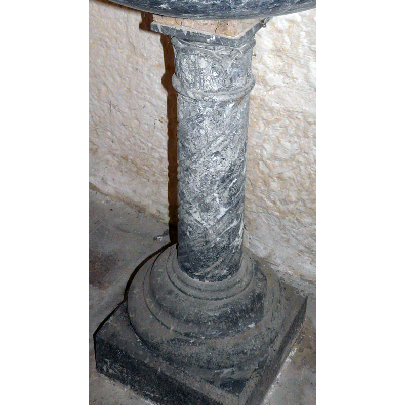
The dark-marble font in this church is relatively modern compared to the church itself; it consists of a shallow round basin raised on a very slender round pedestal base, and a mouldd round-to-square lower base; the stem is carved with torsade, and the capital that tops it is decorated as well; the lower base has several roll mouldings. The metal [copper?] cover is old, shaped like a stretched dome; the finial appears to be damaged.
COORDINATES
UTM: 31T 328687 4971455
Latitude & Longitude (Decimal): 44.875917, 0.831083
Latitude & Longitude (DMS): 44° 52′ 33.3″ N, 0° 49′ 51.9″ E
MEDIUM AND MEASUREMENTS
Material: stone, marble
Font Shape: round, mounted
Basin Interior Shape: round
Basin Exterior Shape: round
LID INFORMATION
Material: metal, copper?
Apparatus: no
Notes: stretched-dome shaped; the finial may be broken