Javerlhac / Javerlac / Javerlhat
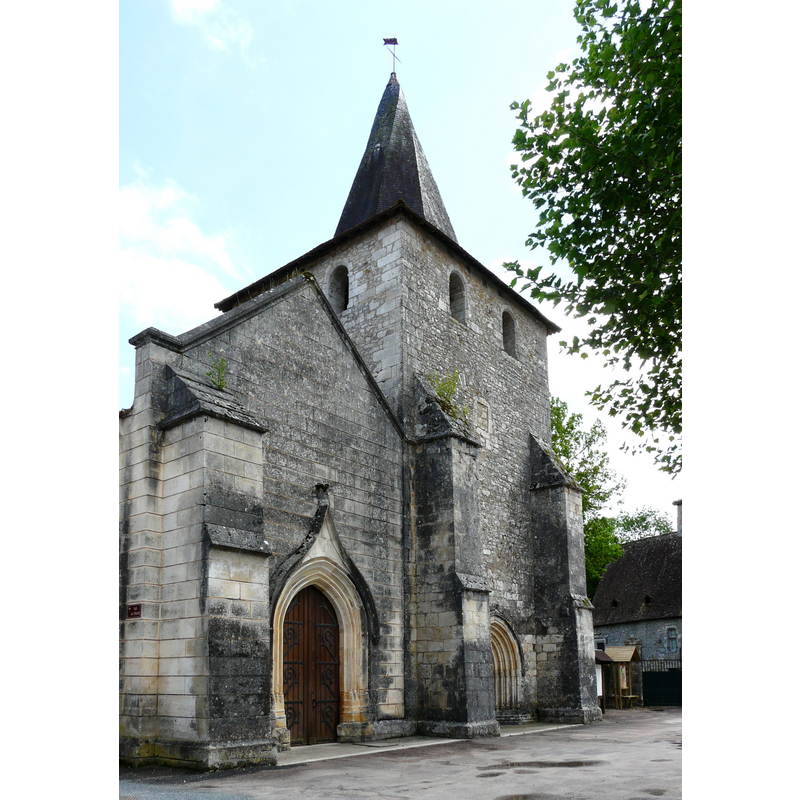
Image copyright © Père Igor, 2009
CC-BY-SA-3.0
Results: 4 records
view of church exterior - northwest end
Copyright Statement: Image copyright © Père Igor, 2009
Image Source: digital photograph [edited] taken 15 May 2009 by Père Igor [accessed 27 July 2013]
Copyright Instructions: CC-BY-SA-3.0
view of church exterior - southwest view
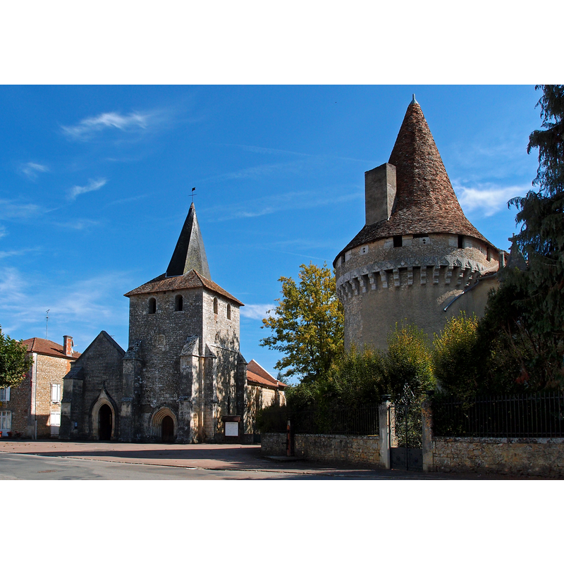
Scene Description: with the castle on the right
Copyright Statement: Image copyright © Michael Stuckey, 2011
Image Source: digital photograph taken 27 September 2011 by Michael Stuckey [http://commons.wikimedia.org/wiki/File:Église_Saint-Étienne_et_le_château_de_Javerlhac.jpg] [accessed 27 July 2013]
Copyright Instructions: CC-BY-SA-3.0 Attribution 3.0 Unported
view of church exterior in context
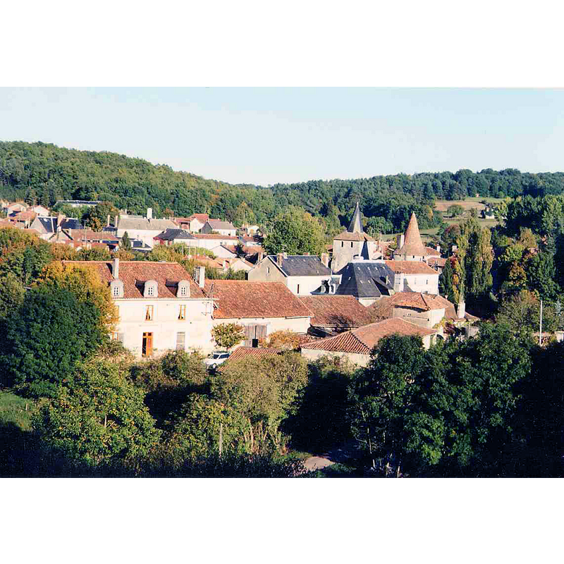
Scene Description: the village of Javerlhac; the church appears near the castle
Copyright Statement: Image copyright © Traumrune, 2003
Image Source: digital photograph taken in September 2003 by Traumrune [http://en.wikipedia.org/wiki/File:Javerlhac_.jpg] [accessed 27 July 2013]
Copyright Instructions: CC-BY-SA-3.0
view of church interior - nave - looking west
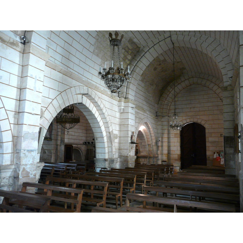
Copyright Statement: Image copyright © Père Igor, 2009
Image Source: digital photograph taken 15 May 2009 by Père Igor [http://en.wikipedia.org/wiki/File:Javerlhac_église_deux_nefs.JPG] [accessed 27 July 2013]
Copyright Instructions: CC-BY-SA-3.0
INFORMATION
Font ID: 18555JAV
Object Type: Baptismal Font1?
Font Century and Period/Style: 12th century, Romanesque
Church / Chapel Name: Église paroissiale Saint-Etienne de Javerlhac
Font Location in Church: [disappeared?]
Church Patron Saint(s): St. Stephen
Church Notes: church listed in Mérimée [ref.: PA00082588]: "Eglise à deux nefs accolées, l'une du 12e siècle à coupole sur le choeur ; l'autre du 16e siècle. Clocher roman avec porche en plein cintre comprenant un enfeu contenant des gisants [...] 12e siècle ; 16e siècle".
Church Address: 24300 Javerlhac-et-la-Chapelle-Saint-Robert, France
Site Location: Dordogne, Nouvelle-Aquitaine, France, Europe
Directions to Site: Located at the confluence of the D75, D92, D93 and D94, in the merged municipality of Javerlhac-et-la-Chapelle-Saint-Robert since 1823
Ecclesiastic Region: Diocèse Périgueux - Sarlat
Historical Region: Périgord / Le Périgord Nontronnais / Aquitaine
Additional Comments: disappeared font? (the one from the original 12thC church here)
Font Notes:
Click to view
The Bulletin de la Société historique et archéologique du Perigord, vol. 15 (1888: 268) informs that a baptismal font was made for this church "d'après un procès verbal du 31 avril 1702", indicating thus that the original font of this church was no longer in use. [NB: we have no information on the baptismal font of the original 12th-century church here].
COORDINATES
UTM: 31T 309595 5049028
Latitude & Longitude (Decimal): 45.568722, 0.559889
Latitude & Longitude (DMS): 45° 34′ 7.4″ N, 0° 33′ 35.6″ E