Fulmodeston / Fulmotestuna
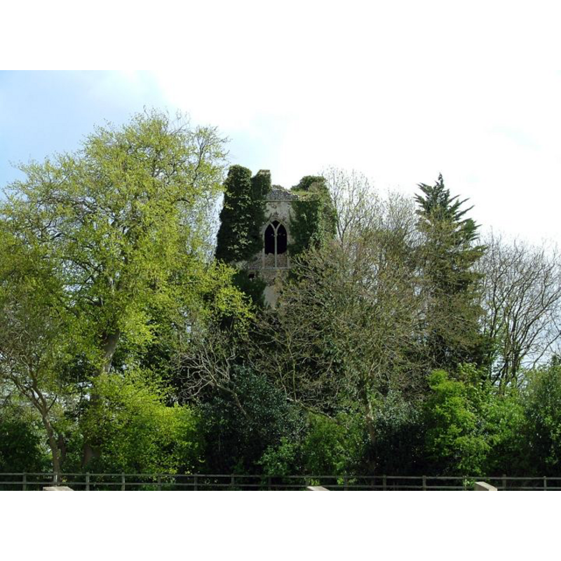
Image copyright © Simon Knott, 2005
Standing permission
Results: 1 records
view of church exterior - west tower
Scene Description: the ruins of old St. Mary's
Copyright Statement: Image copyright © Simon Knott, 2005
Image Source: digital photograph taken by Simon Knott in May 2005 [www.norfolkchurches.co.uk/fulmodestonold/fulmodestonold.htm] [accessed 25 July 2013]
Copyright Instructions: Standing permission
INFORMATION
Font ID: 18539FUL
Object Type: Baptismal Font1?
Font Century and Period/Style: 11th century, Pre-Conquest? / Norman
Church / Chapel Name: Parish Church of St. Mary [abandoned in 1882; now in ruins]
Church Patron Saint(s): St. Mary the Virgin
Church Notes: medieval [ca. 1300?] church abandoned when the new Christ Church was built in 1882
Church Address: Fulmodeston, Norfolk NR21 0LY
Site Location: Norfolk, East Anglia, England, United Kingdom
Directions to Site: Located near Croxton, 7-8 km E of Fakenham, 30 km SW of Cromer, 40 NNW of Norwich
Ecclesiastic Region: Diocese of Norfolk
Historical Region: Hundred of Gallow and Brothercross
Additional Comments: disappeared font? [cf. FontNotes]
Font Notes:
Click to view
Blomefield (1805-1810) reports that Fulmodeston contained at the Conquest "a church not endowed with any land [...] The Church of Fulmodeston is dedicated to St. Mary. In the reign of Edward I [i.e., 1272-1307]. the prior of Castleacre had the patronage; the rector had a manse in the village of Croxton, (which belonged to this parish,) with 20 acres of land". Blomefield (ibid.) names "William de Crakeford" as first recorded "rector, presented by the prior, &c. of Castleacre", in 1176. The church is noted in White (1845) as "an ancient structure, with a square tower"; in Wilson's Gazetteer (1870-1872) as "ancient, but very good", but there is no mention of the font in either source. [NB: we have no information on the font from the abandoned church -- for the font in Christ Church Fulmodeston, see Index entry under Croxton]
Credit and Acknowledgements: We are grateful to Simon Knott, of Norfolk Churches, [www.norfolkchurches.co.uk] for his photograph of the ruins of St. Mary
COORDINATES
UTM: 31U 361930 5856470
Latitude & Longitude (Decimal): 52.8309, 0.9562
REFERENCES
- Blomefield, Francis, An essay towards a topographical history of Norfolk, 1805-1810, vol. 7: 88-91 / [www.british-history.ac.uk/report.aspx?compid=78306] [accessed 25 July 2013]
- White, William, History, gazetteer, and directory of Norfolk and the city and County of the city of Norwich [...], Sheffield: Robert Leader, 1845, [transcribed in www.origins.org.uk/genuki/NFK/places/f/fulmodeston/white1845.shtml [accessed 25 July 2013]
- Wilson, John Marius, Imperial Gazetteer of England and Wales: embracing recent changes in counties, dioceses, parishes, and boroughs [...], Edinburgh: A. Fullarton & Co., 1870-1872, [transcribed in www.visionofbritain.org.uk/place/5780 [accessed 25 July 2013]]