Baconsthorpe / Baconsthorp / Torp
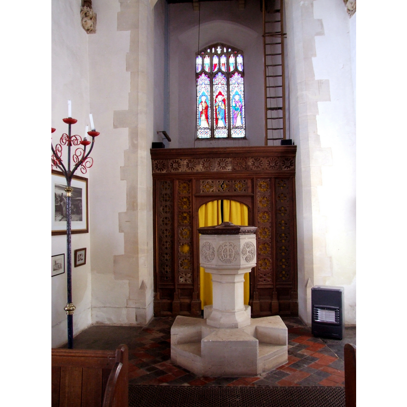
Image copyright © Simon Knott, 2008
Standing permission
Results: 5 records
view of font and cover
Scene Description: the modern font [cf. FontNotes]
Copyright Statement: Image copyright © Simon Knott, 2008
Image Source: digital photograph taken 4 April 2008 by Simon Knott [www.norfolkchurches.co.uk/baconsthorpe/baconsthorpe.htm] [accessed 3 June 2013]
Copyright Instructions: Standing permission
view of church exterior - southeast view
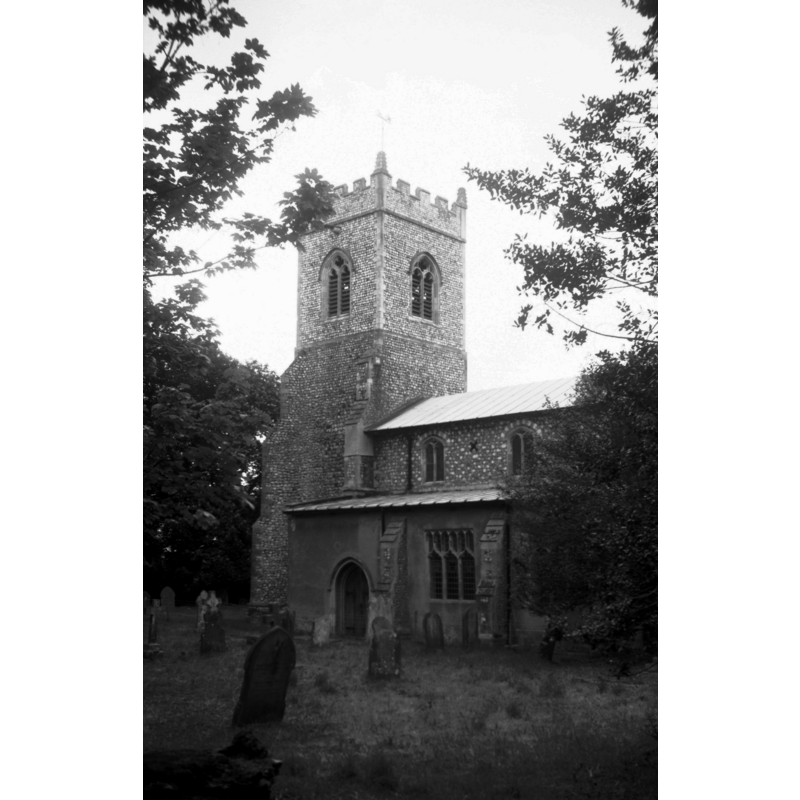
Scene Description: Photo caption: "The tower was rebuilt in 1740 after falling down in the previous year"
Copyright Statement: Image copyright © George Plunkett, 2014
Image Source: B&W photograph taken 22 May 1993 by George Plunkett [www.georgeplunkett.co.uk/Norfolk/B/Baconsthorpe St Mary's church from SE [6980] 1993-05-22.jpg] [accessed 10 June 2014]
Copyright Instructions: Standing permission by Jonathan Plunkett
view of church exterior - southeast view
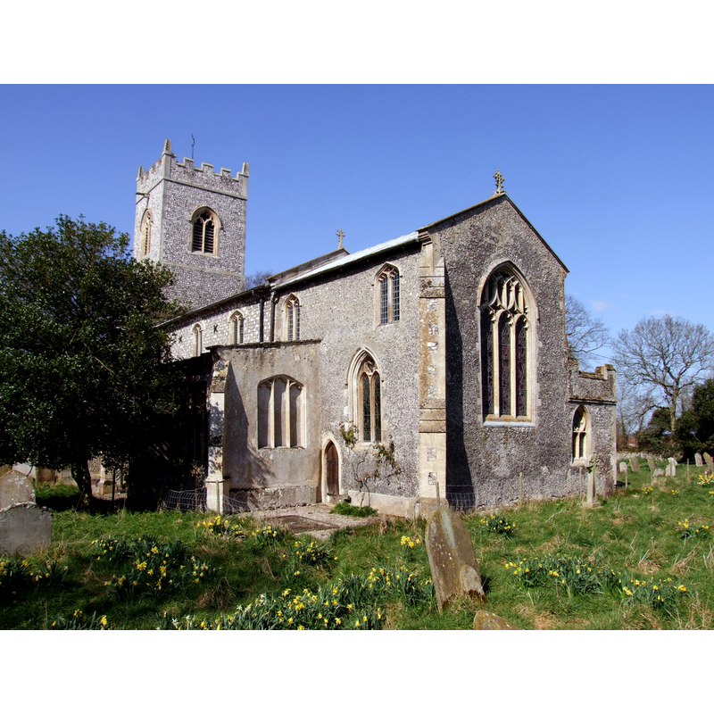
Copyright Statement: Image copyright © Simon Knott, 2008
Image Source: digital photograph taken 4 April 2008 by Simon Knott [www.norfolkchurches.co.uk/baconsthorpe/baconsthorpe.htm] [accessed 3 June 2013]
Copyright Instructions: Standing permission
view of church interior - nave - looking west
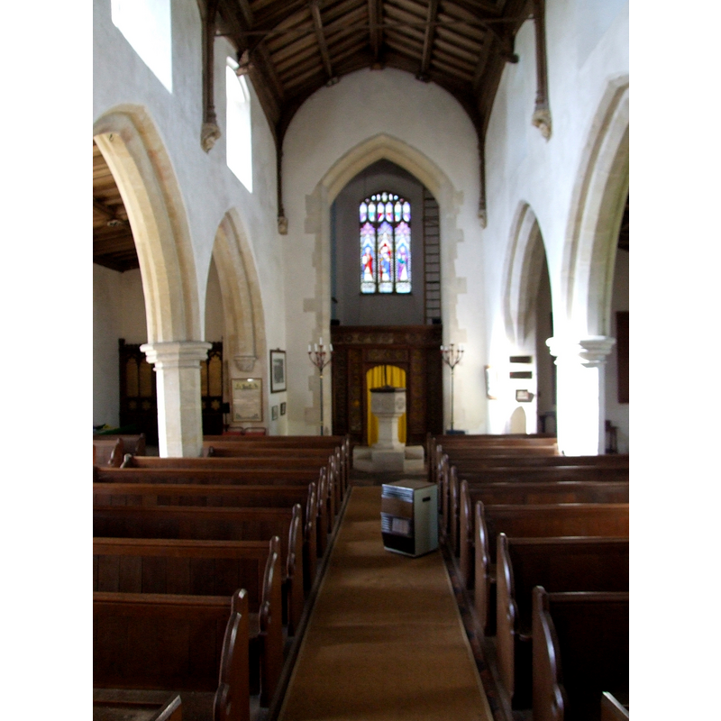
Scene Description: the modern font and cover at the west end, centre aisle
Copyright Statement: Image copyright © Simon Knott, 2008
Image Source: digital photograph taken 4 April 2008 by Simon Knott [www.norfolkchurches.co.uk/baconsthorpe/baconsthorpe.htm] [accessed 3 June 2013]
Copyright Instructions: Standing permission
view of church interior - nave - looking east
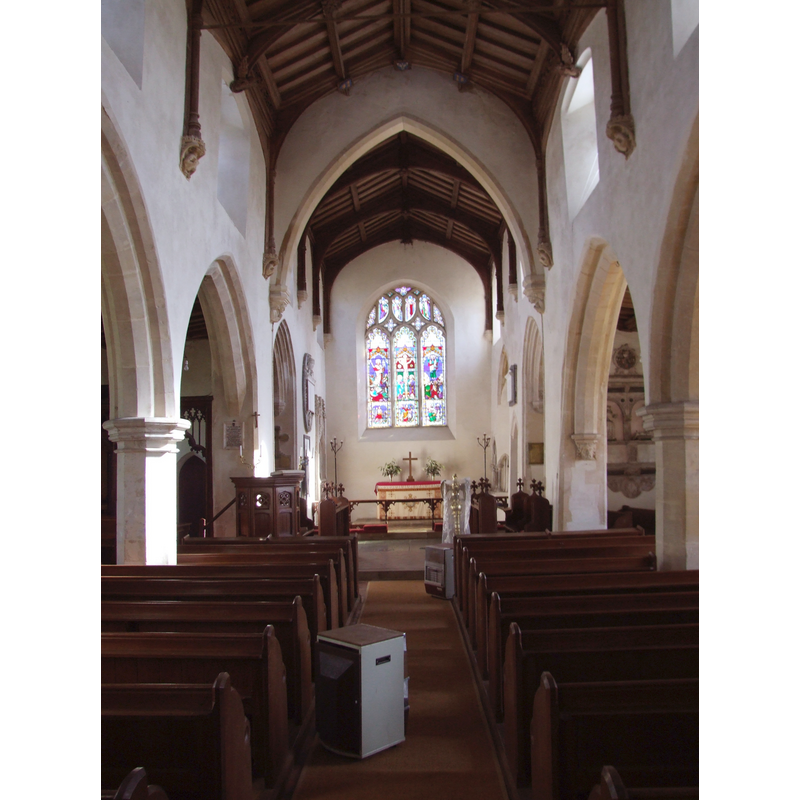
Copyright Statement: Image copyright © Simon Knott, 2008
Image Source: digital photograph taken 4 April 2008 by Simon Knott [www.norfolkchurches.co.uk/baconsthorpe/baconsthorpe.htm] [accessed 3 June 2013]
Copyright Instructions: Standing permission
INFORMATION
Font ID: 18489BAC
Object Type: Baptismal Font1
Font Century and Period/Style: 11th century, Norman
Church / Chapel Name: Parish Church of St. Mary the Virgin
Church Patron Saint(s): St. Mary the Virgin
Church Address: Church Lane, Baconsthorpe, Norfolk NR25 6LS
Site Location: Norfolk, East Anglia, England, United Kingdom
Directions to Site: Located 6 km SE of Holt, 32 km N of Norwich
Ecclesiastic Region: Diocese of Norwich
Historical Region: Hundred of South Erpingham
Additional Comments: destroyed font? (was it destroyed in 1739? [cf. FontNotes])
Font Notes:
Click to view
Blomefield (1805-1810) writes: "This village occurs in Domesday Book by the name of Thorp, and took the additional name of Bacon to distinguish it from other towns of the name of Thorp in this county, the Bacons being anciently lords of it. [...] At the Conqueror's survey here were two lordships, one belonging to Roger Bigot [...] The other lordship belonged to Guard, a Dane, in the Confessor's time, and was held of him by Uluric, or Wulric, a freeman; at the conquest it belonged to Robert Grenon, and Osbert held it of him; [...] to this there appertained 3 villains, one slave, and 2 carucates in demean at the survey, one carucate and an half among the free men, a church endowed with 30 acres [...] The Church is dedicated to St. Mary the Virgin, the nave, one isle, a chancel, with the chapels at their east end, are covered with lead, as is the north porch; the vestry on the north side of the chancel is tiled; the tower was square, but fell above half down in 1739, and contained five bells." Blomefield (1805-1810) names "Ralph" as first recorded rector here, in 1331. The English Heritage listing for this church [NGR: TG1274136862] [www.britishlistedbuildings.co.uk/en-224557-church-of-st-mary-baconsthorpe-norfolk] [accessed 3 June 2013] reads: "octagonal font, 1866, on Maltese cross base having floral and geometric designs to faces". A commentary accompanying a photograph by Whipper-snapper in FLICKR [www.flickr.com/photos/barryslemmings/293207902/] [accessed 3 June 2013] reads: "The church had - one one time - two fonts. One was donated to a Norwich church in 1955 to replace a font destroyed during the Second World War. When the present font was erected in its current position it subsided because it had been put over a coffin under the pavement. When the coffin was investigated it was found to be elaborately fitted, covered in crimosn velvet and highly ornamented."
Credit and Acknowledgements: We are grateful to Simon Knott, of Norfolk Churches [www.norfolkchurches.co.uk], for his photographs of this church and modern font; we are also grateful to Jonathan Plunkett for the photographs of this church taken by his father, George Plunkett, in 1961
COORDINATES
UTM: 31U 375981 5860953
Latitude & Longitude (Decimal): 52.883956, 1.156861
Latitude & Longitude (DMS): 52° 53′ 2.24″ N, 1° 9′ 24.7″ E
REFERENCES
- Blomefield, Francis, An essay towards a topographical history of Norfolk, 1805-1810, vol. 6: 502-513 / [www.british-history.ac.uk/report.aspx?compid=78285] [accessed 3 June 2013]