Thwaite nr. Cromer / Thweyt / Tuit / Twait
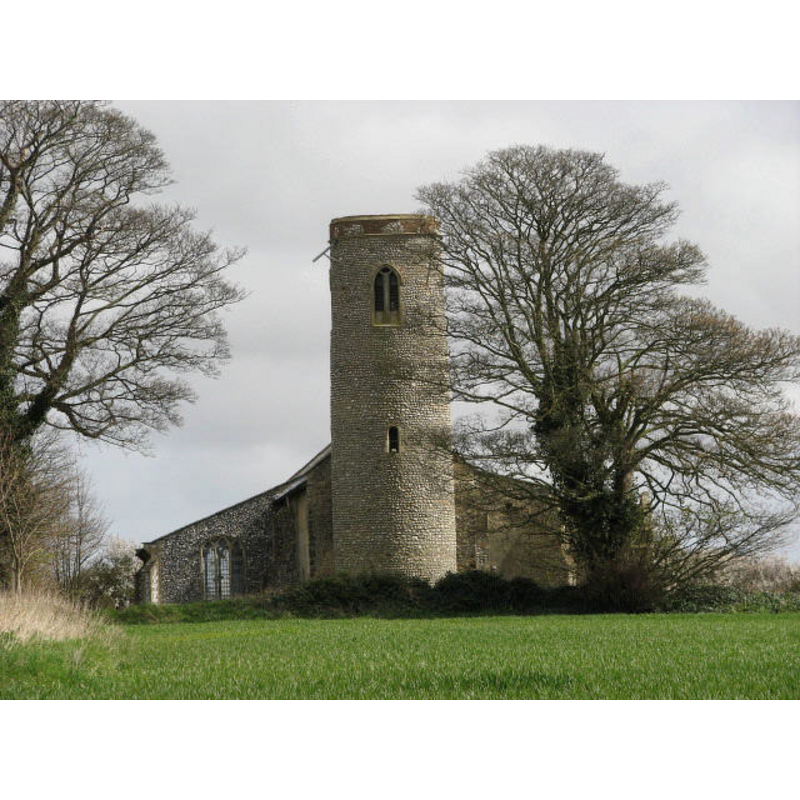
Image copyright © Evelyn Simak, 2007
CC-BY-SA-3.0
Results: 5 records
view of church exterior - west view
Scene Description: in April 2007
Copyright Statement: Image copyright © Evelyn Simak, 2007
Image Source: digital photograph taken 8 April 2007 by Evelyn Simak [www.geograph.org.uk/photo/1555071][accessed 30 May 2013]
Copyright Instructions: CC-BY-SA-3.0
view of church exterior - northwest view
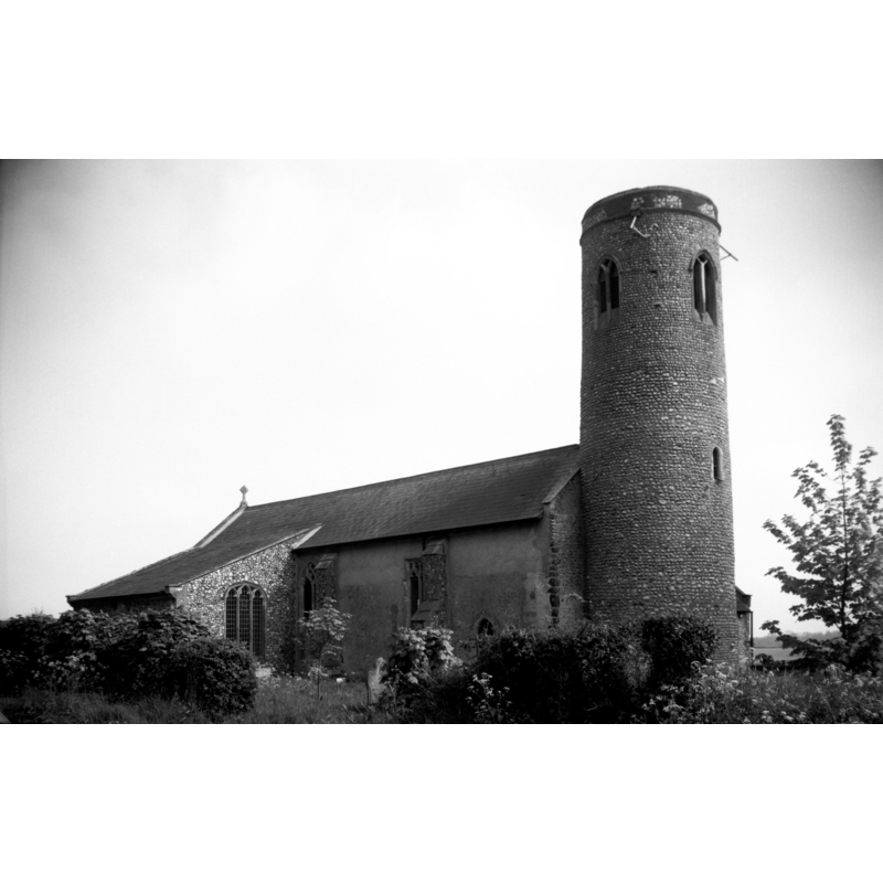
Scene Description: in June 1979
Copyright Statement: Image copyright © George Plunkett, 2013
Image Source: B&W photograph [www.georgeplunkett.co.uk/Norfolk/T/Thwaite All Saints church from NW [6972] 1965-08-27.jpg] [acceessed 30 May 2013]
Copyright Instructions: Standing permission by Jonathan Plunkett
view of church exterior - southeast view
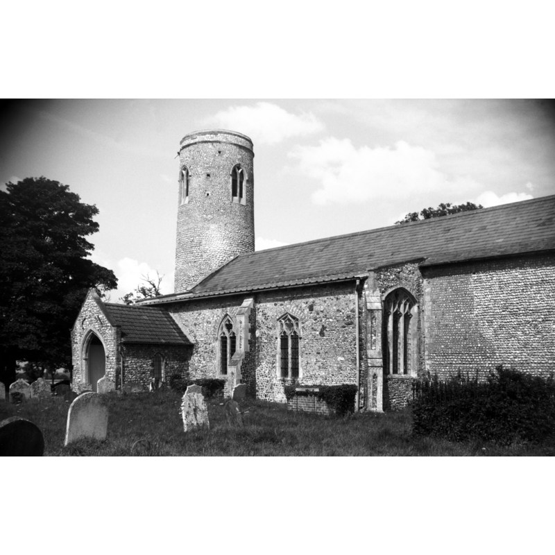
Scene Description: in June 1979
Copyright Statement: Image copyright © George Plunkett, 2013
Image Source: B&W photograph [www.georgeplunkett.co.uk/Norfolk/T/Thwaite All Saints church from SE [5012] 1965-08-27.jpg] [acceessed 30 May 2013]
Copyright Instructions: Standing permission by Jonathan Plunkett
view of church interior - nave - looking east
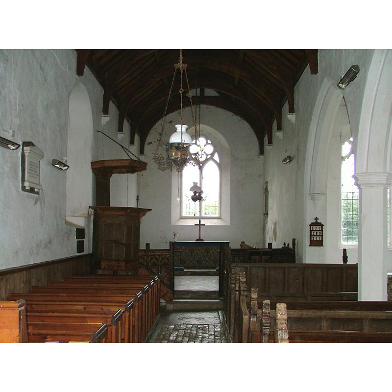
Copyright Statement: Image copyright © Simon Knott, 2005
Image Source: digital photograph October 2005 taken by Simon Knott [www.norfolkchurches.co.uk/thwaite/thwaite.htm] [accessed 31 May 2013]
Copyright Instructions: Standing permission
view of font and cover
![at the west end [though not visible here, the font is attached to the pillar behind it]](/static-50478a99ec6f36a15d6234548c59f63da52304e5/others/permission_not_available.jpg)
Scene Description: at the west end [though not visible here, the font is attached to the pillar behind it]
Copyright Statement: Image copyright © Hugh J Griffiths, 2011, 2013
Image Source: digital photograph taken 4 November 2011 by Hugh J Griffiths [http://eimagesite.net/s2/gst/run.cgi?action=imagen;prid=12080;skr=113_024_015011,15,264] [accessed 30 May 2013]
Copyright Instructions: PERMISSION NOT AVAILABLE -- IMAGE NOT FOR PUBLIC USE
INFORMATION
Font ID: 18478THW
Object Type: Baptismal Font1
Font Century and Period/Style: 14th - 15th century, Medieval
Church / Chapel Name: Parish Church of All Saints
Font Location in Church: Inside the church, by one of the pillars of the S arcade
Church Patron Saint(s): All Saints
Church Notes: round-tower church in the Scarrowbeck Benefice
Church Address: Church Road, Thwaite, Norfolk NR11 7PP
Site Location: Norfolk, East Anglia, England, United Kingdom
Directions to Site: Located on the A140, near Alby, 10 km S of Cromer, 30 N of Norwich
Ecclesiastic Region: Diocese of Norwich
Historical Region: Hundred of South Erpingham
Additional Comments: disappeared font? (the one from the Domesday book time here)
Font Notes:
Click to view
There is an entry in the Domesday survey [http://domesdaymap.co.uk/place/TG1932/thwaite/] [accessed 25 March 2014], which reports a church and church lands in it. Blomefield (1805-1810) writes: "T[hweyt], Commonly called Twait, was given to the abbey of St. Bennets at Holm by the founder King Canute; at the grand survey [i.e., Domesday, 1086] we find it valued at 40s. per annum; half a leuca in length, and the same in breadth, paid 4d. halfpenny gelt, and had a church endowed with 6 acres [...] The Church is dedicated to all the Saints, [...] and was confirmed with the town to Holm abbey by Edward the Confessor". Blomefield (ibid.) names "Peter Trussebut" as first recorded rector here, in 1322. The present font consists of an octagonal basin decorated with a recessed moulding at the upper sides, chamfered at the underbowl, raised on an octagonal pedestal base and a splaying lower base of the same shape, and a polygonal plinth. The font appears to be a crude work and plain except as indicated above; it is set against one of the pillars of the arcade; the basin shows considerable damage probably related to the old cover hardware; it has been perfunctorily repaired. The font cover is octagonal, flat and plain; appears modern. [NB: we have no information on the font of the original church here].
Credit and Acknowledgements: We are grateful to Jonathan Plunkett for the photographs of this church, taken by his father, George Plunkett, in 1965 and 1993
COORDINATES
UTM: 31U 382537 5857409
Latitude & Longitude (Decimal): 52.853589, 1.255531
Latitude & Longitude (DMS): 52° 51′ 12.92″ N, 1° 15′ 19.91″ E
MEDIUM AND MEASUREMENTS
Material: stone
Font Shape: octagonal, mounted
Basin Interior Shape: round
Basin Exterior Shape: octagonal
LID INFORMATION
Date: modern
Material: wood
Apparatus: no
Notes: [cf. FontNotes]
REFERENCES
- Blomefield, Francis, An essay towards a topographical history of Norfolk, 1805-1810, vol. 6: 468-471 / [www.british-history.ac.uk/report.aspx?compid=78280] [accessed 30 May 2013]