Bickerston / Bikereston / Bikerston / Bixton
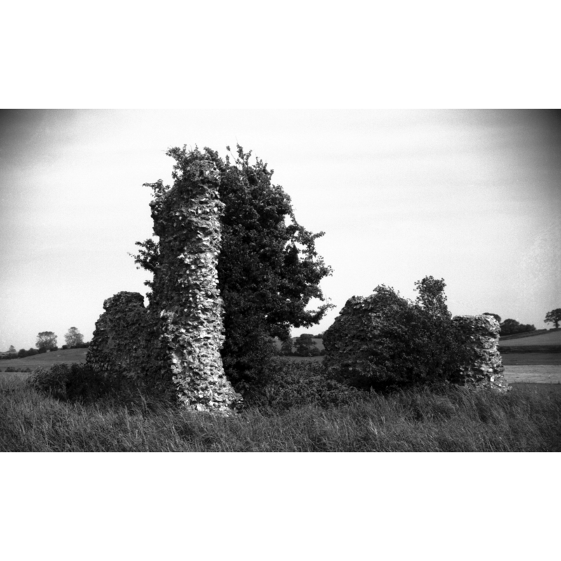
Image copyright © George Plunkett, 2014
Standing permission by Jonathan Plunkett
Results: 4 records
view of church exterior
Scene Description: Photo caption: "Fragments of tower and nave. Site became part of Barnham Broom parish"
Copyright Statement: Image copyright © George Plunkett, 2014
Image Source: B&W photograph taken 4 June 1966 by George Plunkett [www.georgeplunkett.co.uk/Norfolk/B/Barnham Broom St Andrew's Bickerston ruin [5057] 1966-06-04.jpg] [accessed 10 June 2014]
Copyright Instructions: Standing permission by Jonathan Plunkett
view of church exterior - detail
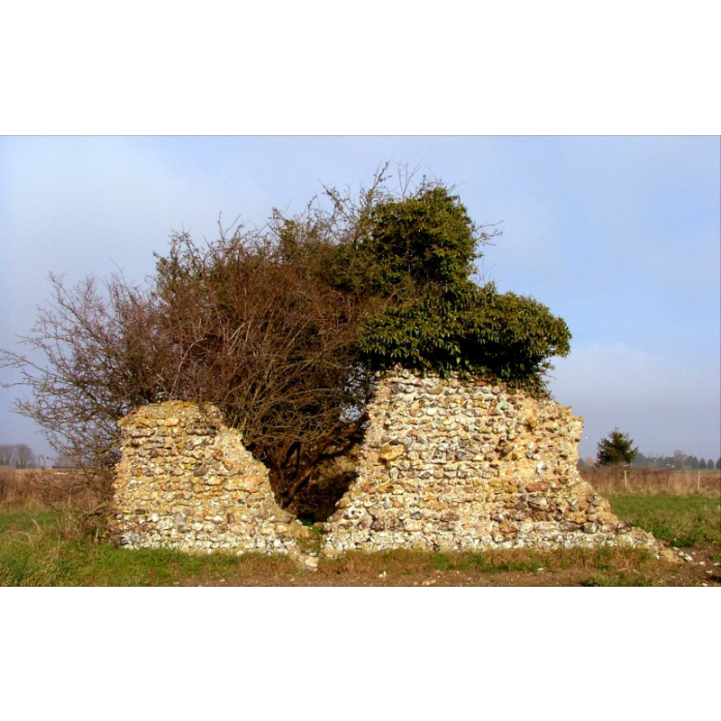
Scene Description: the ruins of St. Andrew
Copyright Statement: Image copyright © Simon Knott, 2006
Image Source: digital photograph February 2006 taken by Simon Knott [www.norfolkchurches.co.uk/bickerston/bickerston.htm] [accessed 30 May 2013]
Copyright Instructions: Standing permission
view of church exterior - detail
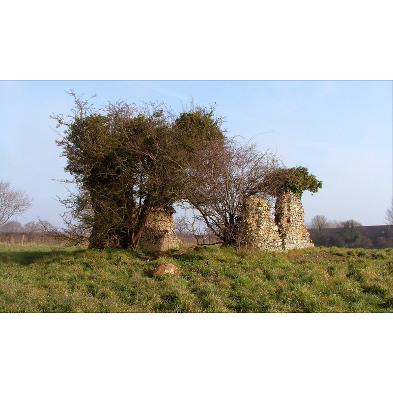
Scene Description: the ruins of St. Andrew
Copyright Statement: Image copyright © Simon Knott, 2006
Image Source: digital photograph February 2006 taken by Simon Knott [www.norfolkchurches.co.uk/bickerston/bickerston.htm] [accessed 30 May 2013]
Copyright Instructions: Standing permission
view of church exterior - detail
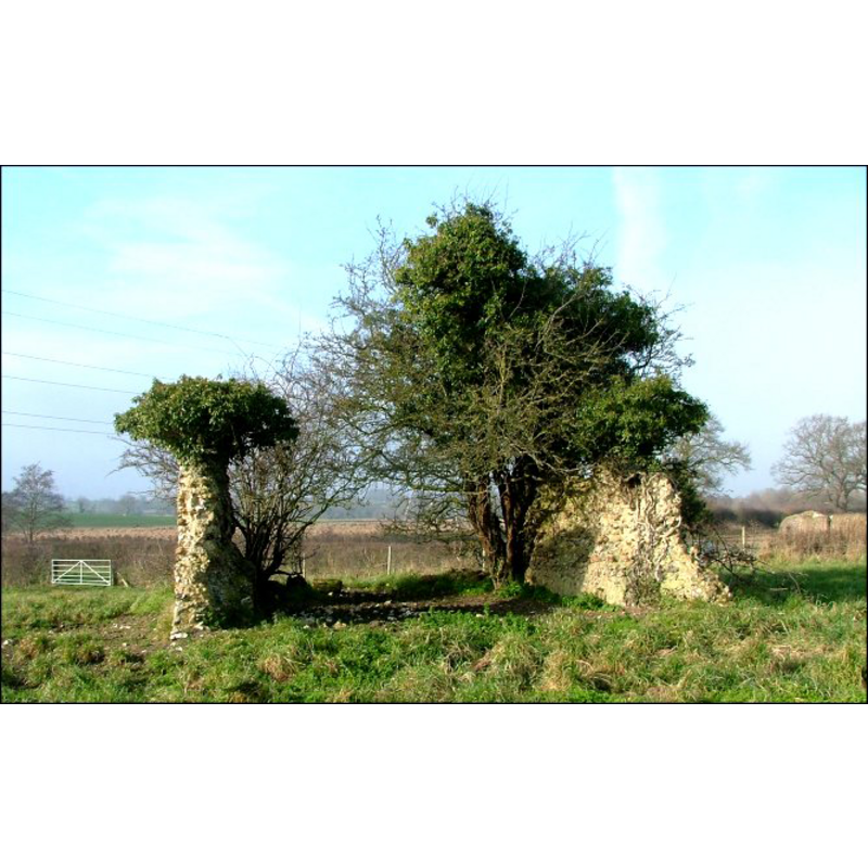
Scene Description: the ruins of St. Andrew
Copyright Statement: Image copyright © Simon Knott, 2006
Image Source: digital photograph February 2006 taken by Simon Knott [www.norfolkchurches.co.uk/bickerston/bickerston.htm] [accessed 30 May 2013]
Copyright Instructions: Standing permission
INFORMATION
Font ID: 18476BIX
Object Type: Baptismal Font1
Font Century and Period/Style: 12th - 13th century, Medieval
Church / Chapel Name: Parish Church of St. Andrew [aka All Saints'] [in ruins by 1800]
Church Patron Saint(s): St. Andrew [All Saints']
Church Address: the remains of old St. Andrew's Church are off Honingham Road, just NE of the Bickerston Bridge
Site Location: Norfolk, East Anglia, England, United Kingdom
Directions to Site: Located just NNE of Barnham-Broom, WSW of Norwich
Ecclesiastic Region: [Diocese of Norwich]
Historical Region: Hundred of Forehoe
Additional Comments: disappeared font? (the one from the medieval church now in ruins)
Font Notes:
Click to view
Blomefield (1805-1810) writes: "B[ixton], [o]r Bikereston, was dedicated to St. Andrew, and was a parochial church, and had two rectors; Sir Will. de Mortimer was patron of one mediety, and Warine de Herford of the other; each rector had eleven acres glebe", and names the first recorded rectors of the two medieties: "Adam de Herford, to Herford's mediety", in 1307, and "Richard de Helmingham", to Mortimer's mediety, in 1295. Blomefield (ibid.) adds: "The Church is ruinated, and it hath been a sinecure for some time; it is now esteemed as an hamlet to Bernham-Broome." In his entry for Bernham-Broome, Blomefield (ibid.) notes: "Its two churches are consolidated, and the church of Bickerston, or Bixton, which was dedicated to St. Andrew, was consolidated to them Ao. 1680." White's Gazetteer of 1854 (p. 467) notes: "There was anciently a church at Bickerston, the foundations of which are still to be seen", and the ruins were reported still visible in White's 1883 edition. Knott (2006) describes the ramains as "Two broken flint walls boil with elder in a field on the road between Colton and Barnham Broom [...] In fact, they are probably the remains of a Norman church [...] Bickerston, sometimes recorded as Bixton, is in the parish of Barnham Broom, and has been for centuries. There are no parish records in existence, suggesting that St Andrew fell into disuse at, or even before, the Reformation."
Credit and Acknowledgements: We are grateful to Simon Knott, of Norfolk Churches [www.norfolkchurches.co.uk], for his photographs of the remains of this church; we are also grateful to Jonathan Plunkett for the photographs of this church, taken by his father, George Plunkett, in June 1966
COORDINATES
UTM: 31U 370194 5833528
Latitude & Longitude (Decimal): 52.636192, 1.081772
Latitude & Longitude (DMS): 52° 38′ 10.29″ N, 1° 4′ 54.38″ E
REFERENCES
- Blomefield, Francis, An essay towards a topographical history of Norfolk, 1805-1810, vol. 2: 375-377 / [www.british-history.ac.uk/report.aspx?compid=78083] [accessed 30 May 2013]
- Blomefield, Francis, An essay towards a topographical history of Norfolk, 1805-1810, vol. 2: 377-381 / [www.british-history.ac.uk/report.aspx?compid=78084] [accessed 30 May 2013]
- Knott, Simon, The Norfolk Churches Site, Simon Knott, 2004. [standing permission to reproduce images received from Simon (February 2005]. URL: www.norfolkchurches.co.uk.