Heydon nr. Royston
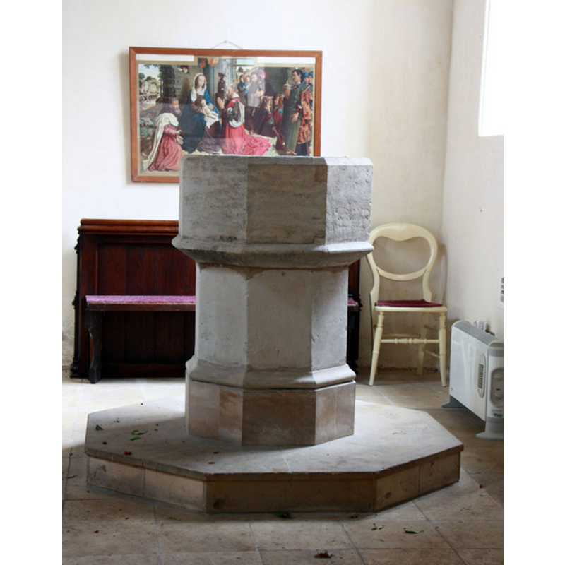
Image copyright © John Salmon, 2011
CC-BY-SA-3.0
Results: 6 records
view of font
Scene Description: the restored font inside the tower space in 2011
Copyright Statement: Image copyright © John Salmon, 2011
Image Source: digital photograph taken 20 January 2011 by John Salmon [www.geograph.org.uk/photo/2241595] [accessed 22 May 2013]
Copyright Instructions: CC-BY-SA-3.0
view of church exterior - north view
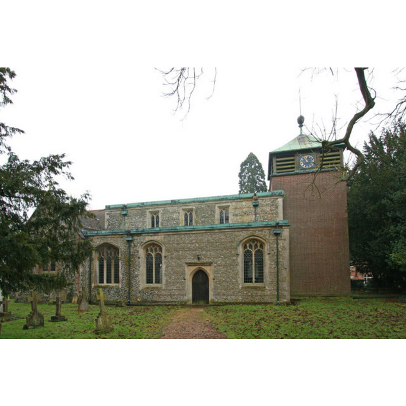
Scene Description: the restored church in 2011
Copyright Statement: Image copyright © John Salmon, 2011
Image Source: digital photograph taken 20 January 2011 by John Salmon [www.geograph.org.uk/photo/2241568] [accessed 22 May 2013]
Copyright Instructions: CC-BY-SA-3.0
view of church exterior - southeast view
![the church before the 1940 bombing
B&W pre1940 EXT SE B&W photograph in Cambridgeshire Churches [www.druidic.org/camchurch/churches/heydon.htm] [accessed 22 May 2013]
modern EXT NW digital photograph taken 20 January 2011 by John Salmon [www.geograph.org.uk/photo/2241568] [accessed 22 May 2013]
modern INT E digital photograph taken 20 January 2011 by John Salmon [www.geograph.org.uk/photo/2241571] [accessed 22 May 2013]
modern INT W digital photograph taken 20 January 2011 by John Salmon [www.geograph.org.uk/photo/2241577] [accessed 22 May 2013]
restored FONT digital photograph taken 20 January 2011 by John Salmon [www.geograph.org.uk/photo/2241595] [accessed 22 May 2013]](/static-50478a99ec6f36a15d6234548c59f63da52304e5/compressed/1130528005_compressed.png)
Scene Description: the church before the 1940 bombing
B&W pre1940 EXT SE B&W photograph in Cambridgeshire Churches [www.druidic.org/camchurch/churches/heydon.htm] [accessed 22 May 2013]
modern EXT NW digital photograph taken 20 January 2011 by John Salmon [www.geograph.org.uk/photo/2241568] [accessed 22 May 2013]
modern INT E digital photograph taken 20 January 2011 by John Salmon [www.geograph.org.uk/photo/2241571] [accessed 22 May 2013]
modern INT W digital photograph taken 20 January 2011 by John Salmon [www.geograph.org.uk/photo/2241577] [accessed 22 May 2013]
restored FONT digital photograph taken 20 January 2011 by John Salmon [www.geograph.org.uk/photo/2241595] [accessed 22 May 2013]
Copyright Statement: Image copyright © Cambridgeshire Churches, 2013
Image Source: B&W photograph in Cambridgeshire Churches [www.druidic.org/camchurch/churches/heydon.htm] [accessed 22 May 2013]
Copyright Instructions: Assumed PD
view of church interior - nave - looking west
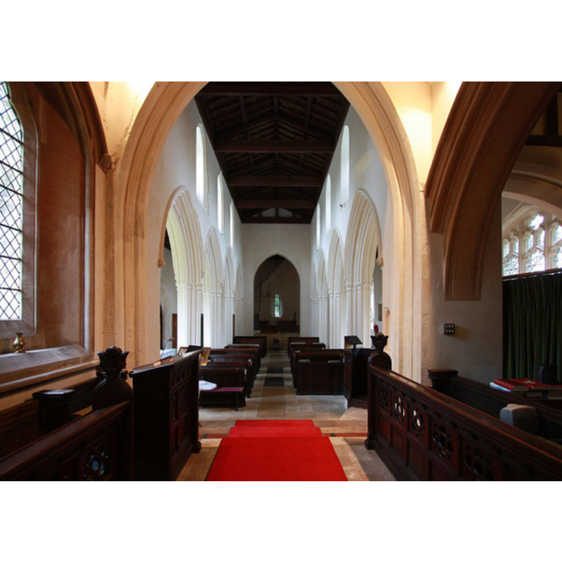
Scene Description: the restored church in 2011
Copyright Statement: Image copyright © John Salmon, 2011
Image Source: digital photograph taken 20 January 2011 by John Salmon [www.geograph.org.uk/photo/2241577] [accessed 22 May 2013]
Copyright Instructions: CC-BY-SA-3.0
view of church interior - nave - looking east
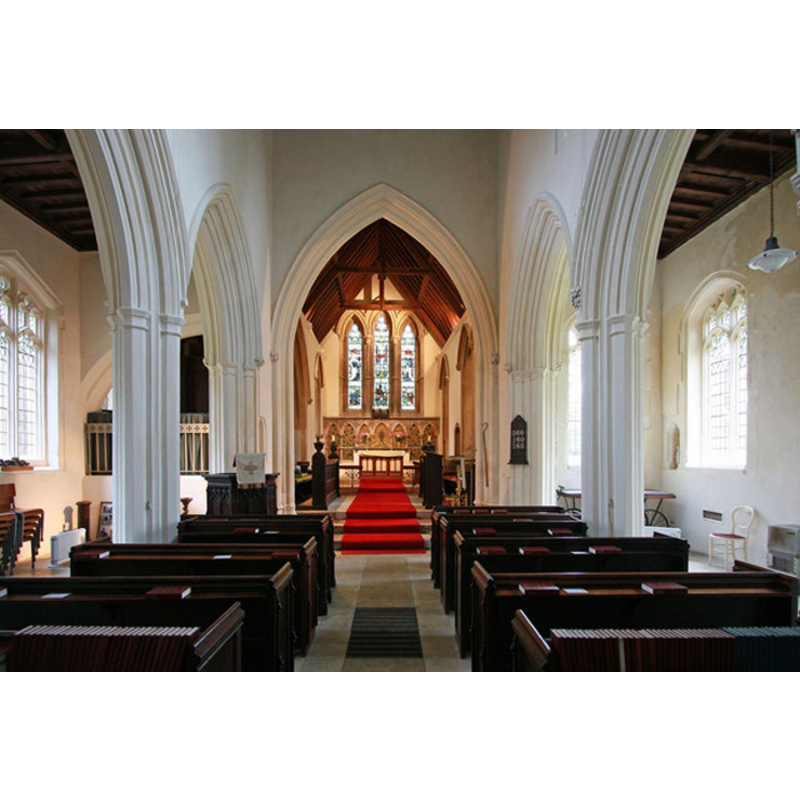
Scene Description: the restored church in 2011
Copyright Statement: Image copyright © John Salmon, 2011
Image Source: digital photograph taken 20 January 2011 by John Salmon [www.geograph.org.uk/photo/2241571] [accessed 22 May 2013]
Copyright Instructions: CC-BY-SA-3.0
view of church

Scene Description: the remains of the church right after the German bombing in 1940
Copyright Statement: Image copyright © mym, 2005
Image Source: B&W photographs taken in 1940; reproduced in www.geograph.org.uk/photo/3307 [accessed 22 May 2013]
Copyright Instructions: PERMISSION NOT AVAILABLE -- IMAGE NOT FOR PUBLIC USE
INFORMATION
Font ID: 18471HEY
Object Type: Baptismal Font1
Font Century and Period/Style: 14th century [restored], Decorated [altered]
Church / Chapel Name: Parish Church of he Holy Trinity
Font Location in Church: Inside the restored church, beneath the tower
Church Patron Saint(s): The Holy Trinity
Church Notes: church destroyed by German bombing in 1940; re-built, consecrated in 1956
Church Address: Chishill Road, Heydon, Cambridgeshire SG8 8PN
Site Location: Cambridgeshire, East, England, United Kingdom
Directions to Site: Located off (S) the A505, about 12 km E of Royston
Ecclesiastic Region: Diocese of Chelmsford
Additional Comments: damaged font (in the 1940, WWII bombing) -- restored font
Font Notes:
Click to view
The present font is a restoration of the one damaged in the 1940 bombing; it consists of an octagonal basin raised on an octagonal pedestal base and an octagonal plinth; plain except for a couple of mouldings.
Credit and Acknowledgements: We are grateful to Mark Ynys-Mon, of Cambridgeshire Churches [www.druidic.org/camchurch], for his photograph of this church
COORDINATES
UTM: 31U 300276 5769428
Latitude & Longitude (Decimal): 52.039438, 0.087858
Latitude & Longitude (DMS): 52° 2′ 21.98″ N, 0° 5′ 16.29″ E
MEDIUM AND MEASUREMENTS
Material: stone
Font Shape: octagonal, mounted
Basin Interior Shape: round
Basin Exterior Shape: octagonal