Peyzac-le-Moustier No. 2 / Paisac e lo Mostièr / Peyzac-de-Montignac
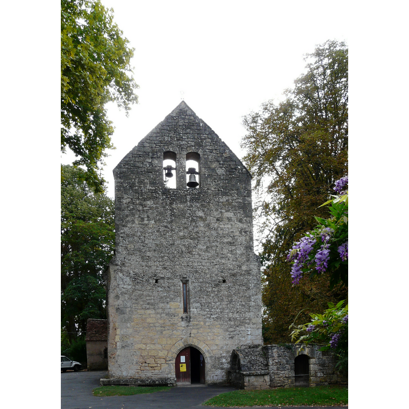
Image copyright © Père Igor, 2011
CC-BY-SA-3.0
Results: 4 records
view of church exterior - west view
Scene Description: the structure at the bottom right is an 'enfeu', a tomb built onto the church wall
Copyright Statement: Image copyright © Père Igor, 2011
Image Source: digital photograph [edited] taken 12 September 2011 by Père Igor [http://commons.wikimedia.org/wiki/File:Peyzac_Moustier_église.jpg] [accessed 19 May 2013]
Copyright Instructions: CC-BY-SA-3.0
view of church exterior - northeast view
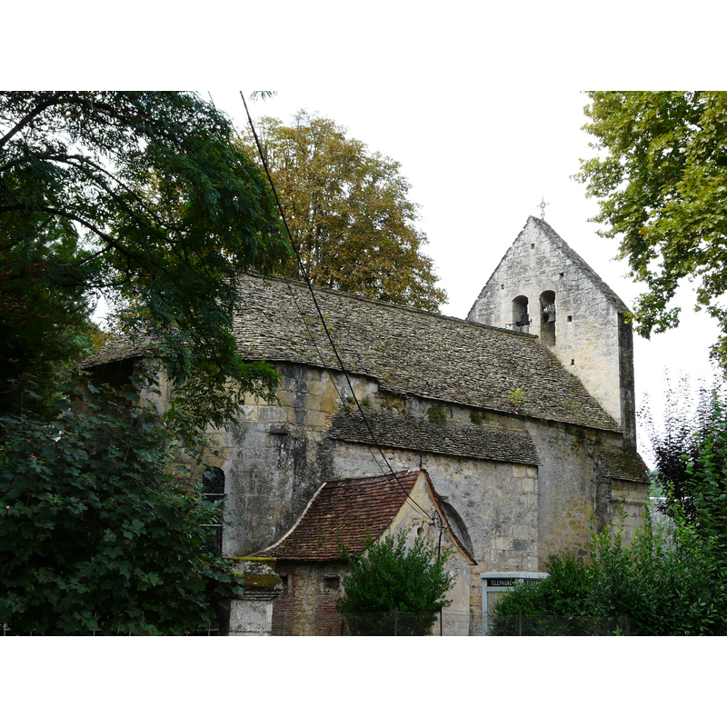
Copyright Statement: Image copyright © Père Igor, 2011
Image Source: digital photograph taken 12 September 2011 by Père Igor [http://commons.wikimedia.org/wiki/File:Peyzac_Moustier_%C3%A9glise_%284%29.jpg] [accessed 19 May 2013]
Copyright Instructions: CC-BY-SA-3.0
view of church interior - nave - looking east
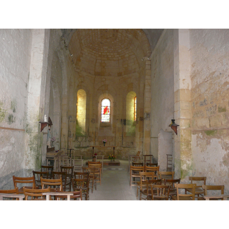
Copyright Statement: Image copyright © Père Igor, 2011
Image Source: digital photograph taken 12 September 2011 by Père Igor [http://commons.wikimedia.org/wiki/File:Peyzac_Moustier_église_nef.jpg] [accessed 19 May 2013]
Copyright Instructions: CC-BY-SA-3.0
view of stoup
![[cf. FontNotes]](/static-50478a99ec6f36a15d6234548c59f63da52304e5/compressed/1130519002_compressed.png)
Scene Description: [cf. FontNotes]
Copyright Statement: Image copyright © Père Igor, 2011
Image Source: digital photograph taken 12 September 2011 by Père Igor [http://commons.wikimedia.org/wiki/File:Peyzac_Moustier_église_bénitier.jpg] [accessed 19 May 2013]
Copyright Instructions: CC-BY-SA-3.0
INFORMATION
Font ID: 18463PEY
Object Type: Other
Object Details: altar, Roman,
Font Century and Period/Style: 2nd - 5th century, Roman [altered]
Church / Chapel Name: Église Saint-Robert du Moustier
Font Location in Church: Inside the church
Church Patron Saint(s): St. Robert
Church Notes: church originally 12thC
Church Address: 24620 Peyzac Le Moustier, France
Site Location: Dordogne, Nouvelle-Aquitaine, France, Europe
Directions to Site: Located off the D66 in the canton Montignac, arrondissement Sarlat-la-Canéda, 10 km from Montignac
Historical Region: The three hamlets Le Moustier, Peyzac and La Roque-Saint-Christophe merged in 1793 under the name 'Peyzac-de-Montignac'; in turn this became 'Peyzac-le-Moustier' in 1925
Additional Comments: re-cycled Roman altar?
Font Notes:
Click to view
The holy-water stoup in this church is a monolith of rectangular shape, resembling an old Roman altar, which it may have been originally. The church itself is dated in Mérimée [référence PA00082765] as the former chapel of on ancient priory that apparently depended from La Roque-Saint-Christophe; dated 12th-century. [cf. Index entry for Peyzac-le-Moustier No. 1 for a font in this church]
COORDINATES
UTM: 31T 347056 4984094
Latitude & Longitude (Decimal): 44.993806, 1.059667
Latitude & Longitude (DMS): 44° 59′ 37.7″ N, 1° 3′ 34.8″ E