Oxborough No. 3 / Oxburgh / Oxenburh
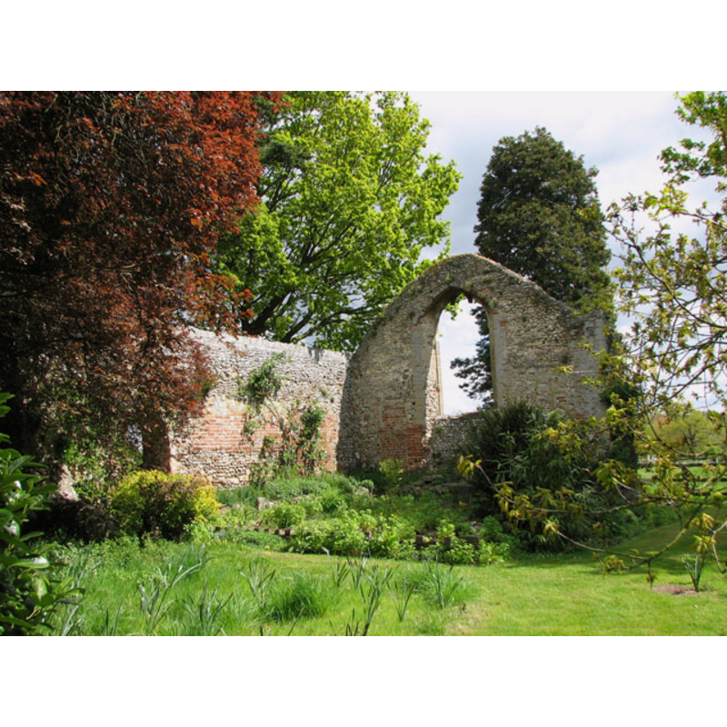
Image copyright © Evelyn Simak, 2010
CC-BY-SA-3.0
Results: 1 records
view of church interior - nave - detail
Scene Description: Ruins of old St. Mary Magdalene's
Copyright Statement: Image copyright © Evelyn Simak, 2010
Image Source: digital photograph taken 13 May 2010 by Evelyn Simak [www.geograph.org.uk/photo/1857099] [accessed 15 May 2013]
Copyright Instructions: CC-BY-SA-3.0
INFORMATION
Font ID: 18456OXB
Object Type: Baptismal Font1?
Font Date: ca. 950?
Font Century and Period/Style: 10th century (mid?), Pre-Conquest
Church / Chapel Name: Parish Church of St. Mary Magdalene [in ruins]
Font Location in Church: [cf. FontNotes]
Church Wikidata: https://commons.wikimedia.org/wiki/File:Oxborough_Hythe,_ruin_of_the_church_of_St._Mary_Magdalene_(geograph_4353781).jpg
Church Patron Saint(s): St. Mary Magdalene
Church Notes: one Norman doorway and some other remains of the medieval church/chapel here -- said to have been abandoned in the 14thC
Church Address: Ferry Road, Oxborough, Norfolk PE33 9PT
Site Location: Norfolk, East Anglia, England, United Kingdom
Directions to Site: Located in a the gardens of The Old Rectory, a private property, E of Ferry Rd
Ecclesiastic Region: [Diocese of Norwich]
Historical Region: Hundred of South Greenhoe
Additional Comments: disappeared font? (the one from the original church here)
Font Notes:
Click to view
In his entry for 'Oxburgh', Blomefield (1805-1810) describes the then church of St. John the Evangelist in some detail, as is his custom, and adds: "South-west of the present church, about half a mile, and near to the rectory-house, stands the ancient parochial or mother church, being a single building of flint, &c. with a finishing over, and having four large buttresses of free-stone, one at each corner: it is a very plain rude edifice about 34 feet in length, and 20 in breadth, very much resembling that draught of the church of Glastonbury [...] About the south-west part of this pile, near the foundation of the buttress, a gardener digging some few years past, found a small Saxon brass coin, on one side the legend is Aedelred Rex, the reverse is obscure, but seems to be Leofstan, probably the mint-master. This is that Edelred or Eldred, who was King of England in 946, about whose reign this church was most likely erected. The greatest part of the old pile is still entire, with the arches of the east and west windows, and some of the principals of the old roof; the western part of it is now a dove-house, and has been so time immemorial; it was most likely disused some ages since, upon the building of the other church, as may be supposed from the burials of several rectors there, some ages past. On the north side of the east window, is an arch in the wall, no doubt for the imago principalis, which was enjoined to be in all churches; to this old church there belonged a very large churchyard or cemetery, containing 3 or 4 acres of ground, now part of the glebe". [NB: the monarch to whom the foundation of this church is attributed above would probably be Eadred [aka Eadreadus, Edred], son of Edward the Elder, and younger brother of Edmund I, from whom he inherited the throne; he reigned from 946 to his death in 955].
COORDINATES
Latitude & Longitude (Decimal): 52.57447, 0.56245
Latitude & Longitude (DMS): 52° 34′ 28.11″ N, 0° 33′ 44.82″ E
REFERENCES
- Blomefield, Francis, An essay towards a topographical history of Norfolk, 1805-1810, vol. 6: 168-197 / [www.british-history.ac.uk/report.aspx?compid=78244] [accessed 15 May 2013]