Caldecote nr. Swffham / Caldachota / Caldanchota / Caldechota / Corket
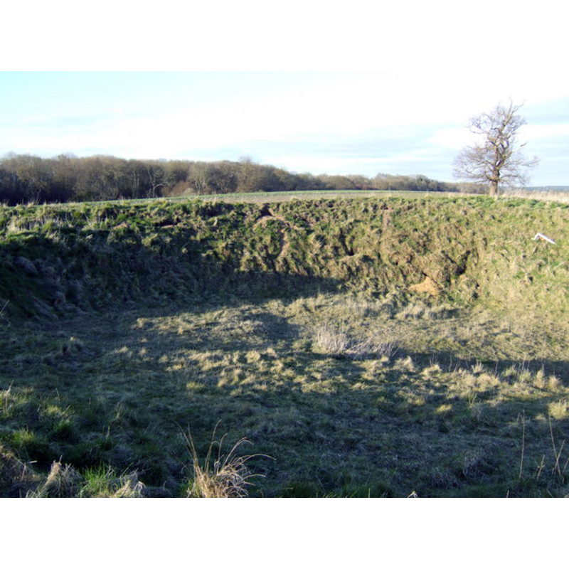
Image copyright © Jonathan Billinger, 2007
CC-BY-SA-3.0
Results: 2 records
view of church exterior
Scene Description: all that remains now [April 2007] of the church ruins
Copyright Statement: Image copyright © Jonathan Billinger, 2007
Image Source: digital photograph taken 4 April 2007 by Jonathan Billinger [www.geograph.org.uk/photo/518396] [accessed 8 May 2013]
Copyright Instructions: CC-BY-SA-3.0
view of church exterior in context
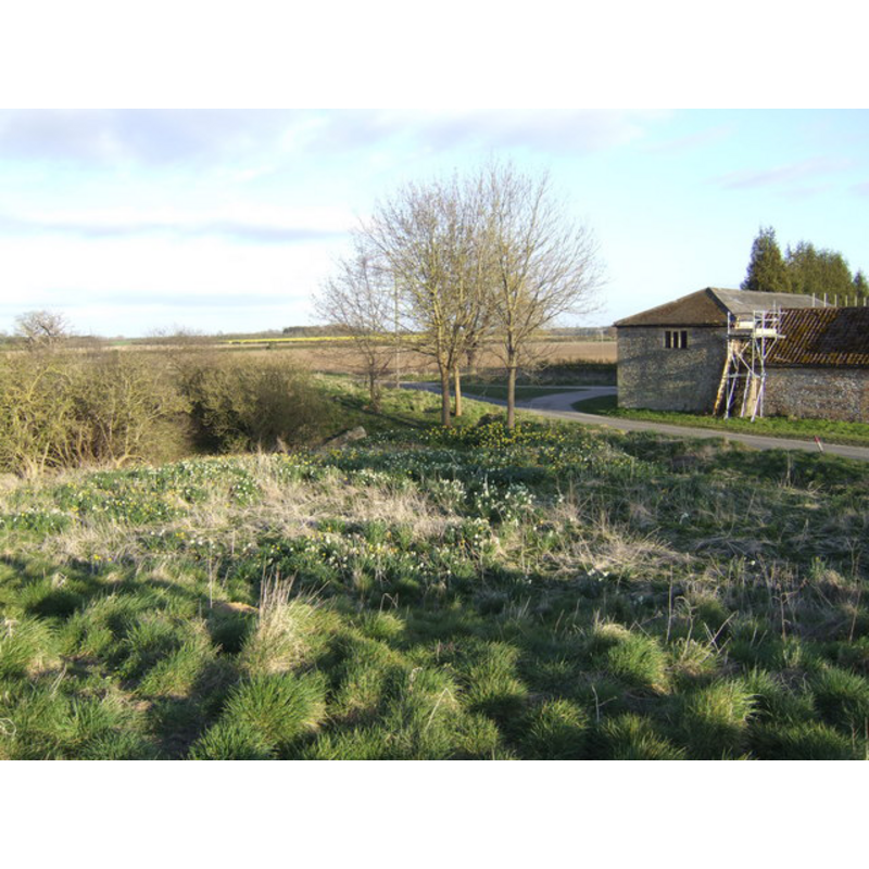
Scene Description: church ruins in context -- camera positioned on the church ramparts; showing the Caldecote Farm on the right
Copyright Statement: Image copyright © Jonathan Billinger, 2007
Image Source: digital photograph taken 4 April 2007 by Jonathan Billinger [www.geograph.org.uk/photo/397732] [accessed 8 May 2013]
Copyright Instructions: CC-BY-SA-3.0
INFORMATION
Font ID: 18454CAL
Object Type: Baptismal Font1?
Church / Chapel Name: Parish Church of St. Mary [in ruins]
Church Patron Saint(s): St. Mary the Virgin
Church Notes: reported to have been in ruins by 1700 [cf. FontNotes]
Church Address: [cf. Directions to Site & FontNotes]
Site Location: Norfolk, East Anglia, England, United Kingdom
Directions to Site: Located by Caldecote Farm, 10 km SW of Swaffham
Ecclesiastic Region: [Diocese of Norwich]
Historical Region: Hundred of South Greenhoe
Additional Comments: disappeared font? (the one from the 13thC-14thC church here)
Font Notes:
Click to view
Blomefield (1805-1810) writes that Caldecote was, in his time, "reduced to a single farm-house", although at the time of the Domesday survey "here were two manors". On the church itself, Blomefield (ibid.) writes: "The church, which was dedicated to the Virgin Mary, hath been in ruins above a century past; many of the walls are still standing; the site of it is on an hill on the north side, and near to the yards of the manor, or farm-house; it was a single building of flint, chalk, &c. in length about 27 feet, and 17 in breadth, with a north and a south door". "Roger Boydin" appears as its first recorded rector, in 1305. A footnote in Blomefield (ibid.) informs that in 1583 the rector was "William Strickland [...] also rector of Melton St. Mary. [...] In his answer to the King's Queries in 1603, he observes that the church was then profaned, and had only a case standing, and one house in the parish". [NB: we have no information on the font from the medieval church here].
COORDINATES
UTM: 31U 335821 5830675
Latitude & Longitude (Decimal): 52.601254, 0.57568
Latitude & Longitude (DMS): 52° 36′ 4.51″ N, 0° 34′ 32.45″ E
REFERENCES
- Blomefield, Francis, An essay towards a topographical history of Norfolk, 1805-1810, vol. 6: 56-60 / [www.british-history.ac.uk/report.aspx?compid=78228] [accessed 8 May 2013]