Shotesham No. 4 / Great Shotesham / High Shotesham / Scotesha / Scotesia / Scotessa / Scotessâ / Scotessam
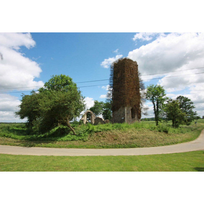
Image copyright © John Salmon, 2010
CC-BY-SA-3.0
Results: 4 records
view of church exterior - northwest view
Scene Description: the remains of St. Martin's church
Copyright Statement: Image copyright © John Salmon, 2010
Image Source: digital photograph taken 12 June 2010 by John Salmon [www.geograph.org.uk/photo/1925190] [accessed 25 April 2013]
Copyright Instructions: CC-BY-SA-3.0
view of church interior - west end
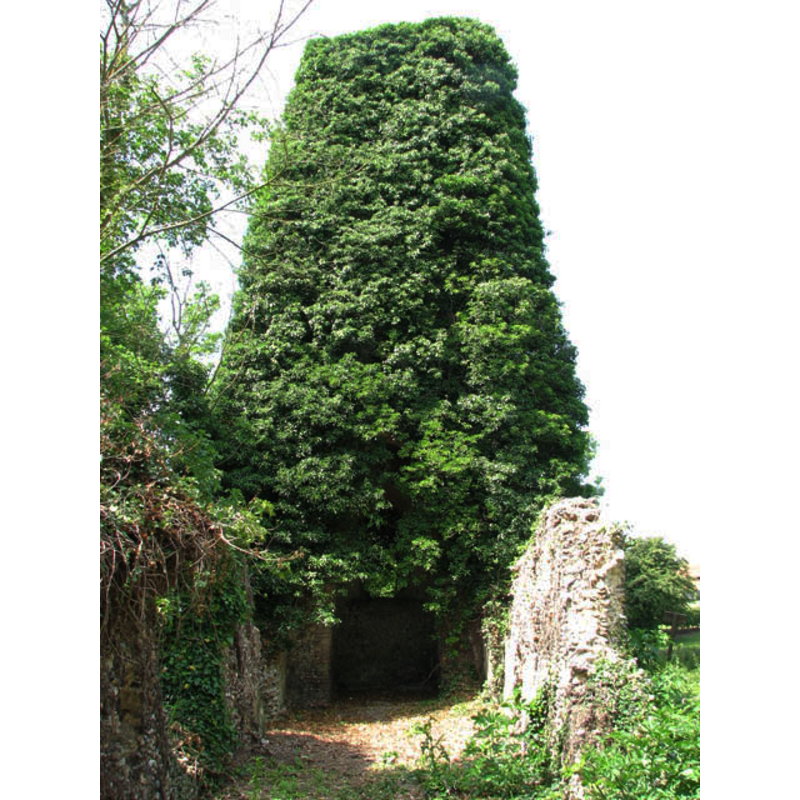
Scene Description: showing the doorway into the tower from the west end of the nave
Copyright Statement: Image copyright © Evelyn Simak, 2009
Image Source: digital photograph taken 25 June 2009 by Evelyn Simak [www.geograph.org.uk/photo/1372635] [accessed 25 April 2013]
Copyright Instructions: CC-BY-SA-3.0
view of church interior - nave - looking west
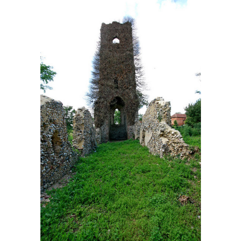
Scene Description: the remains of St. Martin's church
Copyright Statement: Image copyright © John Salmon, 2010
Image Source: digital photograph taken 12 June 2010 by John Salmon [www.geograph.org.uk/photo/1925186] [accessed 25 April 2013]
Copyright Instructions: CC-BY-SA-3.0
view of church interior - nave - looking east
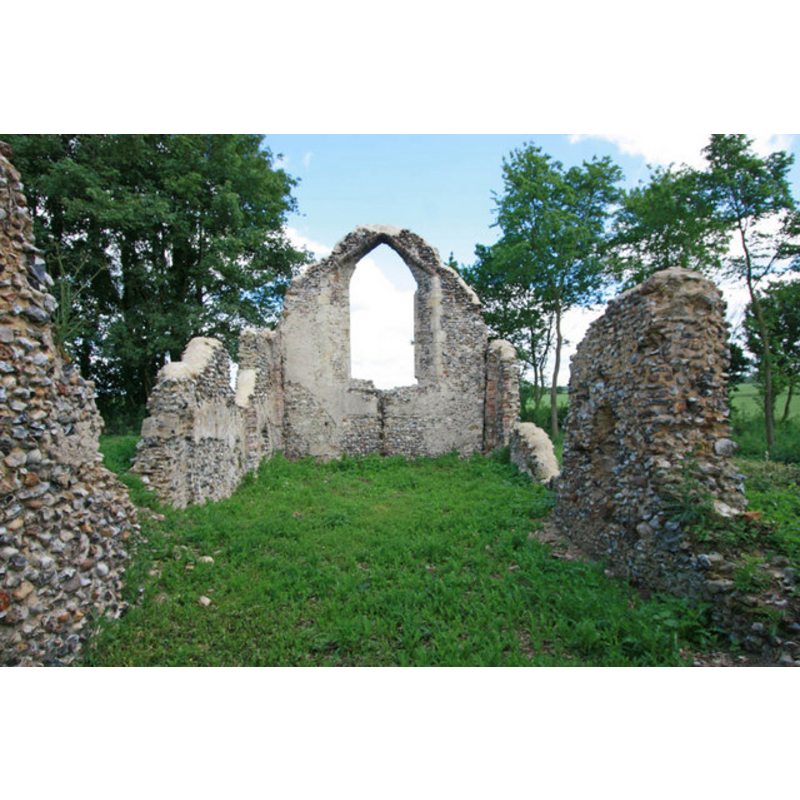
Scene Description: the remains of St. Martin's church
Copyright Statement: Image copyright © John Salmon, 2010
Image Source: digital photograph taken 12 June 2010 by John Salmon [www.geograph.org.uk/photo/1372635] [accessed 25 April 2013]
Copyright Instructions: CC-BY-SA-3.0
INFORMATION
Font ID: 18434SHO
Object Type: Baptismal Font1?
Font Century and Period/Style: 11th century, Norman
Church / Chapel Name: Parish Church of St. Martin [in ruins]
Church Patron Saint(s): St. Martin of Tours
Church Address: Off Roger's Lane, Shotesham NR15 1UW
Site Location: Norfolk, East Anglia, England, United Kingdom
Ecclesiastic Region: [Diocese of Norwhich]
Historical Region: Hundred of Henstede [aka Henstead]
Additional Comments: disappeared font? (the one from the Domesday-time church here)
Font Notes:
Click to view
Blomefield (1805-1810) writes in his entry for Shotesham: "it was in above twelve parts, at the Confessor's and Conqueror's surveys; it had four capital manors, four parish churches, two hamlets [...] The church of St. Martin belonged to the Abbot of St. Bennet at Holm [...] Master Richard de Boyland was rector here in Edward the First's time [i.e., 1272-1307] [...] The ruins of the church may be seen not far distant from St. Mary's." [NB: we have no information on the font from the Domesday-time church here].
COORDINATES
UTM: 31U 384684 5822442
Latitude & Longitude (Decimal): 52.539843, 1.299659
Latitude & Longitude (DMS): 52° 32′ 23.44″ N, 1° 17′ 58.77″ E
REFERENCES
- Blomefield, Francis, An essay towards a topographical history of Norfolk, 1805-1810, vol. 5: 503-519 / [www.british-history.ac.uk/report.aspx?compid=78216] [accessed 25 April 2013]