Kirby Bedon No. 2 / Kerkebei / Kirby Bidon / Kirkebei / Kirkeby
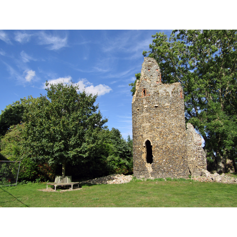
Image copyright © Colin Smith, 2020
Image and permission received from the author (e-mail of 15 November 2020)
Results: 2 records
view of church exterior in context
Scene Description: remains of the 13thC round tower of Kirby Bedon St Mary's
Copyright Statement: Image copyright © Colin Smith, 2020
Image Source: digital photograph taken 20 August 2020 by Colin Smith
Copyright Instructions: Image and permission received from the author (e-mail of 15 November 2020)
view of church exterior in context
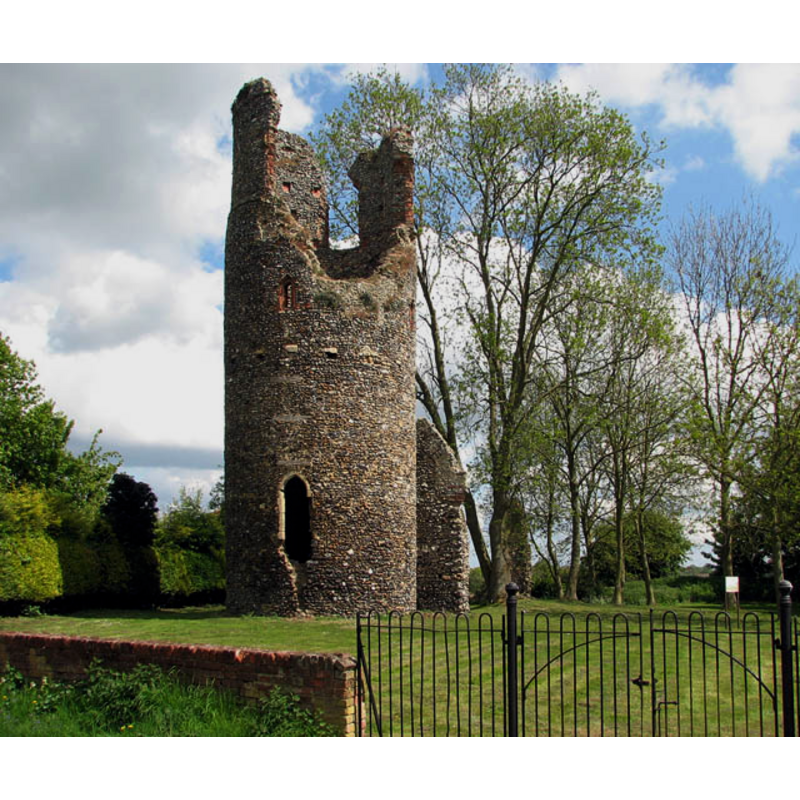
Scene Description: remains of the 13thC round tower of Kirby Bedon St Mary's
Copyright Statement: Image copyright © Evelyn Simak, 2009
Image Source: digital photograph taken 3 May 2009 by Evelyn Simak [www.geograph.org.uk/photo/1284068] [accessed 24 April 2013]
Copyright Instructions: CC-BY-SA-2.0
INFORMATION
Font ID: 18430KIR
Object Type: Baptismal Font1?
Font Century and Period/Style: 11th century, Pre-Conquest? / Norman
Church / Chapel Name: Parish Church of St. Mary [in ruins]
Church Patron Saint(s): St. Mary the Virgin
Church Address: Kirby Bedon, Norwich NR14 7DX, UK -- Tel.: +44 1508 538619
Site Location: Norfolk, East Anglia, England, United Kingdom
Directions to Site: Located off (N) Kirby Rd, N of the A146 [aka London Rd], 5 km SE of Norwich
Ecclesiastic Region: Diocese of Norwich
Historical Region: Hundred of Henstede [aka Henstead]
Additional Comments: disappeared font? (the one from the Domesday-time church here)
Font Notes:
Click to view
There are seven entries for Kirby [Bedon] [variant spelling] in the Domesday survey [https://opendomesday.org/place/TG2705/kirby-bedon/] accessed 15 November 2020], one of which reports "2 churches. 0.16 church lands" in it. Blomefield (1805-1810) writes: "Kirby, or Kirkeby [...] and Bidon, or Bedon [...] take its name from its churches, is no wonder, there being two here, long before the Confessor's time; for in his survey, they were found to have each of them 10 acres of glebe [...] The church of St. Mary at Kirby-Bedon, was appropriated to the abbey of Langleye [...] The church stood east of St. Andrew's, their churchyards being parted by the road only; it is now in ruins; it had a south porch, nave, and chancel, the steeple is standing, and is round, and had two large bells, which were lately taken down, and placed in St. Andrew's church." Blomefield (ibid.) names "William old Barlick of Saxlingham" as first recorded vicar of St. Mary's, in 1308, and "John de Cressingham", who resigned in 1318, as first recorded rector. Wilson's Imperial Gazetter of 1870-1872) reports: "St. Mary's church is now an ivy clad ruin." The entry for this church in Historic England [Listing NGR: TG2792705414] notes; "Ruins of parish church. C13 circular western tower with C14 belfry stage. Flint with brick dressings. Tower survives with part of western gable wall. Occasional fragments of masonry reveal wall lines of body of church. 3 stage tower. Lancet to west. Ringing chamber windows are of brick and rebated. Set-off below belfry. Belfry window type now unidentifiable. Tall tower arch blocked and low rounded tower doorway inserted, probably in C15." [NB: we have no information on the font of the Domesday-time church here, one of two]
Credit and Acknowledgements: We are grateful to Colin Smith for his photograph of the ruins of this church
COORDINATES
UTM: 31U 389170 5828894
Latitude & Longitude (Decimal): 52.59875, 1.363613
Latitude & Longitude (DMS): 52° 35′ 55.5″ N, 1° 21′ 49.01″ E
REFERENCES
- Blomefield, Francis, An essay towards a topographical history of Norfolk, 1805-1810, vol. 5: 474-483 / [www.british-history.ac.uk/report.aspx?compid=78211] [accessed 24 April 2013]