Hackford nr. Reepham / Hacforda [Domesday] / Hackford by Reepham / Hackford juxta Reepham / Hackforda
![Main image for Hackford nr. Reepham / Hacforda [Domesday] / Hackford by Reepham / Hackford juxta Reepham / Hackforda](/static-50478a99ec6f36a15d6234548c59f63da52304e5/compressed/1131007034_compressed.png)
Image copyright © Simon Knott, 2004
Standing permission
Results: 3 records
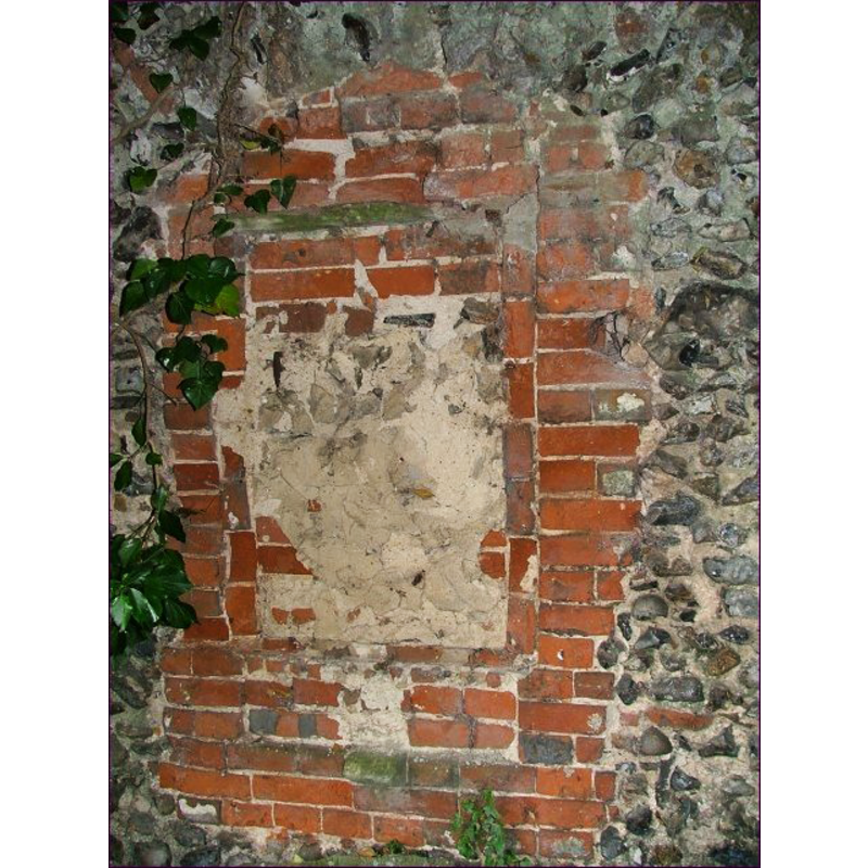
view of church exterior - detail
Scene Description: ruins of old All Saints'
Copyright Statement: Image copyright © Simon Knott, 2004
Image Source: digital photograph June 2004 taken by Simon Knott [www.norfolkchurches.co.uk/hackford/hackford.htm] [accessed 7 October 2013]
Copyright Instructions: Standing permission
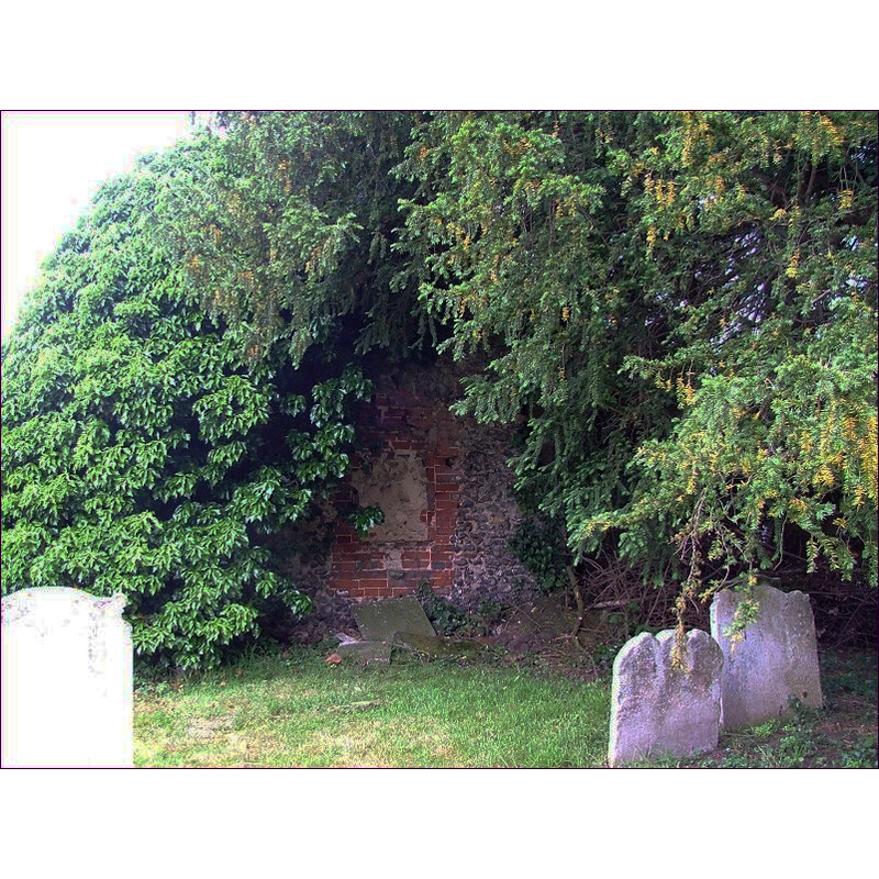
INFORMATION
Font ID: 18390HAC
Object Type: Baptismal Font1?
Font Century and Period/Style: 11th century, Pre-Conquest
Church / Chapel Name: Parish Church of All Saints [in ruins; burnt down in ca. 1500]
Church Patron Saint(s): All Saints
Church Address: [the few remaing ruins of old All Saints' share the churchyard now with Reepham St. Mary's and Whitwell St. Michael's]
Site Location: Norfolk, East Anglia, England, United Kingdom
Directions to Site: Located 3 km W of Reepham
Ecclesiastic Region: [Diocese of Norwich]
Historical Region: Hundred of Eynford
Additional Comments: destroyed font? (the church burned down in 1500/1600) [cf. FontNotes]
Font Notes:
Click to view
The Domesday entry for "Hackforda", transcribed and translated in Blomefield (1805-1810) reports "a church endowed with 9 acres, and 2 acres of meadow" here; this same author writes: "The Church of Hackford was a rectory dedicated to All-Saints", and notes that, sometime around "April 18, in the 35th of Henry VIII [i.e., 1544] the late parish church of Hackford, chancel, with all the church goods, ornaments, and jewels, and most part of the dwelling-houses, &c. in Hackford, were by misfortune lately burnt by fire, the said church or rectory of Hackford, was consolidated to Whitwell, by William Lord Bishop of Norwich, all parties consenting." Blomefield (ibid.) refers to a possible re-building of Hackford's church: "John Goddyng, rector, by his will in 1531, gives to the making of a chapel in the south part of Hackford church, if one happens there to be edified, 6s. 8d. if not, to the repair of the church; [...] and I find Anthony Sugate to bequeath by will 20 marks to the rebuilding of the said church after it was burnt, if ever it should be rebuilt." Gorton (1833) reports a church at Hackford, 2 miles west of Reepham, in 1829. In its entry for Reepham White's Gazetteer of 1836 notes: "Hackford [...] had anciently a separate church [...] but it was burnt down with part of the town, in 1500". [NB: it is not clear from the available sources whether or not the old All Saints was actually re-built at all, and whether the Gorton reference is to a re-built church or to the neighbouring one at Whitwell that took over the parochial functions when All Saints was destroyed]. The ruins of old All Saints are reported in Knott (2004): "The part that survives must have been at the west of the building, but is a curiousity; it consists of a flint wall, the knapped flints facing east - that is to say, they were on the exterior of an eastern wall. The central void appears to have been a window, so it may well be that this was the eastern wall of a south porch. The void was bricked up to form a mausoleum, probably towards the end of the 17th century. A large tablet was cemented to the brickwork, but this has fallen down in recent years, and now lies broken in pieces on the ground below. Trees and bushes overgrow the ruins pleasantly, and a scattering of later gravestones stand in the green cushion where the body of the church used to be."
Credit and Acknowledgements: We are grateful to Simon Knott, of Norfolk Churches [wwwnorfolkchurches.co.uk] for his photographs of the ruins of this church
COORDINATES
UTM: 31U 372638 5847487
Latitude & Longitude (Decimal): 52.762193, 1.11246
Latitude & Longitude (DMS): 52° 45′ 43.9″ N, 1° 6′ 44.86″ E
REFERENCES
- Blomefield, Francis, An essay towards a topographical history of Norfolk, 1805-1810, vol. 8: 223-226 / [www.british-history.ac.uk/report.aspx?compid=78453] [accessed 4 October 2013]
- White, William, History, Gazetteer, and Directory of Norfolk, [s.l.]: [printed for the author], 1883, p. 506