Carleton Forehoe / Carlentuna / Karlentuna
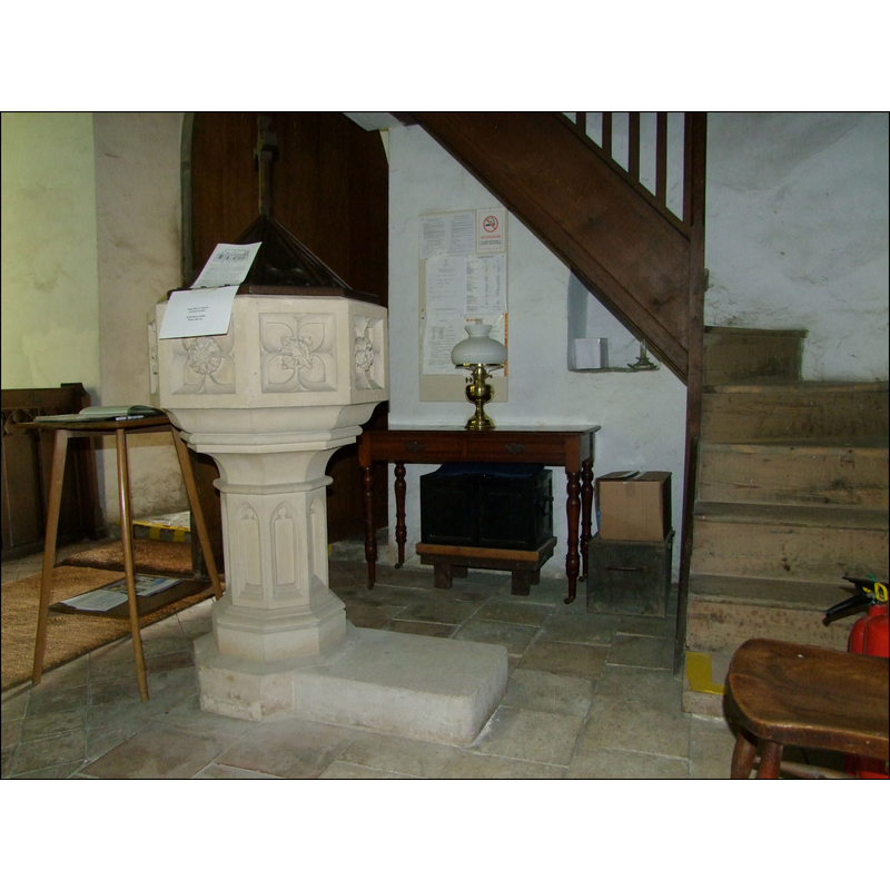
Image copyright © Simon Knott, 2010
Standing permission
Results: 6 records
view of font and cover in context
Scene Description: the modern font
Copyright Statement: Image copyright © Simon Knott, 2010
Image Source: digital photograph taken 5 August 2010 by Simon Knott [www.norfolkchurches.co.uk/carltonforehoe/carltonforehoe.htm] [accessed 18 March 2013]
Copyright Instructions: Standing permission
view of church exterior - southwest end
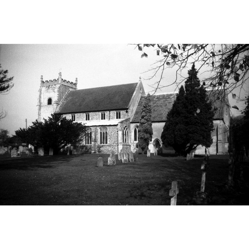
Scene Description: Photo caption: "Tower built 1713, and porch"
view of church exterior - southeast view
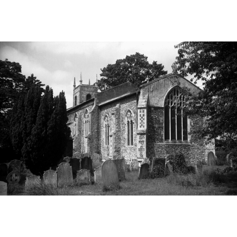
Scene Description: Photo caption: ""Nice original gable cross." (H Munro Cautley)"
Copyright Statement: Image copyright © George Plunkett, 2014
Image Source: B&W photograph taken 15 June 1993 by George Plunkett [www.georgeplunkett.co.uk/Norfolk/C/Carleton Forehoe St Mary's church from SE [7015] 1993-06-15.jpg] [accessed 24 June 2014]
Copyright Instructions: Standing permission by Jonathan Plunkett
view of church exterior - northeast view
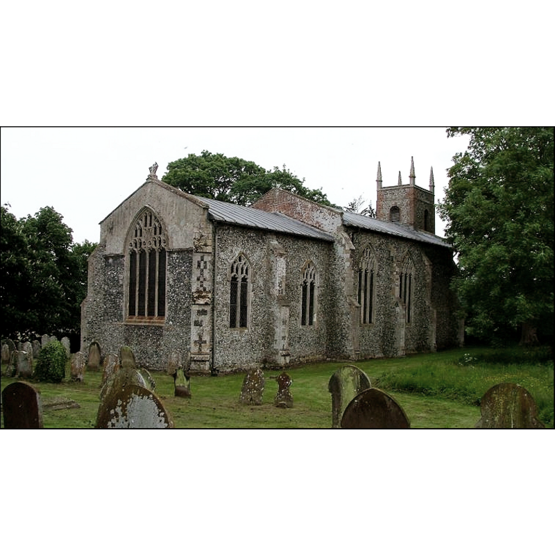
Copyright Statement: Image copyright © Simon Knott, 2010
Image Source: digital photograph taken 5 August 2010 by Simon Knott [www.norfolkchurches.co.uk/carltonforehoe/carltonforehoe.htm] [accessed 18 March 2013]
Copyright Instructions: Standing permission
view of church interior - nave - looking west
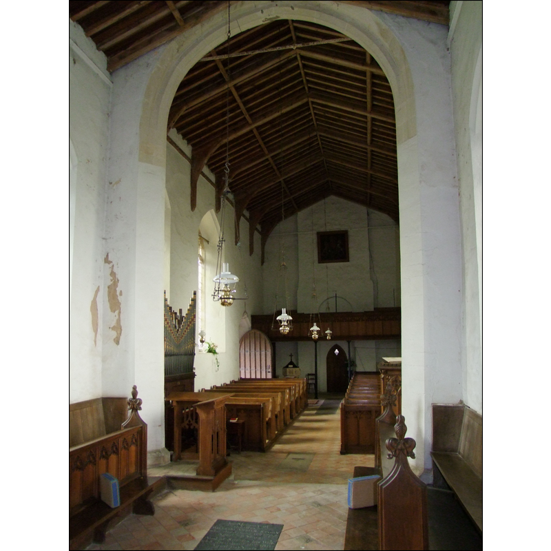
Copyright Statement: Image copyright © Simon Knott, 2010
Image Source: digital photograph taken 5 August 2010 by Simon Knott [www.norfolkchurches.co.uk/carltonforehoe/carltonforehoe.htm] [accessed 18 March 2013]
Copyright Instructions: Standing permission
view of church interior - nave - looking east
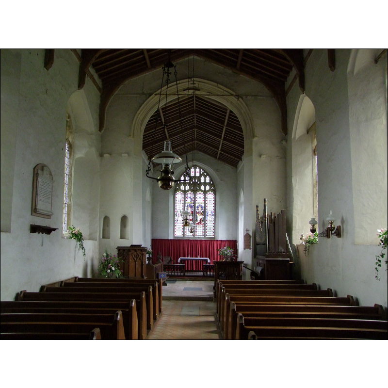
Copyright Statement: Image copyright © Simon Knott, 2010
Image Source: digital photograph taken 5 August 2010 by Simon Knott [www.norfolkchurches.co.uk/carltonforehoe/carltonforehoe.htm] [accessed 18 March 2013]
Copyright Instructions: Standing permission
INFORMATION
Font ID: 18388CAR
Object Type: Baptismal Font1
Font Century and Period/Style: 13th century, Medieval
Church / Chapel Name: Parish Church of St. Mary
Church Patron Saint(s): St. Mary the Virgin
Church Address: Barnham Broom Road, Carleton Forehoe, Norfolk, NR9 4AL
Site Location: Norfolk, East Anglia, England, United Kingdom
Directions to Site: Located 5-6 km NNW of Wymondham
Ecclesiastic Region: Diocese of Norwich
Historical Region: Hundred of Forehoe [aka Forehou]
Additional Comments: disappeared font? (the one from the original pre-1249 church here)
Font Notes:
Click to view
There are three entries for Carleton [Forehoe] [variant spelling] in the Domesday survey [http://domesdaymap.co.uk/place/TG0805/carleton-forehoe/] [accessed 26 June 2014], neither of which mentions a church or cleric in it. Blomefield (1805-1810) writes: "The Church was dedicated to St. Mary", and names "Rich. Thoke" as the first recorded vicar here, in 1301. The present font, octagonal and with carved sides, is modern. [...] The advowson of this church of Carleton, and one acre of land, was given by the foundress, Isabell, widow of Hugh de Albany Earl of Arundel, who in 1249 founded the nunnery of Marham, for Cistertian or white nuns, and dedicated it to St. Mary the Virgin, St. Barbara, and St. Edmund the King and Confessor, for the souls of William late Earl Warren, her father, and Maud, her mother, daughter of William Marshall the elder, Earl of Pembrook, Hugh Earl of Arundel, and all her ancestors; and it was dedicated this year, on 27th Jan. by Richard de la Wiche Bishop of Chichester, and John Earl Warren, her brother: she purchased it of Richard de Dunham; and Roger de Skerning Bishop of Norwich appropriated it, and settled a vicar, whom the Bishops of Norwich were to nominate, and the Convent to present;[NB: we have no information on the font from the medieval church here].
Credit and Acknowledgements: We are grateful to Simon Knott [www.norfolkchurches.co.uk] for his photographs of this church and modern font; we are also grateful to Jonathan Plunkett for the photographs of this church, taken by his father, George Plunkett, in 1993
COORDINATES
UTM: 31U 370337 5830683
Latitude & Longitude (Decimal): 52.610658, 1.085003
Latitude & Longitude (DMS): 52° 36′ 38.37″ N, 1° 5′ 6.01″ E
REFERENCES
- Blomefield, Francis, An essay towards a topographical history of Norfolk, 1805-1810, vol. 2: 402-405 / [www.british-history.ac.uk/report.aspx?compid=78089] [accessed 18 March 2013]