Crownthorpe / Congrethorp / Cronkethorp / Crownthorp / Crungethorp
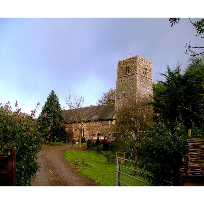
Image copyright © Simon Knott, 2005
Standing permission
Results: 2 records
view of church exterior - northwest view
Scene Description: the former church in 2005, a private residence
Copyright Statement: Image copyright © Simon Knott, 2005
Image Source: digital photograph taken December 2005 by Simon Knott [www.norfolkchurches.co.uk/crownthorpe/crownthorpe.htm] [accessed 15 March 2013]
Copyright Instructions: Standing permission
view of church exterior - southwest view
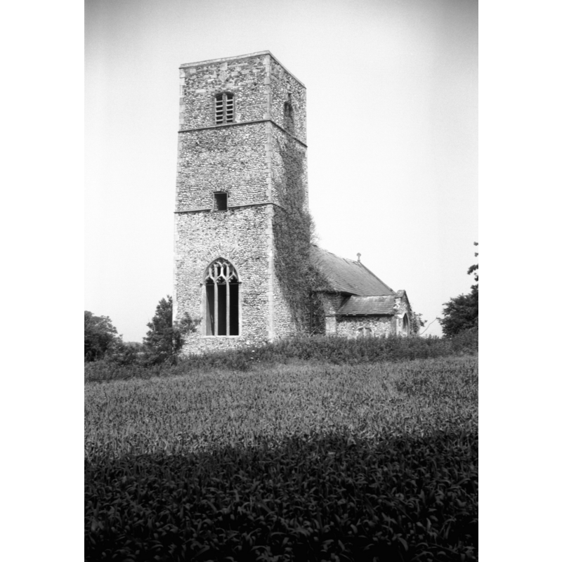
Scene Description: the building in 1986, already disused but still a church
Copyright Statement: Image copyright © Jonathan Plunkett, 2013
Image Source: B&W photograph taken in 1986 by George Plunkett
Copyright Instructions: Standing permission by Jonathan Plunkett
INFORMATION
Font ID: 18383CRO
Object Type: Baptismal Font1?
Church / Chapel Name: Parish Church of St. James [now a private residence]
Church Patron Saint(s): St. James
Site Location: Norfolk, East Anglia, England, United Kingdom
Directions to Site: Located 4 km N W of Wymondham
Ecclesiastic Region: [Diocese of Norwich]
Historical Region: Hundred of Forehoe
Additional Comments: disappeared font? (the one from the medieval church here)
Font Notes:
Click to view
Blomefield (1805-1810) writes: "Crungethorp, or Crownthorp church is dedicated to St. James [...] The Church and chancel are of an equal height, and are thatched; there are no isles, the tower is square, and hath only one bell: the south chapel is in ruins, the south porch is thatched." Blomefield (ibid.) names "John North" its first recorded rector, in 1321, and cites two entries in Domesday: "Congrethorp" (fol. 23), and Cronkrethorp (fol. 213), neither of which mentions a church or a priest in it." Knott (2005) [www.norfolkchurches.co.uk/crownthorpe/crownthorpe.htm] [accessed 15 March 2013] informs: "Today, St James remains a part of the landscape as it has done for centuries; the only signs that it is no longer a church are the private garden which surrounds it and the Union flag that flies from the top of its tower." [NB: we have no information on the font of the medieval church here].
Credit and Acknowledgements: We are grateful to Simon Knott [www.norfolkchurches.co.uk] for his 2005 photograph of this former church. We are also grateful to Jonathan Plunkett for the photograph of this church, taken by his father, George Plunkett, in 1986.
COORDINATES
UTM: 31U 369431 5828004
Latitude & Longitude (Decimal): 52.586372, 1.072683
Latitude & Longitude (DMS): 52° 35′ 10.94″ N, 1° 4′ 21.66″ E
REFERENCES
- Blomefield, Francis, An essay towards a topographical history of Norfolk, 1805-1810, vol. 2: 399-402 / [www.british-history.ac.uk/report.aspx?compid=78088] [accessed 15 March 2013]