Hockwold / Hoccuella / Hockwold-with-Wilton
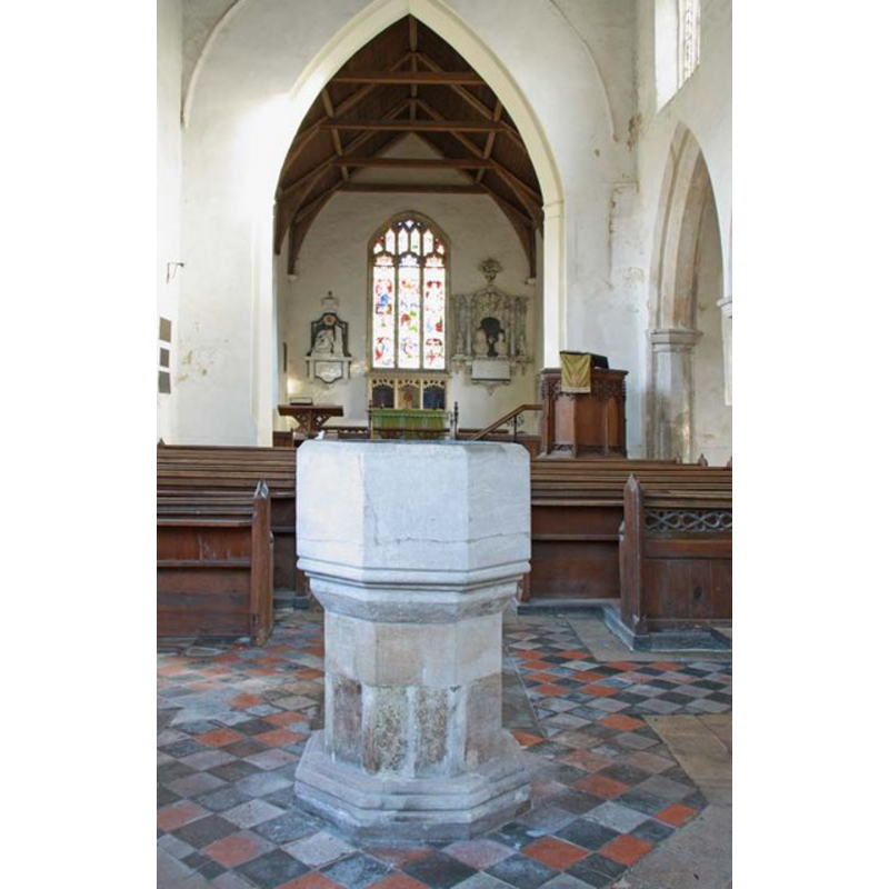
Image copyright © John Salmon, 2009
CC-BY-SA-3.0
Results: 5 records
view of font
Scene Description: at the west end of the nave, looking east towards the altar
Copyright Statement: Image copyright © John Salmon, 2009
Image Source: digital photograph taken 12 December 2009 by John Salmon [www.geograph.org.uk/photo/1617696] [accessed 12 March 2013]
Copyright Instructions: CC-BY-SA-3.0
view of church exterior - southeast view
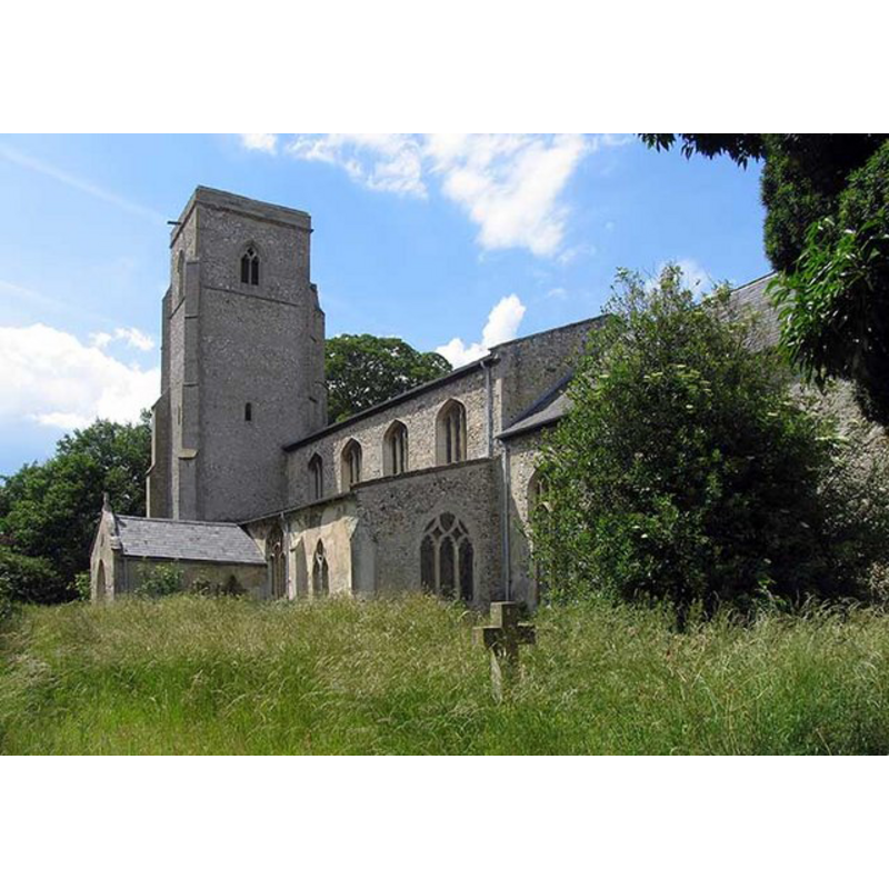
Copyright Statement: Image copyright © John Salmon, 2008
Image Source: digital photograph taken 17 June 2008 by John Salmon [www.geograph.org.uk/photo/855895] [accessed 12 March 2013]
Copyright Instructions: CC-BY-SA-3.0
view of font in context
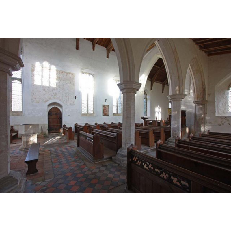
Scene Description: the font on the left (west end) in this view of the south aisle and nave, looking roughly northeast
Copyright Statement: Image copyright © John Salmon, 2009
Image Source: digital photograph taken 12 December 2009 by John Salmon [www.geograph.org.uk/photo/1617669] [accessed 12 March 2013]
Copyright Instructions: CC-BY-SA-3.0
view of church interior - nave - looking west
Copyright Statement: Image copyright © John Salmon, 2009
Image Source: digital photograph taken 12 December 2009 by John Salmon [www.geograph.org.uk/photo/1617676] [accessed 12 March 2013]
Copyright Instructions: CC-BY-SA-3.0
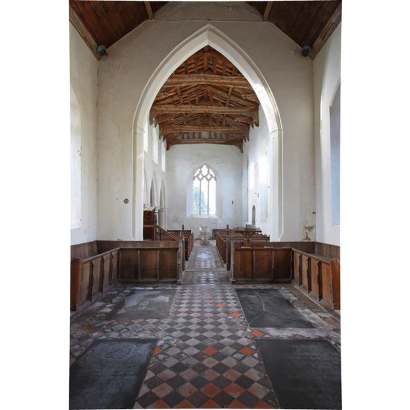
view of church interior - nave - looking east
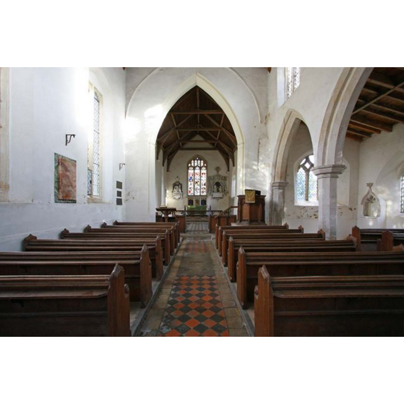
Copyright Statement: Image copyright © John Salmon, 2009
Image Source: digital photograph taken 12 December 2009 by John Salmon [www.geograph.org.uk/photo/1617662] [accessed 12 March 2013]
Copyright Instructions: CC-BY-SA-3.0
INFORMATION
Font ID: 18375HOC
Object Type: Baptismal Font1
Font Century and Period/Style: 14th century, Decorated
Church / Chapel Name: Parish Church of St. Peter [redundant]
Font Location in Church: Inside the church, at the W end of the nave
Church Patron Saint(s): St. Peter
Church Address: Station Road, Hockwold, Thetford, Norfolk, IP26 4H
Site Location: Norfolk, East Anglia, England, United Kingdom
Directions to Site: Located next to Wilton 16 km W of Thetford
Ecclesiastic Region: Diocese of Norwich
Historical Region: Hundred of Grimeshoe [aka Gimeshou]
Additional Comments: altered font? (partially re-tooled?) painted font (white-washed)
Font Notes:
Click to view
Blomefield (1805-1810) writes: "The Church of Hockwold is dedicated to St. Peter, and has a south isle annexed to the nave or body [...] The chancel is of the same materials with the church, but covered with reed [...] at the upper end of the south wall, are three neat arches of stone, worked in the wall, making three seats or stalls for bishop, priest, and deacon; and at the head of these seats is another arch for holy-water; on the summit of these arches are several shields, now daubed over with whiting. [...] At the west end stands a four-square tower of flint, &c. adorned with quoins of freestone, in which hang three bells." Blomefield (ibid.) names the first recorded rectors as "Bernard [...] sans date", and, "Adam Talebot, temp. Henry VIII" [i.e., 1509-1547], but notes that "In 28th Edw. I. the King recovered the presentation, against Edmund de Cockfield, the heir of Andrew de Sackvile being under age, and in ward to the King" [i.e., the 28th year of King Edward I's reign, meaning ca.1300]. The entry in Domesday (fol. 87) mentions 'Hoccuella' but neither church nor priest in it." The church is still standing, though now redundant [source: English Heritage Listing NGR: TL7249188015 [http://list.english-heritage.org.uk/resultsingle.aspx?uid=1306877] [accessed 12 March 2013]. The font consists of an octagonal basin with plain vertical sides, the only ornament a roll moulding at the lower end; raised on a plain octagonal pedestal base, the lower base laso octagonal but with graded moulding all around. The font is partly whitewashed and shows cracks on the basin sides; it may also have been partially re-tooled. It could be the original font of this church.
COORDINATES
UTM: 31U 332685 5815386
Latitude & Longitude (Decimal): 52.46298, 0.53712
Latitude & Longitude (DMS): 52° 27′ 46.73″ N, 0° 32′ 13.63″ E
MEDIUM AND MEASUREMENTS
Material: stone
Font Shape: octagonal, mounted
Basin Interior Shape: round
Basin Exterior Shape: octagonal
Drainage Notes: lead-lined
REFERENCES
- Blomefield, Francis, An essay towards a topographical history of Norfolk, 1805-1810, vol. 2: 177-187 / www.british-history.ac.uk/report.aspx?compid=78050] [accessed 12 March 2013]