Santon nr. Thetford / Santuna
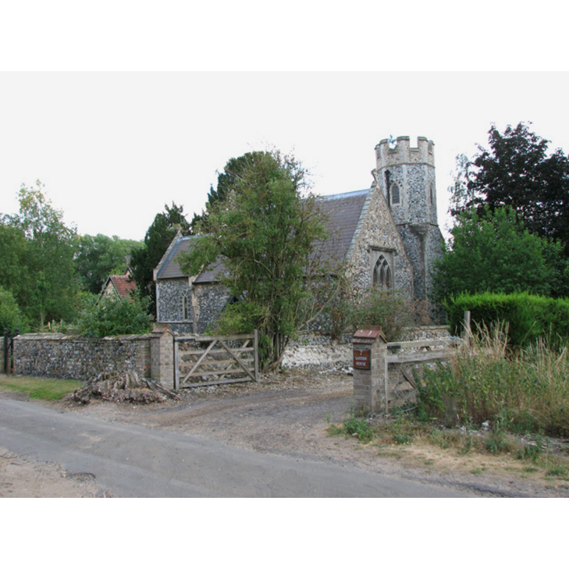
Image copyright © Evelyn Simak, 2010
CC-BY-SA-3.0
Results: 2 records
view of church exterior - northwest view
Copyright Statement: Image copyright © Evelyn Simak, 2010
Image Source: digital photograph taken 21 July 2010 by Evelyn Simak [www.geograph.org.uk/photo/1974507] [accessed 11 March 2013]
Copyright Instructions: CC-BY-SA-3.0
view of church interior - nave - looking east
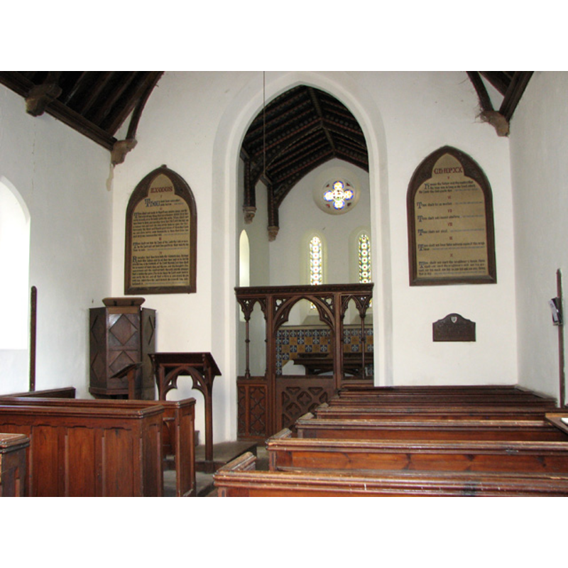
Copyright Statement: Image copyright © Evelyn Simak, 2010
Image Source: digital photograph taken 21 July 2010 by Evelyn Simak [www.geograph.org.uk/photo/1974518] [accessed 11 March 2013]
Copyright Instructions: CC-BY-SA-3.0
INFORMATION
Font ID: 18372SAN
Object Type: Baptismal Font1?
Font Century and Period/Style: 12th - 13th century, Medieval
Church / Chapel Name: Parish Church of All Saints [aka St. Helen's] [redundant]
Church Patron Saint(s): All Saints [St. Helen]
Church Notes: the old chapel or church was re-built in 1628
Site Location: Norfolk, East Anglia, England, United Kingdom
Directions to Site: Located 5-6 km NW of Thetford
Ecclesiastic Region: Diocese of Norwich
Historical Region: Hundred of Grimeshoe [aka Grimeshou]
Additional Comments: disappeared fonts? (the ones from the earlier churches here)
Font Notes:
Click to view
Blomefield (1805-1810) reports: "This is now a depopulated village, and has only a manor or farmhouse; it lies westward of Croxton, near the Ouse-Parva, that divides this county from that of Suffolk; in ancient writings it is wrote Santon, and Stanton". Blomefield (ibid.) further notes an issue with the advowson of this church: "In the 5th year of King John, Peter de Clay had a suit with Thomas de Ingaldesthorp, about the right of presentation to this church" [i.e., 1201 or 1202], but names the first recorded rector 'Robert, son of Hugo de Rokelins', in 1311. The entry in Domesday mentions neither church nor priest in 'Santuna'. Later sources do not mention the old medieval church here. White's Directory of 1883, which gives the dedication as St. Helen's, notes: "a very small edifice, built out of the ruins of the old one by Thomas Bancroft in 1628, and entirely restored in 1858, the present rector adding a chancel with north porch and octagonal tower". Nothing remains of the medieval church here, but "both the original altar table and the 'birdbath' font were stolen several years ago. The church was declared redundant in the 1990s and a trust has since been set up to care for it", reported 21 July 2010 by Evelyn Simak [www.geograph.org.uk/photo/1974510] [accessed 11 March 2013] [NB: the stolen font was probably of the latest re-building in the mid-19th century; we have no information on the fonts of the medieval of Restoration church here].
COORDINATES
UTM: 31U 342968 5813932
Latitude & Longitude (Decimal): 52.452965, 0.689037
Latitude & Longitude (DMS): 52° 27′ 10.67″ N, 0° 41′ 20.53″ E
REFERENCES
- Blomefield, Francis, An essay towards a topographical history of Norfolk, 1805-1810, vol. 2: 155-159 / [www.british-history.ac.uk/report.aspx?compid=78046] [accessed 11 March 2013]
- White, William, History, Gazetteer, and Directory of Norfolk, [s.l.]: [printed for the author], 1883, [cited in www.origins.org.uk/genuki/NFK/places/s/santon/white1883.shtml [accessed 11 March 2013]]