Colveston / Coulston / Colvestuna
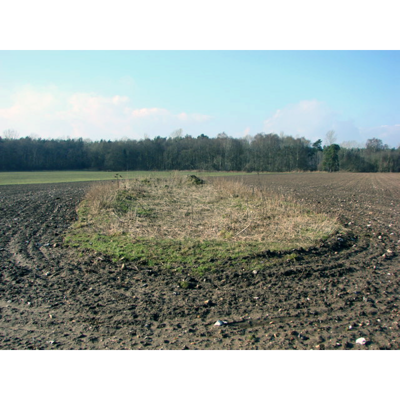
Image copyright © Adrian S Pye, 2010
CC-BY-SA-3.0
Results: 1 records
view of church exterior - ruins
Scene Description: "All that remains of the church of Colveston St Mary the Virgin. Deserted and demolished in the 18th c. Only few walls remain just above ground level. The area of the church remains un-ploughed in the middle of a field. Private Land. Photograph taken with express permission of the landowner." [source: Adrian S Pye]
Copyright Statement: Image copyright © Adrian S Pye, 2010
Image Source: digital photograph taken 19 February 2010 by Adrian S Pye [www.geograph.org.uk/photo/1860527] [accessed 13 March 2013]
Copyright Instructions: CC-BY-SA-3.0
INFORMATION
Font ID: 18277COL
Object Type: Baptismal Font1?
Font Century and Period/Style: 14th century, Decorated
Church / Chapel Name: Parish Church of St. Mary [in ruins long before 1800]
Church Patron Saint(s): St. Mary the Virgin
Site Location: Norfolk, East Anglia, England, United Kingdom
Directions to Site: The site of the ruins is located 10 km N of Brandon, 16 SSW Swaffham, across the river Wissey from Cranwich
Ecclesiastic Region: [Diocese of Norwich]
Historical Region: Hundred of Grimeshoe [aka Gimeshou]
Additional Comments: disappeared font? [cf. FontNotes]
Font Notes:
Click to view
There is an entry for Colveston [variant spelling] in the Domesday survey [https://opendomesday.org/place/TL7995/colveston/] [accessed 25 August 2021] but it mentions neither priest nor church in it. Blomefield (1805-1810) writes: "The Church has been in ruins time immemorial; it stood a little west of the present farm-house, and was dedicated to the Virgin Mary; [...] It formerly belonged to St. Bartholomew of Ichburgh, as the mother and baptismal church". This church did, however, have a rector, the first one recorded being named in Blomefield (ibid.) "William de Surlingham", in 1329. The Domesday entry for 'Colvestuna' mentions neither priest nor church in it. Woodward (1821) reports a Ladbroke lithograph of the church in Colvestone in his 'Manual' [NB: John Burney Ladbrooke (1803–1879) produced a series of lithographs on Norfolk churches, some of which are in the National Archves and the National Trust collections]. The Kelly Directory of 1883 reports: "The church of the Virgin Mary has been dilapidated for many years, and the remains of the foundations are only visible." [NB: not clear whether a font ever existed in the old church here].
COORDINATES
UTM: 31U 340010 5822586
Latitude & Longitude (Decimal): 52.529844, 0.641389
Latitude & Longitude (DMS): 52° 31′ 47.44″ N, 0° 38′ 29″ E
REFERENCES
- Blomefield, Francis, An essay towards a topographical history of Norfolk, 1805-1810, vol. 2: 229-232 / [www.british-history.ac.uk/report.aspx?compid=78056] [accessed 13 March 2013]
- Kelly, Kelly's Directory for Cambridge, Norfolk & Suffolk, London: Kelly's Directories Ltd., 1883, p. 278