Bulverhythe / West St. Leonards / West Marina
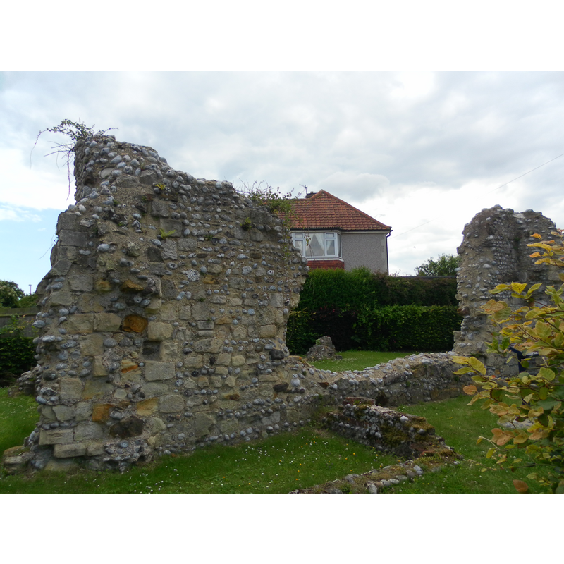
Image copyright © The Voice of Hassocks, 2011
CC-BY-SA-3.0
Results: 1 records
view of church exterior - detail
Scene Description: esternal ruins of St. Mary's, itself built on an earlier church
Copyright Statement: Image copyright © The Voice of Hassocks, 2011
Image Source: digital photograph taken 30 July 2011 by The Voice of Hassocks [http://en.wikipedia.org/wiki/File:Ruins_of_St_Mary%27s_Church,_Glyne_Gap,_Bulverhythe.JPG] [accessed 14 December 2012]
Copyright Instructions: CC-BY-SA-3.0
INFORMATION
Font ID: 18262BUL
Object Type: Baptismal Font1?
Font Century and Period/Style: 12th - 14th century, Medieval
Church / Chapel Name: Parish Church [in ruins]
Church Address: the ruins are located on Hythe Avenue
Site Location: East Sussex, South East, England, United Kingdom
Directions to Site: Bulverhythe is now a suburb of Hastings
Ecclesiastic Region: Diocese of Chichester
Historical Region: Sussex
Additional Comments: disappeared font? -- Bulverhythe was a village near the landing site of William the Conqueror's invasion; it is 10-12 kms from the Hastings battle site
Font Notes:
Click to view
Harrison (1920) reports "fragments of a church" of the Transitional period here. This must be the same as the ones noted in the English Heritage entry [No. 1353218] [http://list.english-heritage.org.uk/resultsingle.aspx?uid=1353218] [accessed 14 December 2012]: "Ruin of St Mary's Chapel TQ 70 NE 4/230 19.1.51. II 2. Ruins of the Chancel of the C13 to C14 Parish Church of St Mary's, Bulverhythe. Consisting of 2 blocks of masonry about 12 ft high with a wall about 3 ft high connecting them. Attached is a tablet saying that the nave and western tower have been entirely destroyd. The walls incorporate carved stones from the earlier Norman Church of the same site." [NB: we have no information on the font of the disappeared church here].
COORDINATES
UTM: 31U 325641 5636068
REFERENCES
- Harrison, Frederick, Notes on Sussex churches, Hove: Combridges, 1920, p. 78