Bromborough
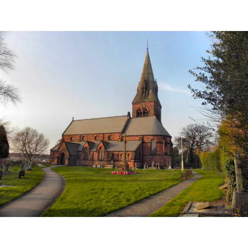
Image copyright © David Dixon, 2011
CC-BY-SA-3.0
Results: 2 records
view of church exterior - south view
Scene Description: the present church (19thC)
Copyright Statement: Image copyright © David Dixon, 2011
Image Source: digital photograph taken 3 March 2011 by Dadid Dixon [www.geograph.org.uk/photo/2294349] [accessed 11 December 2012]
Copyright Instructions: CC-BY-SA-3.0
information
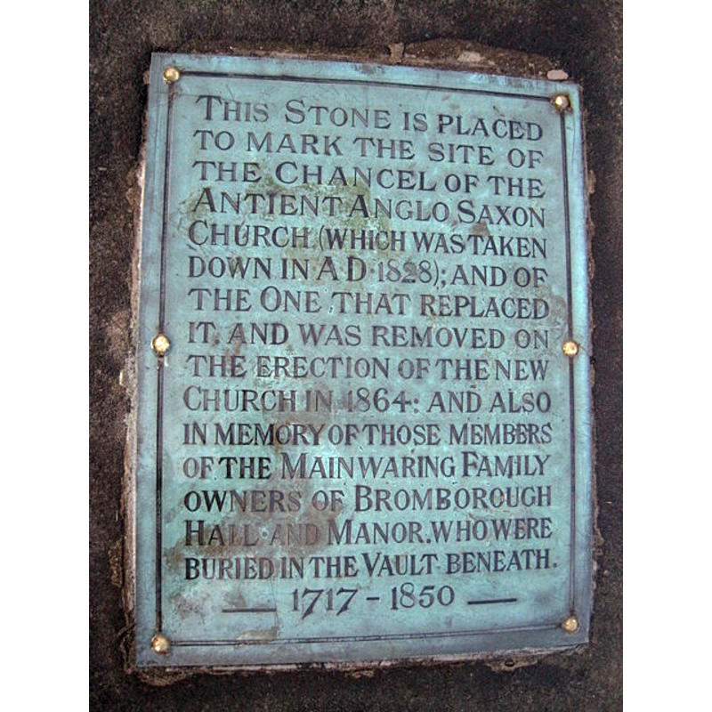
Scene Description: plaque outside the modern church
Copyright Statement: Image copyright © Sue Adair, 2011
Image Source: digital photograph taken 1 February 2011 by Sue Adair [www.geograph.org.uk/photo/2257157] [accessed 11 December 2012]
Copyright Instructions: CC-BY-SA-3.0
INFORMATION
Font ID: 18255BRO
Object Type: Baptismal Font1
Font Century and Period/Style: 10th - 11th century, Pre-Conquest? / Norman?
Church / Chapel Name: Parish Church of St. Barnabas [medieval church demolished in 1828]
Font Location in Church: [cf. FontNotes]
Church Patron Saint(s): St. Barnabas [aka Barnabus, Bernabé]
Church Notes: "The first church on the site was built in 928 adjacent to a monastery which had been founded in 912, probably by Ethelfleda. This church was demolished in 1828 and replaced on the same site by another church.[5] This church was again replaced by the present church. It was built on a big scale between 1862 and 1864 to serve the residents of new large houses which had recently been built in the town. The architect was Sir George Gilbert Scott" [source: http://en.wikipedia.org/wiki/St_Barnabas%27_Church,_Bromborough] [accessed 11 December 2012]
Church Address: Church Square, The Rake, Bromborough, Merseyside, CH62 7AA [the modern church]
Site Location: Merseyside, North West, England, United Kingdom
Directions to Site: Located S of Bebington, N of Eastham
Ecclesiastic Region: Diocese of Chester
Historical Region: formerly Cheshire -- Hundred of Wirral
Additional Comments: disappeared font?
Font Notes:
Click to view
Ellis (1902) notes: "The font in use before the building of the present church was a plain shaft, with a small hollow in the top, holding only water enough to sprinkle with. This is now preserved on the rectory lawn, filled in as a sundial." The present octagonal font is probably from the 1864 rebuilding by G.G. Scott. [NB: we have no information on the font(s) from the pre-Conquest and Norman churches here].
COORDINATES
UTM: 30U 501412 5909304
Latitude & Longitude (Decimal): 53.3329, -2.9788
Latitude & Longitude (DMS): 53° 19′ 58.44″ N, 2° 58′ 43.68″ W
REFERENCES
- Ellis, John W., "The Mediaeval Fonts of the Hundreds of West Derby and Wirral", LVIII (New series: XVII), Transactions of the Historic Society of Lancashire and Cheshire, 1902, pp. 59-80; p. 76, 80