Hangleton / Angleton / Hangeltona / Hangeton / Hangilton
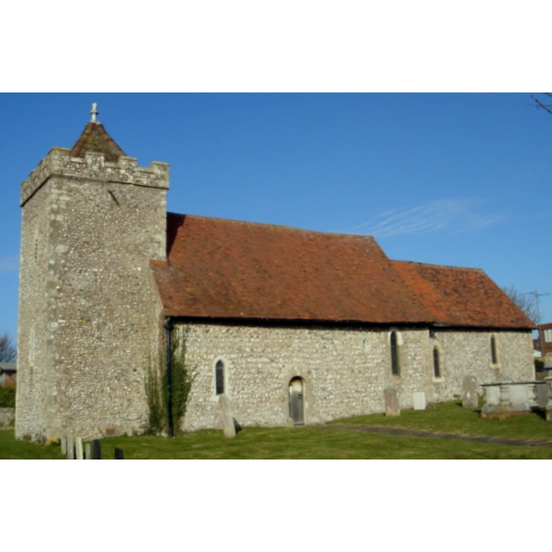
Image copyright © [in the public domain]
Released by its author into the public domain
Results: 1 records
view of church exterior - south view
Copyright Statement: Image copyright © [in the public domain]
Image Source: digital photograph taken 1 March 2008 by The Voice of Hassocks [http://commons.wikimedia.org/wiki/File:St_Helen%27s_Church,_Hangleton_07.jpg] [accessed 6 December 2012]
Copyright Instructions: Released by its author into the public domain
INFORMATION
Font ID: 18253HAN
Object Type: Baptismal Font1, fragment?
Font Century and Period/Style: 11th - 12th century, Norman
Church / Chapel Name: Parish Church of St. Helen
Font Location in Church: [cf. FontNotes]
Church Patron Saint(s): St. Helena
Church Address: Hangleton Way/Downsview, Hove, East Sussex, BN3 8ER
Site Location: East Sussex, South East, England, United Kingdom
Directions to Site: Located in Hove, 5 km NW of Brighton, in Brighton and Hove, 7 km NE of New Shoreham
Ecclesiastic Region: Diocese of Chichester
Historical Region: Half-hundred of Fishersgate -- Rape of Lewes -- Sussex
Additional Comments: damaged font? fragment? [cf. FontNotes]
Font Notes:
Click to view
Harrison (1920) reports a stoup near the south door of the church that was restored in 1876, but was originally probably pre-Conquest. Holden [http://archeolandes.celeonet.fr/hangleton.pdf] [accessed 6 December 2012] reports a number of stones recovered during excavations in the Parsonage House at Hangleton: "There are too few shaped pieces to suggest the parts of the church from which some of them came, except for the possible lancet window. The circular fragments being curved on both inner and outer faces are likely to have come from a tub-shaped vessel ( ? a font). The Victoria County History (Sussex, vol. 7, 1940) notes: "Hangleton was one of the churches granted by William de Warenne II in about 1093 to the priory of Lewes [...] The nave is 12th-century, with the tower an early-13th-century addition. The original chancel was entirely removed about 1300, and a new chancel provided." There is no mention of a font in the VCH entry, but a font appears located at west end, north side the nave. The VCH entry further notes "a plain stoup" is reported "east of the south door", but gives no date for it. [NB: we have no confirrmation that the fragment found belongs to the font from the medieval church here].
COORDINATES
UTM: 30U 697024 5637000
Latitude & Longitude (Decimal): 50.8511, -0.2009
Latitude & Longitude (DMS): 50° 51′ 3.96″ N, 0° 12′ 3.24″ W
MEDIUM AND MEASUREMENTS
Material: stone
REFERENCES
- Victoria County History [online], University of London, 1993-. URL: https://www.british-history.ac.uk.
- Harrison, Frederick, Notes on Sussex churches, Hove: Combridges, 1920, p. 121