West Blatchington / Blachington / Blachyngton / Blechington / Blechinton
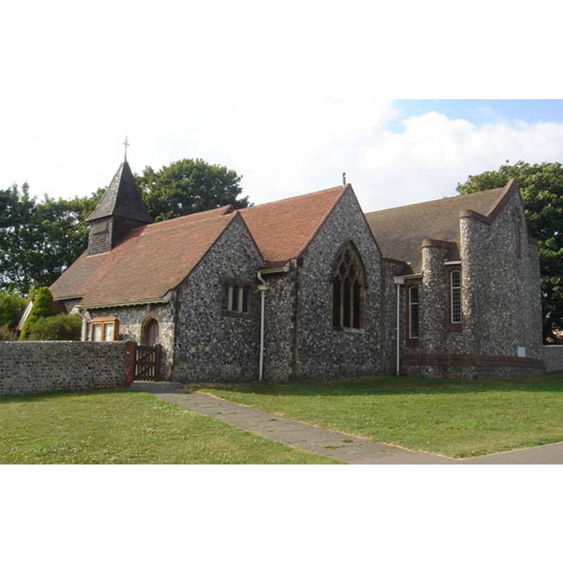
Image copyright © [in the public domain]
Released by its author into the public domain
Results: 2 records
view of church exterior - southeast view
Scene Description: the present church
Copyright Statement: Image copyright © [in the public domain]
Image Source: digital photograph taken 26 July 2008 by The Voice of Hassocks [http://en.wikipedia.org/wiki/File:St_Peter%27s_Church,_West_Blatchington_10.JPG] [accessed 5 December 2012]
Copyright Instructions: Released by its author into the public domain
view of church exterior
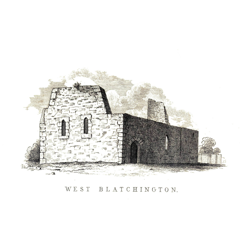
Scene Description: old church remains
Copyright Statement: Image copyright © [in the public domain]
Image Source: "Remains of the West Blatchington Church", in Hussey's 'Notes on the Churches in the Counties of Kent, Sussex, and Surrey' ((1852: 239) [reproduced in http://en.wikisource.org/wiki/File:Remains_of_West_Blatchington_Church.jpg [accessed 6 December 2012]
Copyright Instructions: PD
INFORMATION
Font ID: 18250BLA
Object Type: Baptismal Font1
Font Century and Period/Style: 12th century, Late Norman? / Transitional?
Church / Chapel Name: Parish Church of St. Peter
Font Location in Church: [cf. FontNotes]
Church Patron Saint(s): St. Peter
Church Address: Hangleton Rd/Holmes Avenue, West Blatchington, East Sussex, BN3
Site Location: East Sussex, South East, England, United Kingdom
Directions to Site: Located near Hangleton, just N of Hove, and now part of Brighton and Hove
Ecclesiastic Region: Diocese of Chichester
Historical Region: Hundred of Whalesbone -- Rape of Lewes - Sussex
Additional Comments: disappeared font? (the one from the original 12thC church here was missing already ca. 1596)
Font Notes:
Click to view
Hussey (1852) reports the ruins of the old church still standing at the time. The Victoria County History (Sussex, vol. 7, 1940) notes: "The church consisted originally of a 12th-century nave and chancel. The western annexe appears to be contemporary with the nave itself. [...] In 1596 the church had been practically disused for fifty years and was regarded as a chapel to the manor-house"; it is reported re-built in 1890 and the VCH entry shows a font in place in its plan of the church interior, at the west end of the nave. A deposition given in 1596 and recorded in the Suss. Arch. Coll. (xlix, 163) records witness evidence of the lack of bells, font and pulpit at the time. [NB: we have no information on the 12th-century font of the medieval church here].
COORDINATES
UTM: 30U 698152 5636609
Latitude & Longitude (Decimal): 50.8472, -0.1851
Latitude & Longitude (DMS): 50° 50′ 49.92″ N, 0° 11′ 6.36″ W
REFERENCES
- Victoria County History [online], University of London, 1993-. URL: https://www.british-history.ac.uk.
- Hussey, Arthur, Notes on the churches in the counties of Kent, Sussex, and Surrey mentioned in Domesday Book and those of more recent date [...], London: John Russell Smith, 1852, entry # 33 and p. 239