Ovingdean / Hovingedene / Huuingeden / Ovingdene / Ovyndenne / Vuingeden
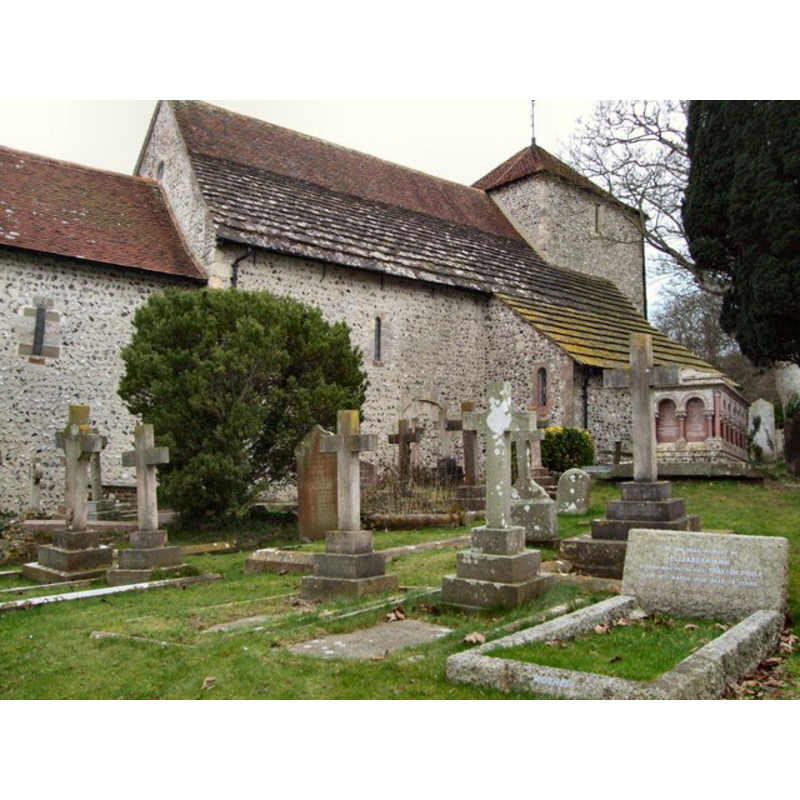
Image copyright © Paul Guillett, 2011
CC-BY-SA-3.0
Results: 2 records
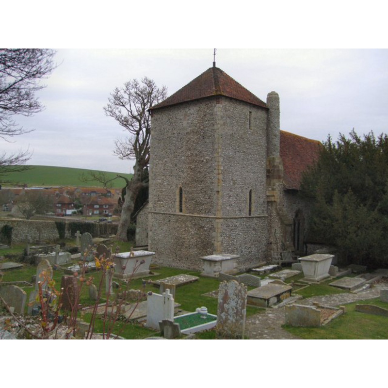
view of church exterior - northeast view
Copyright Statement: Image copyright © Paul Guillett, 2011
Image Source: digital photograph taken 3 January 2011 by Paul Gillett [www.geograph.org.uk/photo/2218671] [accessed 15 November 2012]
Copyright Instructions: CC-BY-SA-3.0
view of church exterior - southwest view
Copyright Statement: Image copyright © Paul Guillett, 2011
Image Source: digital photograph taken 3 January 2011 by Paul Gillett [www.geograph.org.uk/photo/2218683] [accessed 15 November 2012]
Copyright Instructions: CC-BY-SA-3.0
INFORMATION
Font ID: 18247OVI
Object Type: Stoup
Font Century and Period/Style: 11th - 12th century, Pre-Conquest? / Norman?
Church / Chapel Name: Parish Church of St. Wulfram
Font Location in Church: By the blocked N doorway of the nave
Church Patron Saint(s): St. Wulfram [of Sens] [aka Wulfran]
Church Address: Greenways, Ovingdean, East Sussex, BN2 7BA
Site Location: East Sussex, South East, England, United Kingdom
Directions to Site: Located off the B2123, 8 km ESE of Brighton
Ecclesiastic Region: Diocese of Chichester
Historical Region: Hundred of Younsmere -- Rape of Lewes - Sussex
Additional Comments: disappeared font? [cf. FontNotes]
Font Notes:
Click to view
Harrison (1920), who does not mention a font in his entry for this church, writes: "stoup near blocked-up Nor[man] door on N[orth] side of nave".
The Victoria County History (Sussex, vol. 7, 1940) notes: "There are no traces remaining of the earlier church, described as ecclesiola, referred to in Domesday Book, and this may well have been a small building of wood. If so, it must have been replaced by the present church within a generation after the Survey, as the existing nave and chancel were built, at the same time, at the very beginning of the 12th century. [...] The existing registers begin in 1705. [...] The font is modern and there are no ancient monuments." A church interior plan in the VCH entry for this parish shows a font, the modern replacement one, situated towards the west end nave, just west of the south entranceway. [NB: we have no information on the medieval font here].
The Victoria County History (Sussex, vol. 7, 1940) notes: "There are no traces remaining of the earlier church, described as ecclesiola, referred to in Domesday Book, and this may well have been a small building of wood. If so, it must have been replaced by the present church within a generation after the Survey, as the existing nave and chancel were built, at the same time, at the very beginning of the 12th century. [...] The existing registers begin in 1705. [...] The font is modern and there are no ancient monuments." A church interior plan in the VCH entry for this parish shows a font, the modern replacement one, situated towards the west end nave, just west of the south entranceway. [NB: we have no information on the medieval font here].
COORDINATES
UTM: 30U 705864 5633402
Latitude & Longitude (Decimal): 50.8157, -0.0775
Latitude & Longitude (DMS): 50° 48′ 56.52″ N, 0° 4′ 39″ W
MEDIUM AND MEASUREMENTS
Material: stone
REFERENCES
- Victoria County History [online], University of London, 1993-. URL: https://www.british-history.ac.uk.
- Darsy, M.F.I., "Description archéologique et historique du canton de Gamaches", T. 5 (2e sér.), Mémoires de la Société des antiquaires de Picardie, 1858, pp. 157-390; p. 157