Streat / Estrat / Strat / Stret / Street / Strete
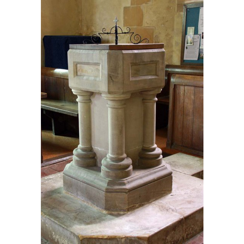
Image copyright © John Salmon, 2009
CC-BY-SA-3.0
Results: 5 records
view of font and cover
Scene Description: the modern font [cf. FontNotes]
Copyright Statement: Image copyright © John Salmon, 2009
Image Source: digital photograph taken 29 August 2009 by John Salmon [www.geograph.org.uk/photo/1506196] [accessed 5 November 2012]
Copyright Instructions: CC-BY-SA-3.0
view of church exterior - southeast view
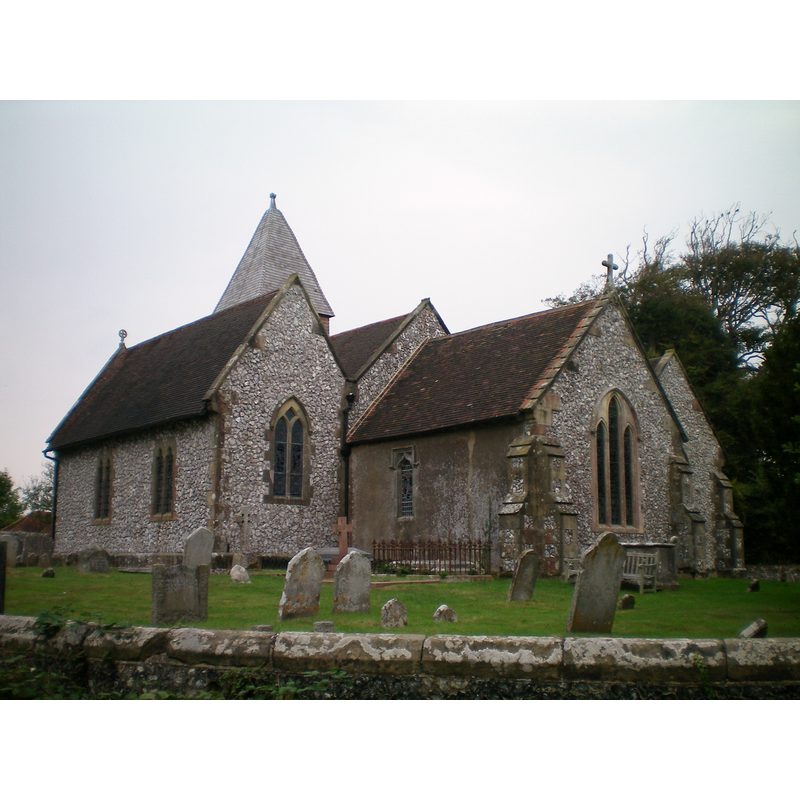
Copyright Statement: Image copyright © [in the public domain]
Image Source: digital photograph taken 20 September by Charlesdrakew [http://en.wikipedia.org/wiki/File:Streat_Church.JPG] [accessed 5 November 2012]
Copyright Instructions: Released by its author into the public domain
view of church exterior - west view
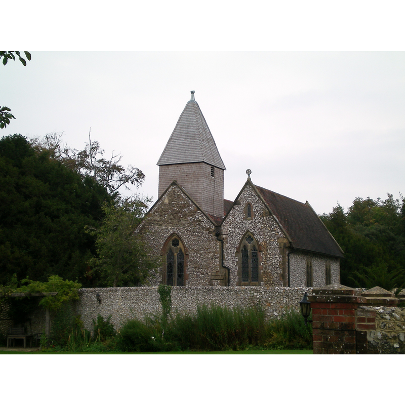
Copyright Statement: Image copyright © [in the public domain]
Image Source: digital photograph taken 20 September by Charlesdrakew [http://en.wikipedia.org/wiki/File:Streat_Church_3.JPG] [accessed 5 November 2012]
Copyright Instructions: Released by its author into the public domain
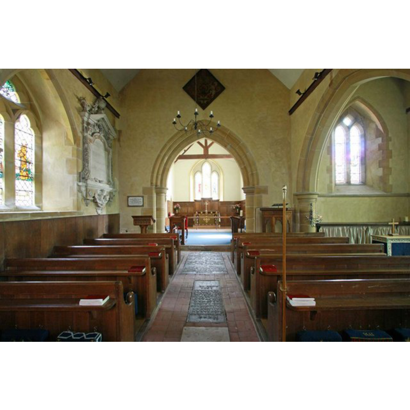
view of church interior - nave - looking west
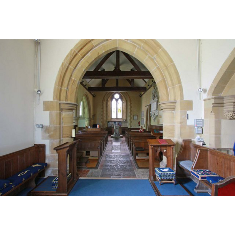
Scene Description: looking west from inside the chancel; the modern font is at the west end, centre aisle
Copyright Statement: Image copyright © John Salmon, 2009
Image Source: digital photograph taken 29 August 2009 by John Salmon [www.geograph.org.uk/photo/1506179] [accessed 5 November 2012]
Copyright Instructions: CC-BY-SA-3.0
view of church interior - nave - looking east
Copyright Statement: Image copyright © John Salmon, 2009
Image Source: digital photograph taken 29 August 2009 by John Salmon [www.geograph.org.uk/photo/1506174] [accessed 5 November 2012]
Copyright Instructions: CC-BY-SA-3.0
INFORMATION
Font ID: 18215STR
Object Type: Baptismal Font1
Font Century and Period/Style: 11th - 12th century, Norman
Church / Chapel Name: Parish Church
Church Address: Streat Lane, Streat, West Sussex, BN6 8RX
Site Location: East Sussex, South East, England, United Kingdom
Directions to Site: Located 5 km SE of Burgess Hill, 10 km W of Lewes
Ecclesiastic Region: Diocese of Chichester
Historical Region: Hundred of Streat [aka Street] -- Rape of Lewes -- Sussex
Additional Comments: disappeared font (the one from the 11thC or 12thC church here)
Font Notes:
Click to view
There is no font mentioned in the entry for this Early English church in Harrison (1920). The Victoria County History (Sussex, vol. 7, 1940) notes: "The parish church is of unknown dedication [...] The nave is said to be of late 11th-or 12th-century work; Hussey [(1852: 293)] in 1852 speaks of Norman north and south doorways, but all original features have disappeared". The VCH entry for this church (ibid.) does not mention a font, but its interior pland shows one located at the west end of the nave. This is probably the same modern font that is in use today, dating probably from the 19th century. [NB: we have no information from the font of the 11th- or 12th-century church here].
COORDINATES
UTM: 30U 705286 5645042
Latitude & Longitude (Decimal): 50.92045, -0.079161
Latitude & Longitude (DMS): 50° 55′ 13.62″ N, 0° 4′ 44.98″ W
REFERENCES
- Victoria County History [online], University of London, 1993-. URL: https://www.british-history.ac.uk.
- Harrison, Frederick, Notes on Sussex churches, Hove: Combridges, 1920, p. 196