Newhaven / Macinge / Mechinghaven / Mechyng / Mechynges / Meeching / Mitching / Myching / Mychyng
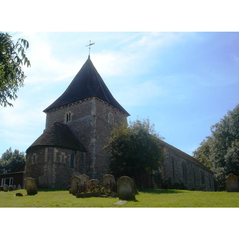
Image copyright © [in the public domain]
Released by its author into the public domain
Results: 1 records
view of church exterior - southwest view
Copyright Statement: Image copyright © [in the public domain]
Image Source: digital photograph taken 19 August 2009 by The Voice of Hassocks [http://en.wikipedia.org/wiki/File:St_Michael_and_All_Angels_Church,_Newhaven_%28IoE_Code_374196%29.jpg] [accessed 30 October 2012]
Copyright Instructions: Released by its author into the public domain
INFORMATION
Font ID: 18212NEW
Object Type: Baptismal Font1
Font Date: ca. 1120?
Font Century and Period/Style: 12th century, Late Norman
Church / Chapel Name: Parish Church of St. Michael / St. Michael and All Angels
Font Location in Church: [cf. FontNotes]
Church Patron Saint(s): St. Michael / St. Michael & All Angels
Church Address: Church Hill, Newhaven, East Sussex, BN9 9HN
Site Location: East Sussex, South East, England, United Kingdom
Directions to Site: Located 11 km S of Lewes, 15 km E of Brighton
Ecclesiastic Region: Diocese of Chichester
Historical Region: Hundred of Holmestrow -- Rape of Lewes -- Sussex
Additional Comments: disappeared font? (the one from the 12thC church here)
Font Notes:
Click to view
Harrison (1920) notes the Norman church here as having been restored and enlarged in 1854, but does not mention a font in it. The Victoria County History (Sussex, vol. 7, 1940) notes: "The church of St. Michael [...] consists of an apsidal sanctuary with an axial tower over the adjoining chancel, all of the early or mid 12th century." There is no font or stoup mentioned in the VCH entry for this church. The present octagonal font is modern, probably 19th-century restoration of this church. [NB: we have no information on the font of the medieval church here].
COORDINATES
UTM: 31U 291769 5630835
Latitude & Longitude (Decimal): 50.7918, 0.0454
Latitude & Longitude (DMS): 50° 47′ 30.48″ N, 0° 2′ 43.44″ E
REFERENCES
- Victoria County History [online], University of London, 1993-. URL: https://www.british-history.ac.uk.
- Harrison, Frederick, Notes on Sussex churches, Hove: Combridges, 1920, p. 154