Buncton / Bongetune
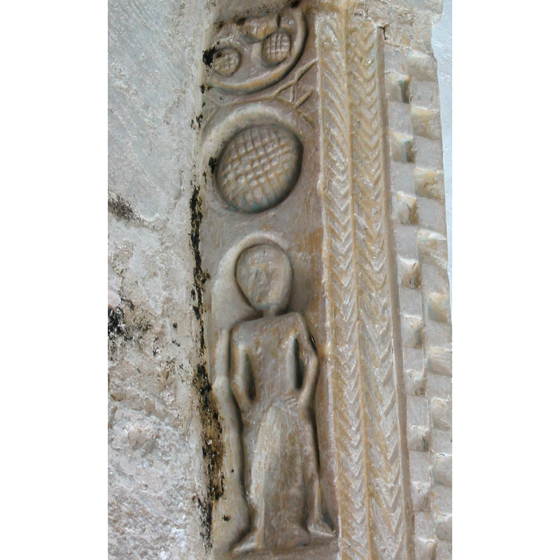
Image copyright © Doug Thompson, 2004
CC-BY-SA-3.0
Results: 3 records
view of church exterior - detail
Scene Description: an unlikely Sheela?
Copyright Statement: Image copyright © Doug Thompson, 2004
Image Source: digital photograph 23 July 2004 by Doug Thompson [http://en.wikipedia.org/wiki/File:Buncton_Carving.jpg] [accessed 24 October 2012]
Copyright Instructions: CC-BY-SA-3.0
view of church exterior - northwest view
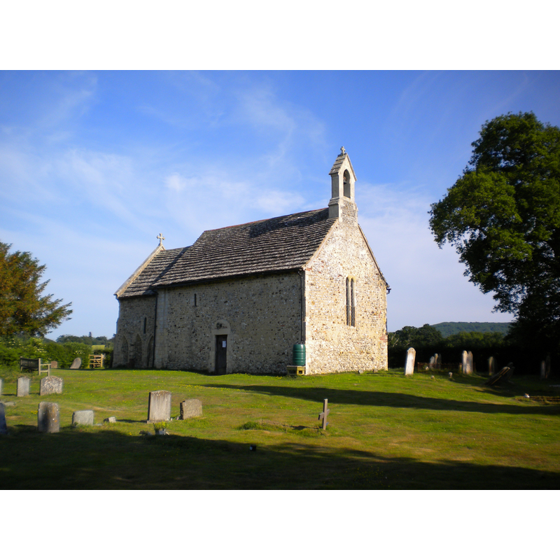
Copyright Statement: Image copyright © [in the public domain]
Image Source: digital photograph taken by Charlesdrakew [http://en.wikipedia.org/wiki/File:Buncton_Chapel.JPG] [accessed 24 October 2012]
Copyright Instructions: Released by its author into the public domain
view of church interior - chancel and east end
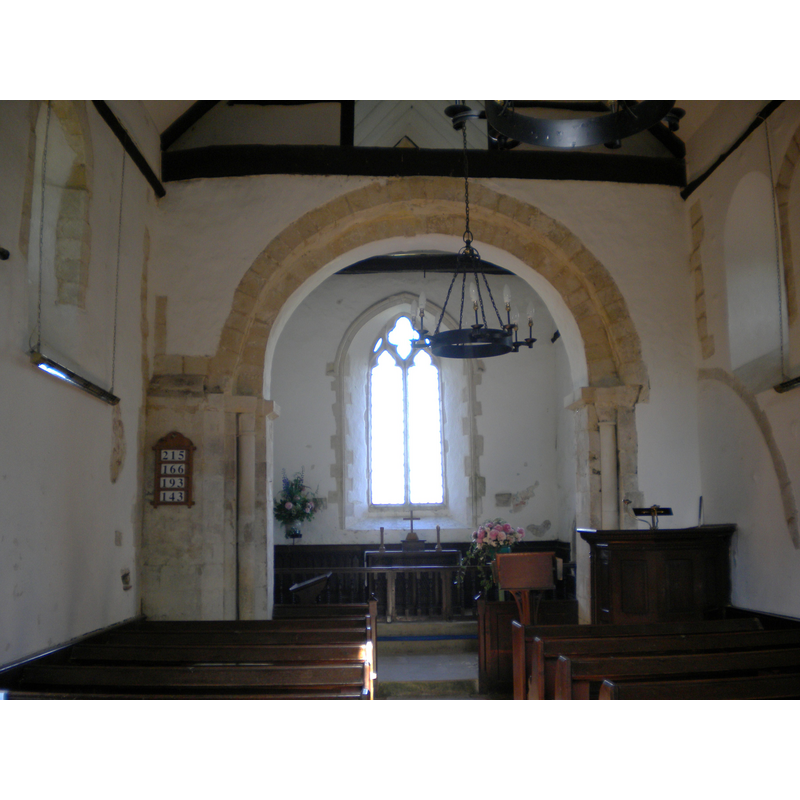
Copyright Statement: Image copyright © [in the public domain]
Image Source: digital photograph taken 27 June 2010 by Charlesdrakew [http://en.wikipedia.org/wiki/File:Buncton_Chapel_chancel_arch_2.JPG] [accessed 24 October 2012]
Copyright Instructions: Released by its author into the public domain
INFORMATION
Font ID: 18204BUN
Object Type: Baptismal Font1?
Church / Chapel Name: Parish Church of All Saints [formerly a chapel of ease to Wiston]
Church Patron Saint(s): All Saints
Church Address: Water Lane, Buncton, West Sussex BN44 3DD
Site Location: West Sussex, South East, England, United Kingdom
Directions to Site: Located off the A24, just S of Wiston, 10 km NW of Shoreham
Ecclesiastic Region: Diocese of Chichester
Historical Region: Hundred of West Grinstead -- Rape of Bramber -- Sussex
Additional Comments: disappeared font? (the one from the 11thC or 12thC church here) -- A Sheela na gig-like image on the outside of the church was destroyed: "the figure on the floor was that of an erotic pagan carving that had stood undisturbed in the church for eight centuries. It was attacked with a chisel and left in more than a hundred pieces. [...] The rare stonework, of a figure with its genitals exposed, is believed to have served as a warning against lust. It is not clear whether the 8in figure, carved over an archway at All Saints Church, Buncton, was male or female. [...] Caroline Mercer, an expert in church restoration, said: "It is a cross between what might be considered pagan and Christian. I am hopeful we can restore it, but whether it will ever return to the church is open to question." [source: Adrian Lee's 'Pagan whodunnit grips village', in The Times (issue of 20 December 2004) -- (c) Times Newspapers Ltd, 2004 [Factiva Document T000000020041220e0ck0002p]]
Font Notes:
Click to view
The Victoria County History (Sussex, vol. 6, pt. 2, 1986) notes: "There was a church at Buncton by the late 11th or 12th century, as is clear from architectural evidence. [...] Buncton was a parish by 1323 [...] The structure is late 11th- or 12th-century; the north and south doorways are of that date, as is the plain chancel arch of two orders. [...] Medieval fittings are a 14th-century piscina and two possibly 15th-century image brackets on the east wall. In 1602 there was neither font nor pulpit." [NB: we have no information on the font of the 11th-12th century church here].
COORDINATES
UTM: 30U 684694 5643472
Latitude & Longitude (Decimal): 50.9133, -0.3726
Latitude & Longitude (DMS): 50° 54′ 47.88″ N, 0° 22′ 21.36″ W
REFERENCES
- Victoria County History [online], University of London, 1993-. URL: https://www.british-history.ac.uk.