Worthing nr. Brighton
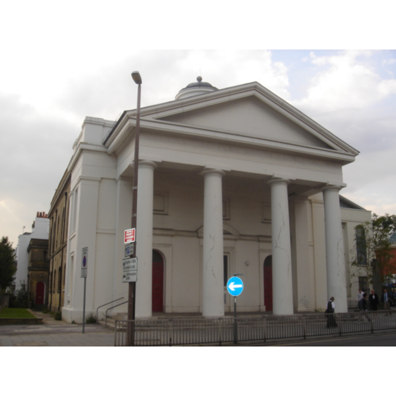
Image copyright © [in the public domain]
Released by its author into the public domain
Results: 1 records
view of church exterior - west end
Copyright Statement: Image copyright © [in the public domain]
Image Source: digital photograph taken 18 September 2008 by The Voice of Hassocks [http://en.wikipedia.org/wiki/File:St_Paul%27s_Church,_Worthing_01.JPG] [accessed 22 October 2012]
Copyright Instructions: Released by its author into the public domain
INFORMATION
Font ID: 18199WOR
Object Type: Baptismal Font1
Font Century and Period/Style: 15th century, Perpendicular
Church / Chapel Name: Parish Church of St. Paul [formerly a chapel] [closed in 1966 - now a cafe and community venue]
Font Location in Church: Inside the church, behind the portico [cf. FontNotes]
Church Patron Saint(s): St. Paul
Previous Font Location(s): The Cathedral of Chichester? [cf. FontNotes]
Church Notes: Built in 1812, "designed by J. B. Rebecca, and the interior was finished by Edward Hide of Worthing." [cf. VCH entry in FontNotes]
Church Address: Ambrose Place, Worthing, West Sussex BN11 1EB
Site Location: West Sussex, South East, England, United Kingdom
Directions to Site: Located on Ambrose Place, Worthing
Ecclesiastic Region: Diocese of Chichester
Historical Region: Hundred of Brightford -- Rape of Bramber -- Sussex
Additional Comments: disappeared font? (from the 13thC chapel here)
Font Notes:
Click to view
The Victoria County History (Sussex, vol. 6, pt. 1, 1980) notes: "A chapel at Worthing was recorded in 1291, [...] and in 1410 was being used for mass. [...] The chapel still existed in the early 16th century, [...] but by 1575 was in private hands. [...] It had been demolished by 1635 [...] That site is unknown". The VCH (ibid.) further notes that a new chapel -later a church- dedicated to St. Paul was built in the early-19th century, and "In 1894 the dean and chapter of Chichester presented a font, probably 15th-century, from the cathedral." [NB: we have no information on the font from the original 13th-century chapel here -- all other churches in Worthing are also 19th-century or later].
COORDINATES
UTM: 30U 685179 5632402
Latitude & Longitude (Decimal): 50.8137, -0.3713
Latitude & Longitude (DMS): 50° 48′ 49.32″ N, 0° 22′ 16.68″ W
MEDIUM AND MEASUREMENTS
Material: stone
Font Shape: octagonal, mounted
Basin Interior Shape: round
Basin Exterior Shape: octagonal
REFERENCES
- Victoria County History [online], University of London, 1993-. URL: https://www.british-history.ac.uk.