West Stoke
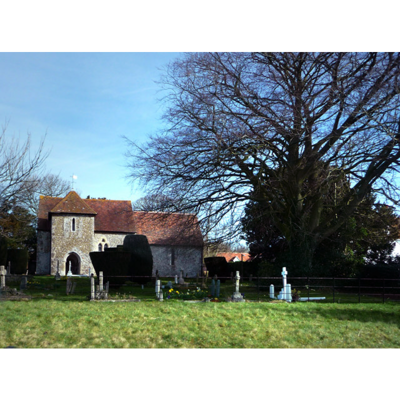
Image copyright © Chris Gunns, 2009
CC-BY-SA-3.0
Results: 2 records
view of church exterior - south view
Copyright Statement: Image copyright © Chris Gunns, 2009
Image Source: digital photograph taken 15 March 2009 by Chris Gunns [www.geograph.org.uk/photo/1206655] [accessed 19 September 2012]
Copyright Instructions: CC-BY-SA-3.0
view of church interior - nave - looking west

Copyright Statement: Image copyright © Fenifur [Jennifer Porrett], 2012
Image Source: Font digital photograph taken 4 April 2012 by Fenifur [Jennifer Porrett] [www.flickr.com/photos/fenifursnippets/6961439668/] [accessed 19 September 2012]
Copyright Instructions: PERMISSION NOT AVAILABLE -- IMAGE NOT FOR PUBLIC USE
INFORMATION
Font ID: 18188STO
Object Type: Baptismal Font1
Font Century and Period/Style: 11th - 13th century, Medieval
Church / Chapel Name: Parish Church of St. Andrew
Font Location in Church: [cf. FontNotes]
Church Patron Saint(s): St. Andrew
Church Address: Downs Rd, West Stoke, West Sussex, PO18 9BN
Site Location: West Sussex, South East, England, United Kingdom
Directions to Site: Located off the B2178, near Funtington
Ecclesiastic Region: Diocese of Chichester
Historical Region: Hundred of Bosham -- Rape of Chichester -- Sussex
Additional Comments: disappeared font? (was it buried in the churchyard in the 19th century?)
Font Notes:
Click to view
No mention of a font here in Harrison (1920), who dates the church to the Eaarly English period. The Victoria County History (Sussex, vol. 4, 1953) notes: "The 11th-century church consisted of a nave and chancel; this was probably the second church mentioned in Domesday Book under Bosham. [...] In the 13th century the chancel was remodelled and extended, or, more probably, rebuilt [...] The communion table, font, [...] and other fittings are modern." The VCH entry (ibid.), however, notes: "The ancient font was tub-shaped, there is a crude drawing of it in Add. MS. 5699." [NB: the old font may have been removed in one of the renovations that ocurred in this church in the 19th century -- we have no information on its present whereabouts]. A 1937 plan of the church interior reproduced in the VCH (ibid.) shows a font located at the west end of the nave. A recent [April 2012] photograph of the church interior shows a modern font at the west end of the nave: octagonal basin with decorated sides, raised on a plain octagonal stem and a circular lower base. Flat wooden cover.
COORDINATES
UTM: 30U 652908 5637820
Latitude & Longitude (Decimal): 50.871812, -0.826761
Latitude & Longitude (DMS): 50° 52′ 18.52″ N, 0° 49′ 36.34″ W
MEDIUM AND MEASUREMENTS
Material: stone
REFERENCES
- Victoria County History [online], University of London, 1993-. URL: https://www.british-history.ac.uk.
- Harrison, Frederick, Notes on Sussex churches, Hove: Combridges, 1920, p. 194