Westbourne / Bourne / West Bourne
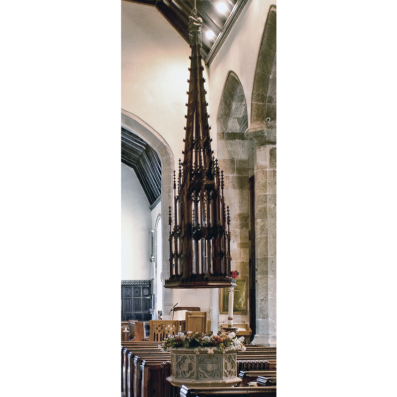
Image copyright © Anguskirk, 2011
CC-BY-SA-3.0
Results: 3 records
view of font and cover
Scene Description: the modern font and its cover
Copyright Statement: Image copyright © Anguskirk, 2011
Image Source: detail of a digital photograph taken 18 October 2011 by Anguskirk [www.flickr.com/photos/anguskirk/6278394856/] [accessed 18 September 2012]
Copyright Instructions: CC-BY-SA-3.0
view of church exterior - southeast view
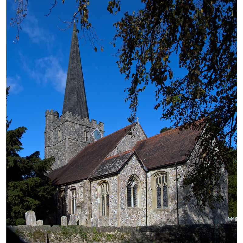
Copyright Statement: Image copyright © Anguskirk, 2011
Image Source: digital photograph taken 18 October 2011 by Anguskirk [www.flickr.com/photos/anguskirk/6277866701/] [accessed 18 September 2012]
Copyright Instructions: CC-BY-SA-3.0
view of font and cover in context
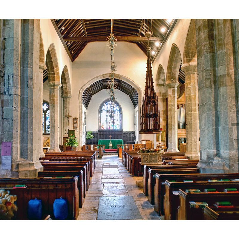
Scene Description: the modern font and cover in the context of the nave; looking east towards the altar
Copyright Statement: Image copyright © Anguskirk, 2011
Image Source: digital photograph taken 18 October 2011 by Anguskirk [www.flickr.com/photos/anguskirk/6278394856/] [accessed 18 September 2012]
Copyright Instructions: CC-BY-SA-3.0
INFORMATION
Font ID: 18181WES
Object Type: Baptismal Font1
Font Century and Period/Style: 11th century, Medieval
Church / Chapel Name: Parish Church of St. John the Baptist
Font Location in Church: [cf. FontNotes]
Church Patron Saint(s): St. John the Baptist
Church Address: Westbourne Rd., Westbourne, West Sussex, PO10 8UL
Site Location: West Sussex, South East, England, United Kingdom
Directions to Site: Located 1 km NE of Emsworth,
Ecclesiastic Region: Diocese of Chichester
Historical Region: Hundred of Westbourne and Singleton -- Rape of Chichester -- Sussex
Additional Comments: disappeared font? (the medieval font(s) here) -- disused font: Buried in the churchyard ca. 1865? [cf. FontNotes]
Font Notes:
Click to view
The Domesday Survey mentions a church at Bourne, aka Westbourne, but nothing of that church remains. Walker (1908) reports that an earlier font, similar to the present one, was buried in the churchyard upon installation of the modern one [cf. infra]. Harrison (1920) reports a "fine (modern) carved cover to font", but does not comment on the font itself. The Victoria County History (Sussex, vol. 4, 1953) reports the church going back to the early-13th century, but does not mention a font in it. The Parish web site [www.westbourneparish.org.uk/nave.html] [accessed 18 September 2012] notes: "The font, with its elaborate wooden cover, was presented in 1865 by Mr. Sperling, the old font then being buried in the churchyard." [NB: the buried font is probably also a late one]. The modern font consists of an octagonal basin raised on a pedestal base; there is a very tall openwork font cover opertaed by a pulley; the cover is probably of the same date as the modern font. [NB: we have no information on the medieval font here].
COORDINATES
UTM: 30U 645835 5636347
Latitude & Longitude (Decimal): 50.8604, -0.9278
Latitude & Longitude (DMS): 50° 51′ 37.44″ N, 0° 55′ 40.08″ W
REFERENCES
- Victoria County History [online], University of London, 1993-. URL: https://www.british-history.ac.uk.
- Harrison, Frederick, Notes on Sussex churches, Hove: Combridges, 1920, p. 208
- Walker, A.K., An introduction to the study of English fonts, with details of those in Sussex, 1908, p.32