North Marden
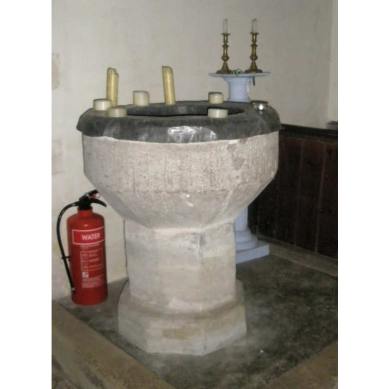
Image copyright © Basher Eyre, 2008
CC-BY-SA-3.0
Results: 2 records
view of font
Copyright Statement: Image copyright © Basher Eyre, 2008
Image Source: digital photograph taken 27 December 2008 by Basher Eyre [www.geograph.org.uk/photo/1093402] [accessed 18 September 2012]
Copyright Instructions: CC-BY-SA-3.0
view of church exterior - southwest end
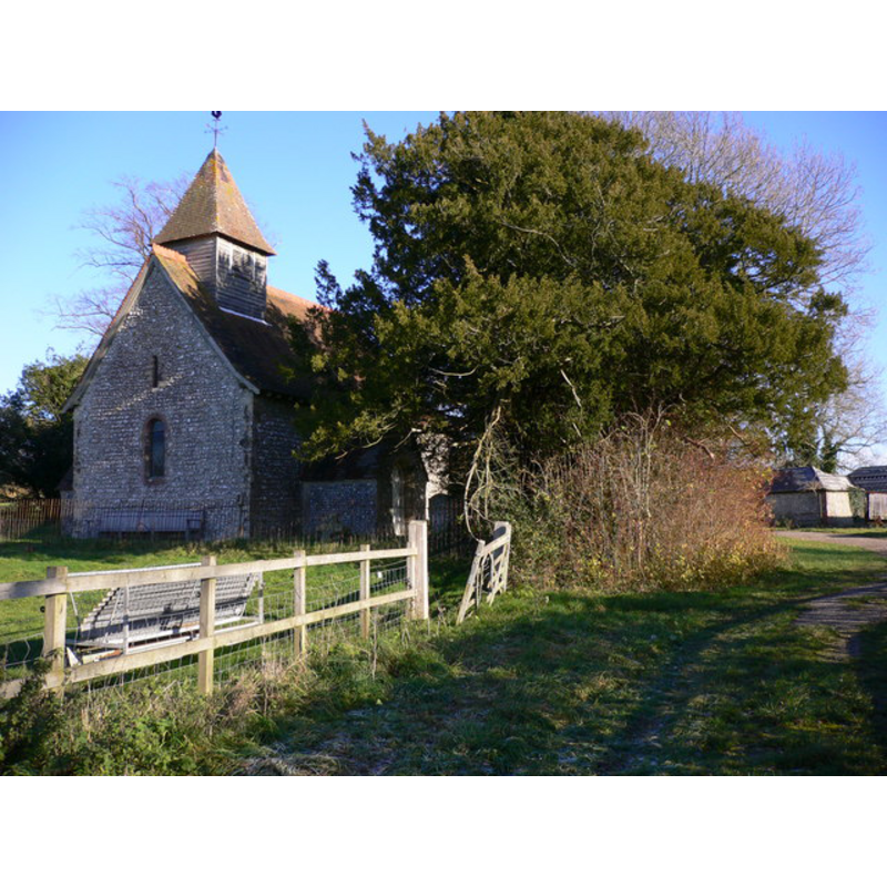
Copyright Statement: Image copyright © Shazz, 2010
Image Source: digital photograph taken 26 November 2010 by Shazz [www.geograph.org.uk/photo/2176608] [accessed 18 September 2012]
Copyright Instructions: CC-BY-SA-3.0
INFORMATION
Font ID: 18177MAR
Object Type: Baptismal Font1
Font Date: ca. 1100?
Font Century and Period/Style: 11th - 12th century [basin only] / 14th century [base only -- composite font?], Medieval / composite
Church / Chapel Name: Parish Church of St. Mary
Font Location in Church: Inside the church, at the SW end of the nave
Church Patron Saint(s): St. Mary the Virgin
Church Address: North Marden, West Sussex, PO18 9JD
Site Location: West Sussex, South East, England, United Kingdom
Directions to Site: Located off (W) the B2141, between Chilgrove and South Harting, 12 km N of Chichester
Ecclesiastic Region: Diocese of Chichester
Historical Region: Hundred of Westbourne and Singleton -- Rape of Chichester -- Sussex
Additional Comments: altered font: 12thC tub font modified in the 14thC to fit new octagonal base [cf. FontNotes]
Font Notes:
Click to view
Harrison (1920) reports a "large font" in this very small Norman church of ca. 1100. The Victoria County History (Sussex, vol. 4, 1953) notes: "The church of North Marden seems to have been founded by Geoffrey son of Azo late in the 12th century. [...] The font appears originally to have been tub-shaped, of the 12th century or earlier; later the lower part was reshaped to fit it on to an octagonal base." The VCH plan of the church interior of 1938 shows the font at the west end of the nave, south side, just west of the south door. The font consists of a round basin the lower half (?) of it appears to have been re-cut to fit the later octagonal base [cf. supra]; the basin is fitted with a new metal lining that folds over the upper rim and hides it.
COORDINATES
UTM: 30U 650886 5645255
Latitude & Longitude (Decimal): 50.939152, -0.852394
Latitude & Longitude (DMS): 50° 56′ 20.95″ N, 0° 51′ 8.62″ W
MEDIUM AND MEASUREMENTS
Material: stone, sandstone?
Font Shape: round, mounted
Basin Interior Shape: round
Basin Exterior Shape: round
REFERENCES
- Victoria County History [online], University of London, 1993-. URL: https://www.british-history.ac.uk.
- Harrison, Frederick, Notes on Sussex churches, Hove: Combridges, 1920, p. 150