Trotton / Traitone
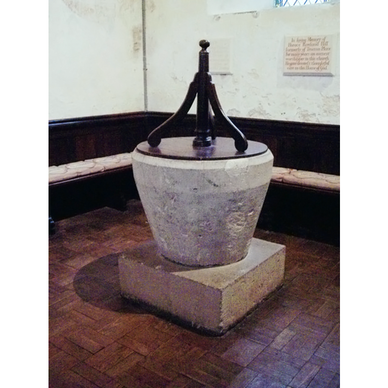
Image copyright © Miss Steel, 2007
CC-BY-SA-3.0
Results: 3 records
view of font and cover
Scene Description: the square lower base is modern
Copyright Statement: Image copyright © Miss Steel, 2007
Image Source: digital photograph taken 21 February 2007 by Miss Steel [www.geograph.org.uk/photo/357323] [accessed 1 August 2012]
Copyright Instructions: CC-BY-SA-3.0
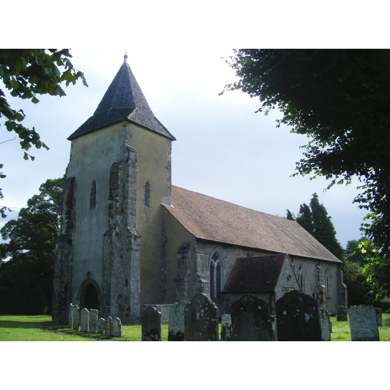
view of church exterior - southwest view
Copyright Statement: Image copyright © Tango, 2009
Image Source: digital photograph taken 19 July 2009 by Tango [http://en.wikipedia.org/wiki/File:Trotton_church.JPG] [accessed 1 August 2012]
Copyright Instructions: CC-BY-SA-3.0
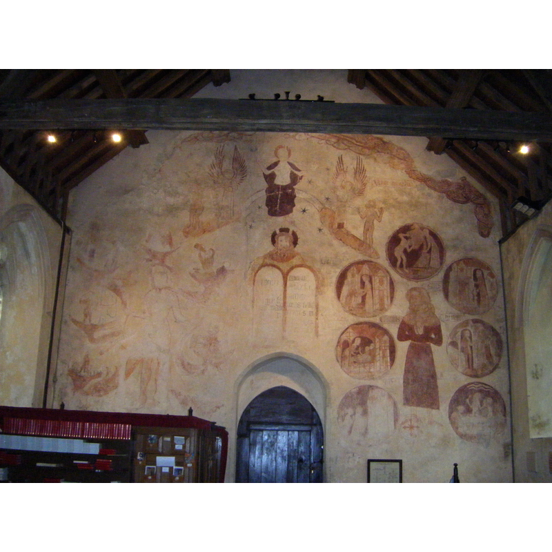
view of church interior - west end
Copyright Statement: Image copyright © Tango, 2009
Image Source: digital photograph taken 19 July 2009 by Tango [http://en.wikipedia.org/wiki/File:Trotton_church_-_west_wall.JPG] [accessed 1 August 2012]
Copyright Instructions: CC-BY-SA-3.0
INFORMATION
Font ID: 18120TRO
Object Type: Baptismal Font1
Font Century and Period/Style: 12th century [basin only], Medieval [composite]
Church / Chapel Name: Parish Church of St. George
Font Location in Church: Inside the church, in the NW corner of the nave
Church Patron Saint(s): St. George
Church Notes: Good Last Judgment paintings on the W wall, perhaps 14thC [described in the VCH entry] -- Grimm executed "A watercolour drawing of a monument in the chancel of Trotton Church in (West) Sussex drawn in 1780 by S.H. Grimm", but not the font
Church Address: Trotton, West Sussex, GU31 5EN
Site Location: West Sussex, South East, England, United Kingdom
Directions to Site: Located on the A272, 11 km W of Midhurst
Ecclesiastic Region: Diocese of Chichester
Historical Region: Hundred of Dumpford -- formerly Sussex
Additional Comments: disappeared font? (the one from the 11thC church here)
Font Notes:
Click to view
The Domesday Book entry for Traitone [Trotton] [http://domesdaymap.co.uk/place/SU8322/trotton/] [accessed 1 August 2012] records a church here. Font noted in Walker (1908), Drummond-Roberts (1935) and Harrison (1920; the latter describes the font utb-shaped, of the Norman period, topped with an early-17th century font cover. The Victoria County History (Sussex, vol. 4, 1953) notes that, with the exception of the 17th century porch, "the rest of the building is of the early 14th. [...] The font, probably 12th-century, is tub-shaped and stands on a square base; its wooden cover is of the 17th century." Described and illustrated in the CRSBI (2008): "A plain, tapering, tub font set directly on a square plinth. There are traces of locks to W, N and S, and there is a damaged area on the rim to the E." The presence of the 12th-century font here suggests an earlier church here, though not the one recorded in 1086. [NB: we have no information on the font of the 11th-century church here].
COORDINATES
UTM: 30U 653700 5651652
Latitude & Longitude (Decimal): 50.995893, -0.809682
Latitude & Longitude (DMS): 50° 59′ 45.22″ N, 0° 48′ 34.85″ W
MEDIUM AND MEASUREMENTS
Material: stone
Font Shape: tub-shaped
Basin Interior Shape: round
Basin Exterior Shape: round
Rim Thickness: 9.5 cm [calculated]
Diameter (inside rim): 58.5 cm*
Diameter (includes rim): 77 cm*
Basin Total Height: 61 cm*
Font Height (less Plinth): 61 cm*
Font Height (with Plinth): 89 cm*
Notes on Measurements: * [CRSBI (2008)]
LID INFORMATION
Date: 17th century?
Material: wood, oak
Apparatus: no
Notes: [cf. FontNotes]
REFERENCES
- Victoria County History [online], University of London, 1993-. URL: https://www.british-history.ac.uk.
- Corpus of Romanesque Sculpture in Britain and Ireland, The Corpus of Romanesque Sculpture in Britain and Ireland, The Corpus of Romanesque Sculpture in Britain and Ireland. URL: http://www.crsbi.ac.uk.
- Drummond-Roberts, Maud F., Some Sussex fonts, photographed and described, Brighton: Southern Publishing Co., 1935, p. 93
- Harrison, Frederick, Notes on Sussex churches, Hove: Combridges, 1920, p. 202
- Walker, A.K., An introduction to the study of English fonts, with details of those in Sussex, 1908, p. 46-47