Gloucester No. 8 / Glouuecestre / Glowecestre
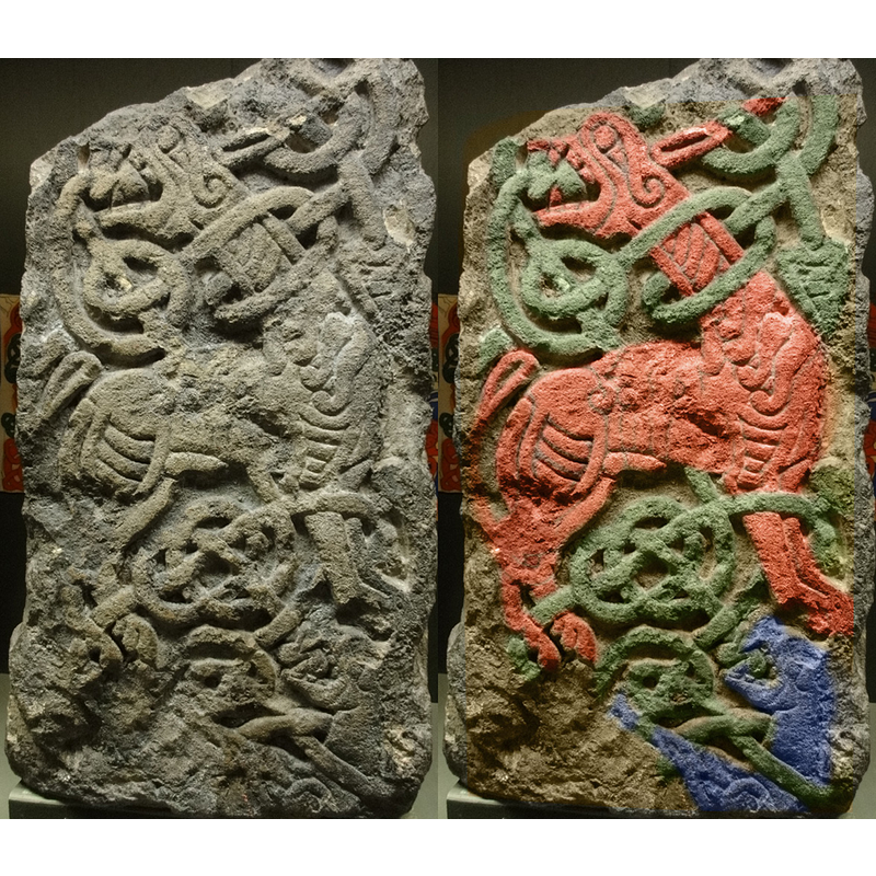
Image copyright © Fæ, 2010
CC-BY-SA-3.0
Results: 2 records
view of church exterior - cross
Scene Description: fragment of a cross from St Oswald's Priory: "Original in the Gloucester City museum. Left hand shows original and right hand shows false colour version to pick out the figures and knots. Found in a wall near St. Oswald's Priory, Gloucester, this cross fragment is dated to the 9th Century." [source: Fæ http://en.wikipedia.org/wiki/File:St_Oswald%27s_Priory_Anglo-Saxon_cross.jpg [accessed 21 June 2012] CCL
Copyright Statement: Image copyright © Fæ, 2010
Image Source: digital photograph taken 24 July 2010 by Fæ [http://en.wikipedia.org/wiki/File:St_Oswald%27s_Priory_Anglo-Saxon_cross.jpg] [accessed 21 June 2012]
Copyright Instructions: CC-BY-SA-3.0
view of church exterior
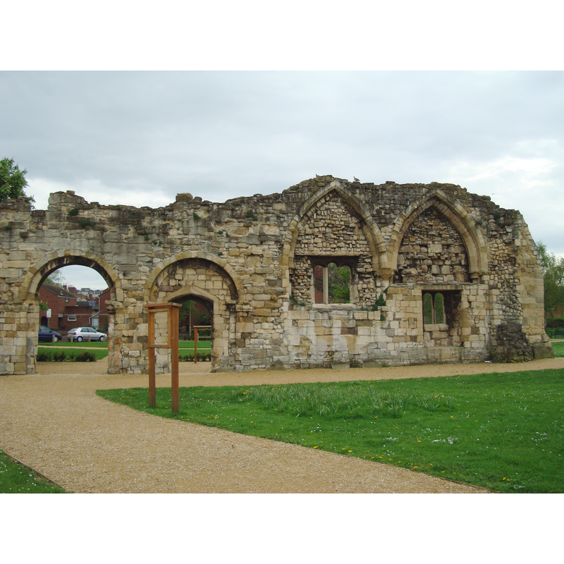
Scene Description: the ruins of the old priory
Copyright Statement: Image copyright © [in the public domain]
Image Source: digital photograph taken 4 May 2008 by John Armagh [http://en.wikipedia.org/wiki/File:Gloucester_StOswaldsPriory.JPG] [accessed 21 June 2012]
Copyright Instructions: Released by its author into the public domain
INFORMATION
Font ID: 18085GLO
Object Type: Baptismal Font1?
Font Century and Period/Style: Medieval
Church / Chapel Name: Parish Church of St. Catherine [part of former priory church of St. Oswald] [demolished ca. 1650]
Church Patron Saint(s): St. Catherine of Alexandria [aka Katherine, Katharine] [St. Oswald]
Church Address: [cf. FontNotes]
Site Location: Gloucestershire, South West, England, United Kingdom
Directions to Site: [cf. FontNotes]
Ecclesiastic Region: Diocese of Gloucester
Historical Region: Hundred of Dudstone
Additional Comments: disappeared font? [cf. FontNotes]
Font Notes:
Click to view
There are five entries for Gloucester [variant spellings] in the Domesday survey [https://opendomesday.org/place/SO8318/gloucester/] [accessed 12 April 2020] none of which mentions priest or church in it. The Victoria County History (Gloucester, vol. 4, 1988) notes: "The church was part, the north transept and aisle, of the former priory church of St. Oswald. [...] St. Oswald's church, which had been accounted a royal free chapel [...] The parish and church were renamed St. Catherine after the Dissolution, although the former name was frequently used. [...] The city corporation pulled down St. Catherine's church in the mid 1650s [...] A new church built for St. Catherine's parish in the late 1860s [...] and later called St. Catharine [...] was replaced in 1915 by a church at Wotton." The VCH (ibid.) further notes that there are no baptismal registers for this parish prior to 1684. [NB: we have no information on the font from the medieval church here].
COORDINATES
UTM: 30U 551789 5746780
Latitude & Longitude (Decimal): 51.8694, -2.2478
Latitude & Longitude (DMS): 51° 52′ 9.84″ N, 2° 14′ 52.08″ W
REFERENCES
- Victoria County History [online], University of London, 1993-. URL: https://www.british-history.ac.uk.