Oxford No. 28 / Oxeneford
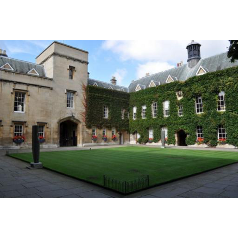
Image copyright © Fishashley, 2010
CC-BY-SA-3.0
Results: 1 records
view of context
Scene Description: Lincoln College quadrangle, site of the former Church of St. Mildred [cf. FontNotes]
Copyright Statement: Image copyright © Fishashley, 2010
Image Source: digital photograph taken 14 December 2010 by Fishashley [http://en.wikipedia.org/wiki/File:Lincoln_quad_front.jpg] [accessed 20 June 2012]
Copyright Instructions: CC-BY-SA-3.0
INFORMATION
Font ID: 18078OXF
Object Type: Baptismal Font1?
Font Century and Period/Style: 12th century, Late Norman
Church / Chapel Name: Church of St. Mildred [suppressed in 1427]
Church Patron Saint(s): St. Mildrith [aka Mildred, Mildþrȳð, Mildryth, Mildthryth]
Church Address: Lincoln College, Turl Street, Oxford OX1 3DR [cf. FontNotes]
Site Location: Oxfordshire, South East, England, United Kingdom
Directions to Site: [originally located in the present grounds of the quadrangle at Lincoln College, on Turl Street]
Ecclesiastic Region: [Diocese of Oxford]
Historical Region: Hundred of Headington
Additional Comments: disappeared font? (the one from the disappeared church here)
Font Notes:
Click to view
There are thirteen entries for Oxford [variant spelling] in the Domesday survey [http://opendomesday.org/place/SP5106/oxford/] [accessed 10 November 2016]; two of them mentions a church in each. The Victoria County History (Oxford, vol. 4, 1979) notes: "The church, which stood on a site later occupied by the front quadrangle of Lincoln College, was granted to St. Frideswide's priory in 1122. [...] the church was suppressed in 1427 for the foundation of Lincoln College." [NB: we have no information on the medieval font here; Loncoln College Chapel does still offer baptism services in it: "The College Chaplain is very happy to prepare current fellows, staff and students for baptism or confirmation in the Chapel. This usually takes place during full-term. All services are conducted according to the rites and ceremonies of the Church of England." [source: www.linc.ox.ac.uk/BaptismandConfirmation [accessed 20 June 2012]].
COORDINATES
UTM: 30U 620386 5735035
Latitude & Longitude (Decimal): 51.75326, -1.255905
Latitude & Longitude (DMS): 51° 45′ 11.74″ N, 1° 15′ 21.26″ W
REFERENCES
- Victoria County History [online], University of London, 1993-. URL: https://www.british-history.ac.uk.