Oxford No. 25 / Oxeneford
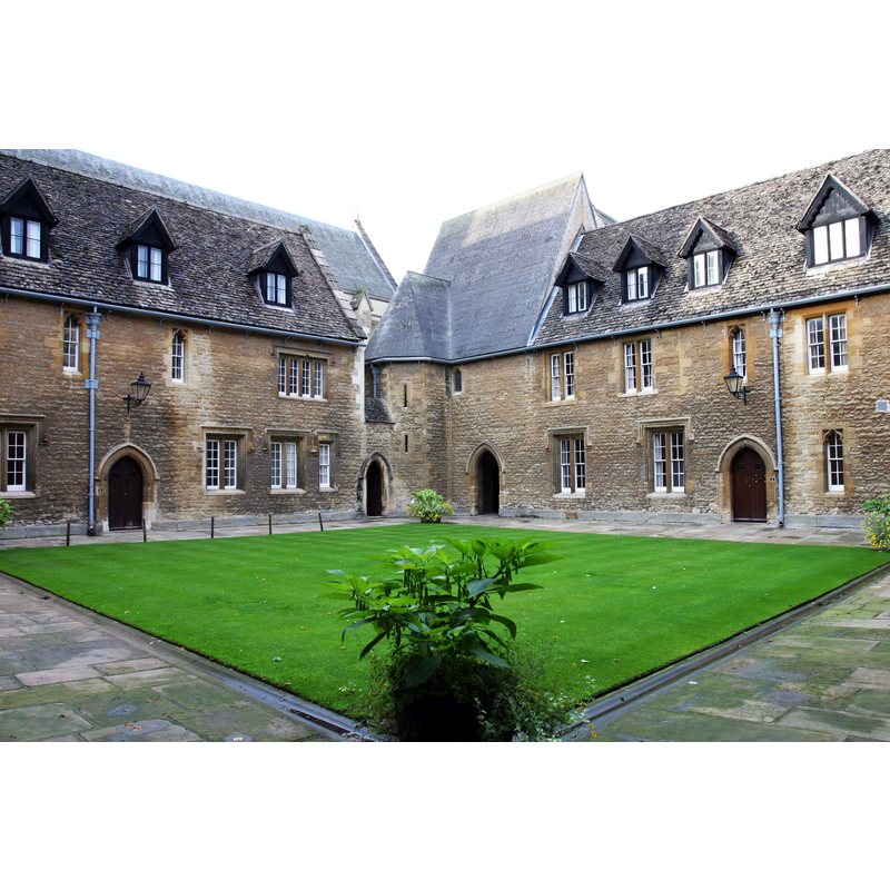
Image copyright © Tom Murphy VII, 2005
CC-BY-SA-3.0
Results: 3 records
view of church exterior
Scene Description: Northeast angle of the Mob Quadrangle, Merton College
Copyright Statement: Image copyright © Tom Murphy VII, 2005
Image Source: digital photograph taken 25 August 2005 by Tom Murphy VII [http://en.wikipedia.org/wiki/File:Mob_Quad.jpg] [accessed 19 June 2012]
Copyright Instructions: CC-BY-SA-3.0
view of context
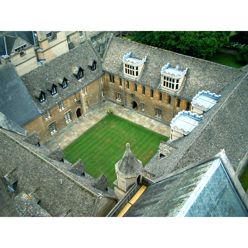
Scene Description: Merton College quadrangle: upper view -- the disappeared church of St. John the Baptist stood on the site of the north range of the Quadrangle
Copyright Statement: Image copyright © DWR, 2003
Image Source: digital phtograph taken 27 June 2003 by DWR [http://en.wikipedia.org/wiki/File:Mob_Quad_from_Chapel_Tower.jpg] [accessed 19 June 2012]
Copyright Instructions: CC-BY-SA-3.0
view of context
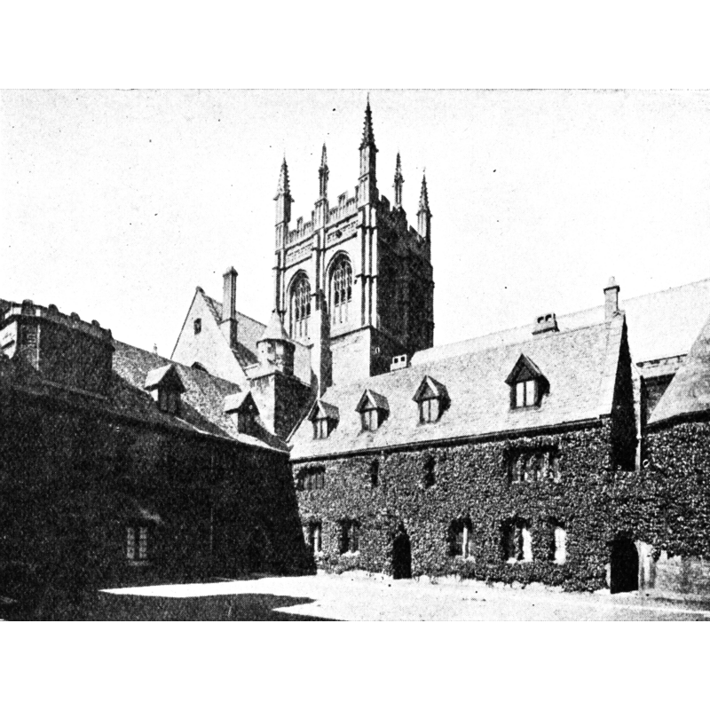
Scene Description: Northwest angle of the Mob Quadrangle, Merton College, ca.1910
Copyright Statement: Image copyright © [in the public domain]
Image Source: half-tone illustration ca.1910 [http://en.wikipedia.org/wiki/File:Merton-college-mob-quad-half-tone-1910.jpg] [accessed 19 June 2012]
Copyright Instructions: PD
INFORMATION
Font ID: 18075OXF
Object Type: Baptismal Font1?
Font Century and Period/Style: 12th - 13th century, Transitional / Early English
Church / Chapel Name: Parish Church of St. John the Baptist [disappeared]
Church Patron Saint(s): St. John the Baptist
Church Address: [originally located "on the site of the north range of Mob Quadrangle in Merton College" [cf. FontNotes]]
Site Location: Oxfordshire, South East, England, United Kingdom
Directions to Site: ***NOT to be mistaken with the present chapel of Merton College*** [Merton College is located on Merton Street, off High Street, in central Oxford]
Ecclesiastic Region: [Diocese of Oxford]
Historical Region: Hundred of Headington
Additional Comments: disappeared font? (the one from the disappeared medieval church here)
Font Notes:
Click to view
There are thirteen entries for Oxford [variant spelling] in the Domesday survey [http://opendomesday.org/place/SP5106/oxford/] [accessed 10 November 2016]; two of them mentions a church in each. The Victoria County History (Oxford, vol. 4, 1979) notes: "The church, which stood on the site of the north range of Mob Quadrangle in Merton College, existed by c. 1206. [...] Merton appropriated the church in 1292 [...] and it became the college chapel [...] until 1847 [...] when, as a result of the abolition of peculiar jurisdictions in the diocese, the bishop claimed authority over the church. Friction between the bishops and the college over the dual nature of the church and the status of its minister continued until its closure in 1891 [...] Throughout the period 1292-1891 the parochial function of St. John's was subsidiary to its function as a college chapel. [...] In 1891 the church ceased to be parochial, and the parish was united with St. Peter-in-the-East." [NB: we have no information on the medieval font of this church]. [cf. Index entry for Oxford No. 26 for the present chapel of Merton College].
COORDINATES
UTM: 30U 620634 573476
Latitude & Longitude (Decimal): 51.7508, -1.2524
Latitude & Longitude (DMS): 51° 45′ 2.88″ N, 1° 15′ 8.64″ W
REFERENCES
- Victoria County History [online], University of London, 1993-. URL: https://www.british-history.ac.uk.