Hemington nr. Lockington
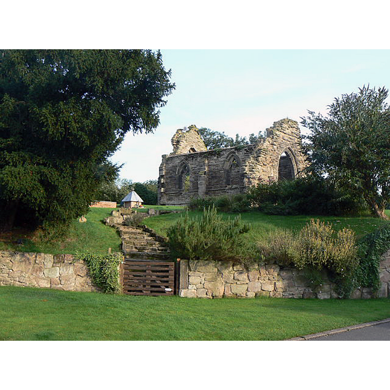
Image copyright © Alan Murray-Rust, 2009
CC-BY-SA-2.0
Results: 3 records
view of church exterior in context
Scene Description: Source caption: "Hemington Chapel. Out of use since the sixteenth century it has become progressively more ruinous. Still shown on the 1:50000 maps as a 'church with tower', the latter collapsed in the 1980s. View from the north west; it now stands in private grounds."
Copyright Statement: Image copyright © Alan Murray-Rust, 2009
Image Source: digital photograph taken 8 August 2009 by Alan Murray-Rust [www.geograph.org.uk/photo/1436855] [accessed 12 October 2019]
Copyright Instructions: CC-BY-SA-2.0
view of church exterior - east end - detail
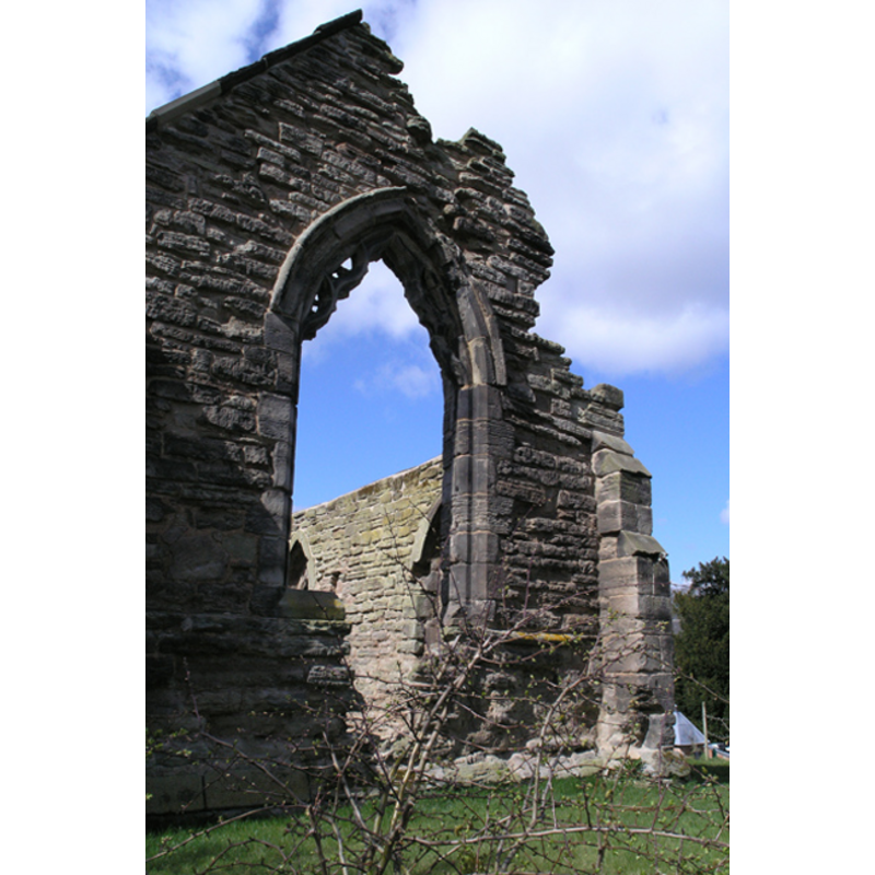
Scene Description: the ruins of the old parish church
Copyright Statement: Image copyright © David Lally, 2008
Image Source: digital photograph taken 30 March 2008 by David Lally [www.geograph.org.uk/photo/745111] [accessed 16 May 2012]
Copyright Instructions: CC-BY-SA-2.0
view of church interior - chancel
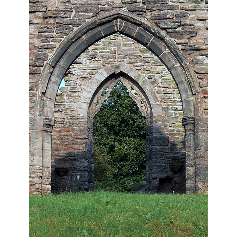
Scene Description: Source caption: "Hemington Chapel. What remains is the chancel of the church, with a fine Decorated period chancel arch and the remains of reticulated tracery of the same period in the east window."
Copyright Statement: Image copyright © Alan Murray-Rust, 2009
Image Source: digital photograph taken 8 August 2009 by Alan Murray-Rust [www.geograph.org.uk/photo/1436860] [accessed 12 October 2019]
Copyright Instructions: CC-BY-SA-2.0
INFORMATION
Font ID: 18042HEM
Object Type: Baptismal Font1?
Font Century and Period/Style: 13th - 14th century, Medieval
Church / Chapel Name: Old Parish Church [in ruins]
Church Notes: The ruins are Listed (Grade II) in English Heritage [Listing NGR: SK4570227798]
Church Address: Church Lane, Lockington, Leicestershire DE74 2RB
Site Location: Leicestershire, East Midlands, England, United Kingdom
Directions to Site: A hamlet or township of Lockington, it is located 3 km W of Kegworth Acres, across the Harrington bridge from Sawley (Derbs.), and SW of Castle Donnington (Derbs.)
Additional Comments: disappeared font? (the one from the ruins here)
Font Notes:
Click to view
The old church is now in ruins; it is said to have been abandoned since the Dissolution [1536-1541] of Henry VIII's time. Lewis (1848) entry for nearby Lockington notes: "Hemington was anciently a separate parish, and had a church, of which there are still large remains, partly converted into two dwellings, adjoining the ruins of the tower". The old church is now in ruins; one local story reports this church has been abandoned since the Dissolution [1536-1541] of Henry VIII's time; another story gives a later date for the abandonment towards the end of the 16th century, during Elizabeth's reign [sources for both stories unavailable or not recorded] [NB: we have no information on its medieval font].
COORDINATES
UTM: 30U 612957 5856432
Latitude & Longitude (Decimal): 52.845773, -1.322758
Latitude & Longitude (DMS): 52° 50′ 44.78″ N, 1° 19′ 21.93″ W