Fordham nr. Colchester / For[de]ham
![Main image for Fordham nr. Colchester / For[de]ham](/static-50478a99ec6f36a15d6234548c59f63da52304e5/compressed/1120430009_compressed.png)
Image copyright © www.camulos.com, 2012
No known copyright restriction / Fair Dealing
Results: 6 records
view of font and cover
Scene Description: the cover on the ground, to the left of the modern font
Copyright Statement: Image copyright © www.camulos.com, 2012
Image Source: digital photograph in www.camulos.com/fordham/church.htm [accessed 18 April 2012]
Copyright Instructions: No known copyright restriction / Fair Dealing
view of church exterior - southwest end
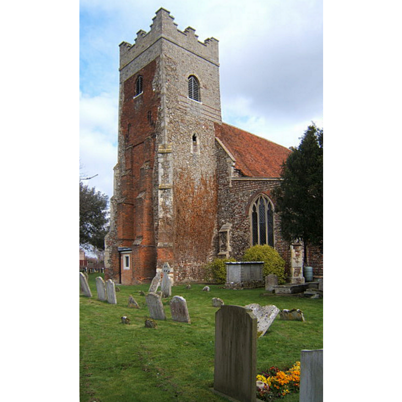
Copyright Statement: Image copyright © Andrew Hill, 2008
Image Source: digital photograph taken 24 March 2008 by Andrew Hill [www.geograph.org.uk/photo/736415] [accessed 14 June 2018]
Copyright Instructions: CC-BY-SA-2.0
view of church exterior in context - southeast view
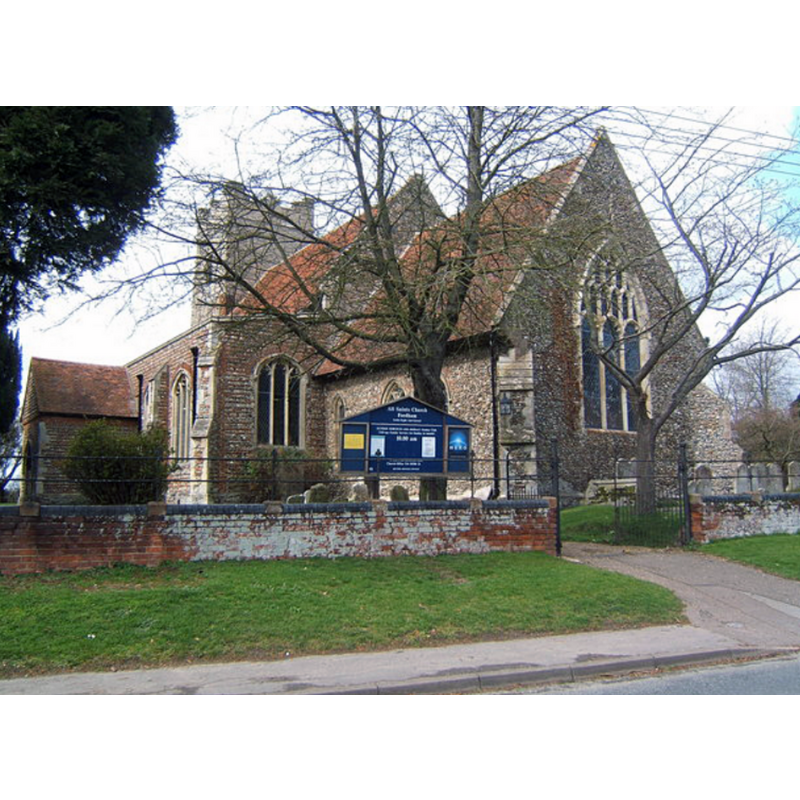
Copyright Statement: Image copyright © Andrew Hill, 2008
Image Source: digital photograph taken 24 March 2008 by Andrew Hill [www.geograph.org.uk/photo/736394] [accessed 14 June 2018]
Copyright Instructions: CC-BY-SA-2.0
view of church exterior - southeast view
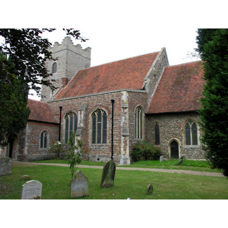
Copyright Statement: Image copyright © John Whitworth, 2012
Image Source: digital photograph taken by John Whitworth [www.essexchurches.info/church.asp?p=Fordham] [accessed 18 April 2012]
Copyright Instructions: Standing permission
view of font in context
Copyright Statement: Image copyright © www.camulos.com, 2012
Image Source: digital photograph in www.camulos.com/fordham/church.htm [accessed 18 April 2012]
Copyright Instructions: No known copyright restriction / Fair Dealing
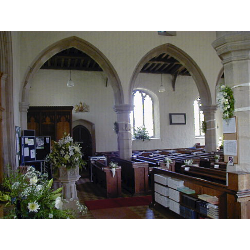
view of church interior - nave - looking west
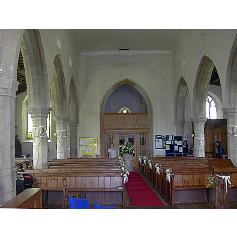
Scene Description: the modern font and cover at the far end
Copyright Statement: Image copyright © www.camulos.com, 2012
Image Source: digital photograph in www.camulos.com/fordham/church.htm [accessed 18 April 2012]
Copyright Instructions: No known copyright restriction / Fair Dealing
INFORMATION
Font ID: 18000FOR
Object Type: Baptismal Font1?
Font Century and Period/Style: 11th century, Pre-Conquest? / Norman
Church / Chapel Name: Parish Church of All Saints
Church Patron Saint(s): All Saints
Church Notes: "The church of ALL SAINTS, Church Road, the invocation recorded in 1516" [cf. VCH entry in FootNotes]
Church Address: Church Road, Fordham, Colchester CO6 3NN, UK
Site Location: Essex, East, England, United Kingdom
Directions to Site: Located off (E) the A1124, NW of Colchester
Ecclesiastic Region: Diocese of Chelmsford
Historical Region: Hundred of Lexden
Additional Comments: disappeared font? (the one from the 11thC church here)
Font Notes:
Click to view
There are four entries for this Fordham [variant spelling] in the Domesday survey [http://opendomesday.org/place/TL9228/fordham/] [accessed 14 June 2018], none of which mentions priest or church in it. The Victoria County History (Essex, vol. 10, 2001) notes: "William I [1086-1087] gave Fordham church to Bec abbey in Normandy in 1087 [...] The nave is probably 11th- or early 12th-century, but the church was largely rebuilt in the earlier 14th century"; there is no mention of a font in the VCH entry for this parish. The present font, an octagonal basin on a pedestal base, is modern and located at the west end of the nave. The entry for this church in Historic England [Listing NGR: TL9275028087] mentions no font in it. [NB: we have no information on the medieval font of this church].
Credit and Acknowledgements: We are grateful to John Whitworth, of www.essexchurches.info, for his photograph of this church
COORDINATES
UTM: 31U 348792 5754193
Latitude & Longitude (Decimal): 51.91792, 0.80132
Latitude & Longitude (DMS): 51° 55′ 4.51″ N, 0° 48′ 4.75″ E
REFERENCES
- Victoria County History [online], University of London, 1993-. URL: https://www.british-history.ac.uk.