East Donyland / Dunilanda / Dunulunda / Rowhedge
Results: 5 records
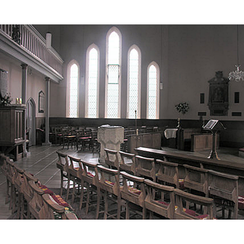
view of font
view of font
view of church exterior - southwest view
![Source caption: "St Lawrence Church, East Donyland [...] is sometimes called St Lawrence Church, Rowhedge as it is in the settlement of Rowhedge".](/static-50478a99ec6f36a15d6234548c59f63da52304e5/compressed/1180614068_compressed.png)
Scene Description: Source caption: "St Lawrence Church, East Donyland [...] is sometimes called St Lawrence Church, Rowhedge as it is in the settlement of Rowhedge".
Copyright Statement: Image copyright © Hamish Griffin, 2014
Image Source: edited detail of a digital photograph taken 13 June 2014 by Hamish Griffin [www.geograph.org.uk/photo/4027648] [accessed 14 June 2018]
Copyright Instructions: CC-BY-SA-2.0
view of church exterior in context
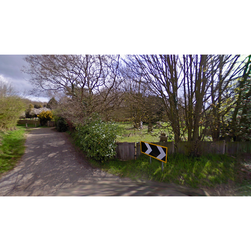
Scene Description: the site of the disappeared Old St. Lawrence's, East Donyland
Copyright Statement: Image copyright © Hellen Barrell's Essex & Suffolk Surnames, 2018
Image Source: digital photograph in Hellen Barrell's Essex & Suffolk Surnames [http://essexandsuffolksurnames.co.uk/wp-content/uploads/2017/08/corner-lane.png] [accessed 14 June 2018]
Copyright Instructions: No known copyright restriction / Fair Dealing
view of church exterior in context
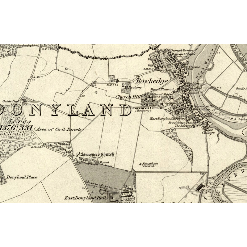
Scene Description: The site of the old church is seen in this map in the northwest corner of the East Donyland Hall lands
Copyright Statement: Image copyright © National Library of Scotland, 2018
Image Source: digital image of a 1881 map in the National Library of Scotland, reproduced in Hellen Barrell's Essex & Suffolk Surnames [http://essexandsuffolksurnames.co.uk/where-was-east-donylands-old-church/] [accessed 14 June 2018]
Copyright Instructions: No known copyright restriction / Fair Dealing
INFORMATION
Font ID: 17999DON
Object Type: Baptismal Font1?
Font Century and Period/Style: 12th century, Medieval
Church / Chapel Name: Old Parish Church of St. Laurence [demolished ca. 1840]
Font Location in Church: [cf. FontNotes]
Church Patron Saint(s): St. Lawrence [aka Laurence]
Church Address: [the modern church: Church Hill, Rowhedge, Colchester CO5 7EB, UK]
Site Location: Essex, East, England, United Kingdom
Directions to Site: Located off (E) the B1025, SSE of Colchester
Ecclesiastic Region: Diocese of Chelmsford [formerly in the Diocese of Rochester]
Historical Region: Hundred of Lexden
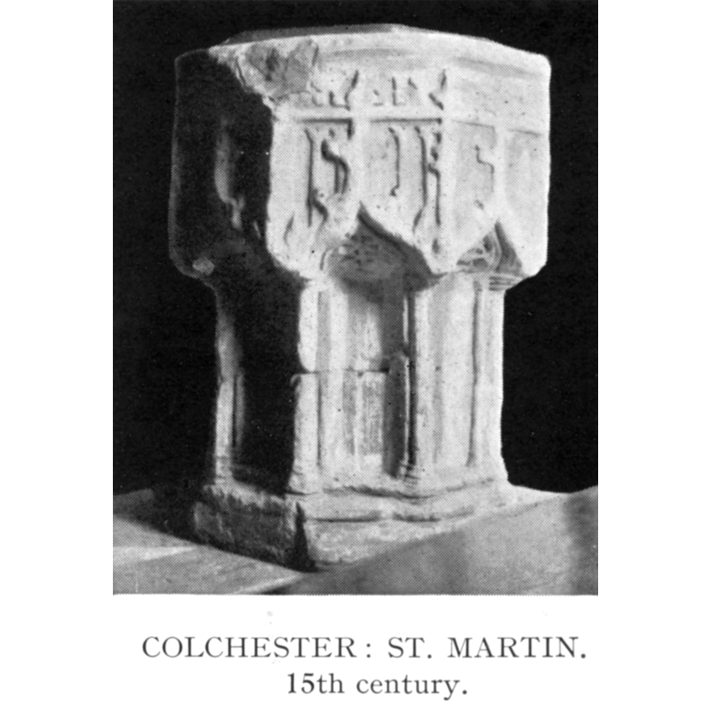
Additional Comments: disappeared font? (from the church known here ca. 1178?) -- moved font/recycled font: the font originally from Colchester St. Martin's
Town/City Wikipedia: https://en.wikipedia.org/wiki/East_Donyland
Font Notes:
Click to view
There are five entries for [East] Donyland [variant spelling] in the Domesday survey [http://opendomesday.org/place/TM0120/east-donyland/] [accessed 14 June 2018], none of which mentions priest or church in it. The Victoria County History (Essex, vol. 10, 2012) notes: "The advowson of East Donyland church was confirmed to St. John's abbey, Colchester, in 1178, and the abbey retained it until the Dissolution [...] The medieval church of St. Laurence, [...] demolished c. 1840, stood on the east side of the Fingringhoe road, just north of East Donyland Hall. [...] It may have been 12th-century in origin, but was remodelled if not rebuilt in the 13th century. [...] The church was replaced in 1837-8 by an octagonal building of white brick, c. ½ mile east of the old church on the outskirts of the growing village of Rowhedge [...] described in [...] as the ugliest parish church in England, [...] The interior was re-ordered in 1969 when the floor was replaced, the pews re- arranged, the 14th-century font from St. Martin's, Colchester, placed in the centre of the nave". The VCH (Essex, vol. 9, 1994) reports a 15th-century font, formerly from East Donyland, moved to Colchester St Leonard's. The entry for this modern church in Historic England [Listing NGR: TM0299521556] mentions no font in it.
COORDINATES
Latitude & Longitude (Decimal): 51.8557, 0.9463
Latitude & Longitude (DMS): 51° 51' 20" N, 0° 56' 46" E
REFERENCES
- Victoria County History [online], University of London, 1993-. URL: https://www.british-history.ac.uk.
- Victoria County History [online], University of London, 1993-. URL: https://www.british-history.ac.uk.