Blundeston
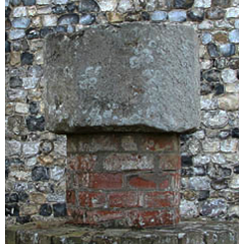
Image copyright © Evelyn Simak, 2009
CC-BY-SA-3.0
Results: 6 records
B01: design element - patterns - unidentified
Copyright Statement: Image copyright © Evelyn Simak, 2009
Image Source: digital photograph taken 27 September 2009 by Evelyn Simak [www.geograph.org.uk/photo/1510643] [accessed 1 March 2012]
Copyright Instructions: CC-BY-SA-3.0
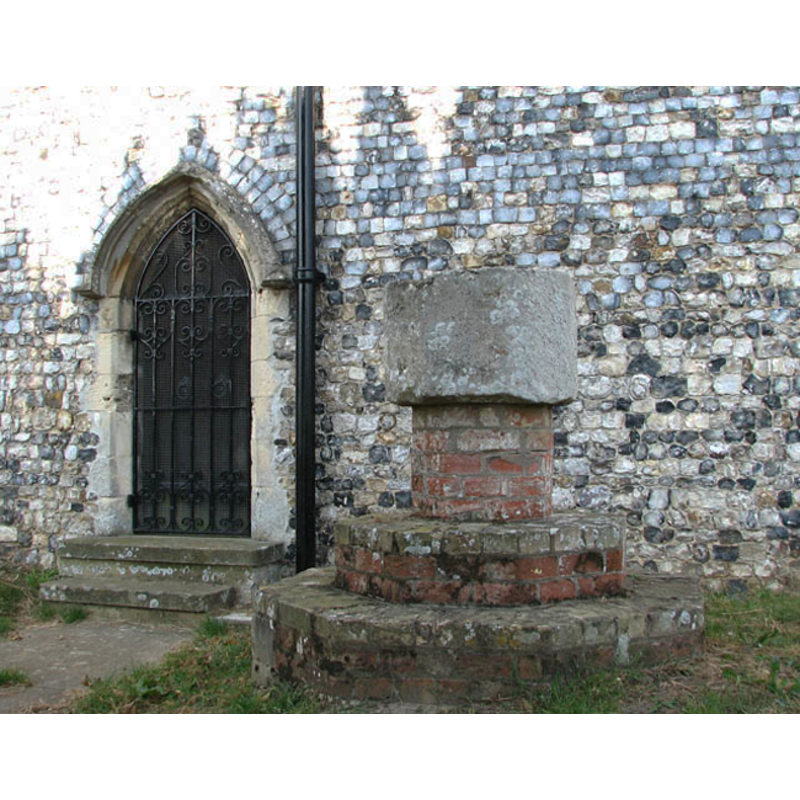
view of font
Scene Description: the font from Flixton St. Andrew's, now outise Blundeston St. Mary's; only the basin is original
Copyright Statement: Image copyright © Evelyn Simak, 2009
Image Source: detail of a digital photograph taken 27 September 2009 by Evelyn Simak [www.geograph.org.uk/photo/1510586] [accessed 1 March 2012]
Copyright Instructions: CC-BY-SA-3.0
view of font in context
Scene Description: the font from Flixton St. Andrew's, now outise Blundeston St. Mary's; only the basin is original
Copyright Statement: Image copyright © Evelyn Simak, 2009
Image Source: digital photograph taken 27 September 2009 by Evelyn Simak [www.geograph.org.uk/photo/1510586] [accessed 1 March 2012]
Copyright Instructions: CC-BY-SA-3.0
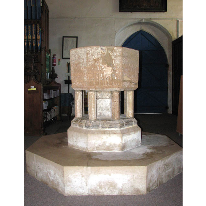
view of font
Scene Description: the 14th-century (?) font inside the church [cf. FontNotes]
Copyright Statement: Image copyright © Evelyn Simak, 2009
Image Source: digital photograph taken 27 September 2009 by Evelyn Simak [www.geograph.org.uk/photo/1510643] [accessed 1 March 2012]
Copyright Instructions: CC-BY-SA-3.0
view of church exterior - southwest view
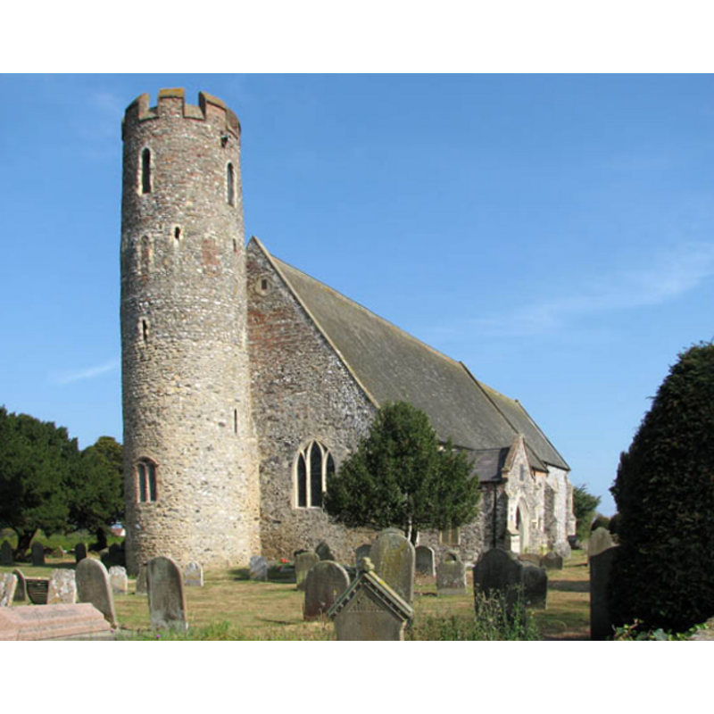
Copyright Statement: Image copyright © Evelyn Simak, 2009
Image Source: digital photograph taken 27 September 2009 by Evelyn Simak [www.geograph.org.uk/photo/1510544] [accessed 1 March 2012]
Copyright Instructions: CC-BY-SA-3.0
view of church exterior - southwest view
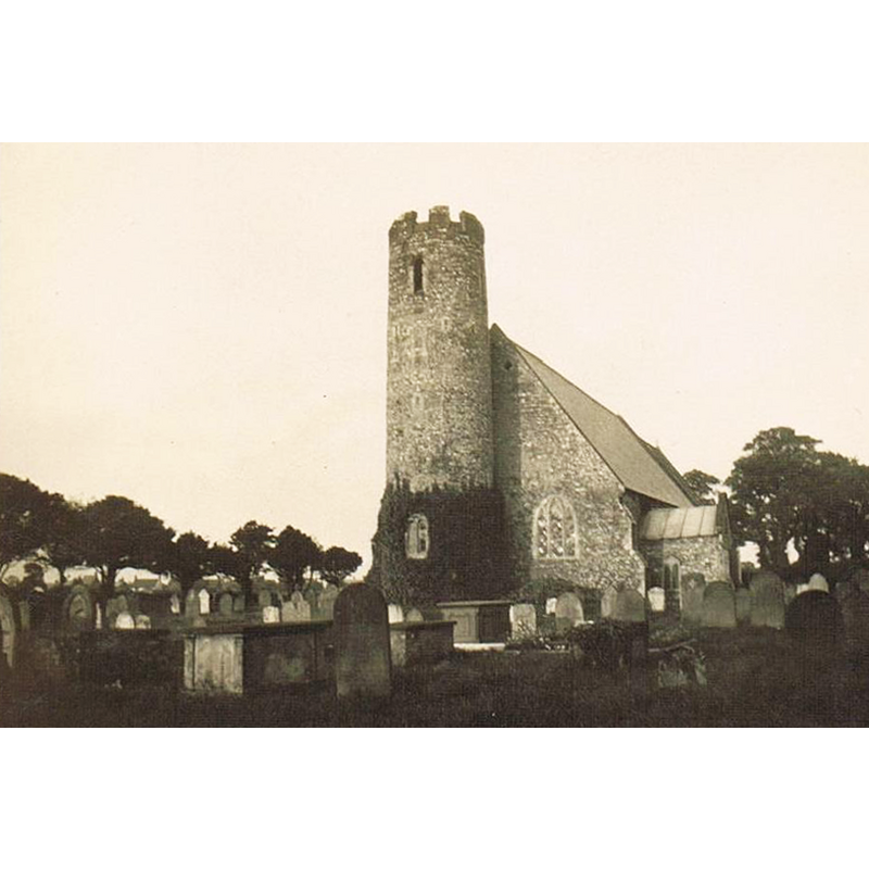
Copyright Statement: Image copyright © Arobson, 1930
Image Source: photograph taken 28 September 1930 by Arobson [http://en.wikipedia.org/wiki/File:Blundeston_Church.JPG] [accessed 1 March 2012]
Copyright Instructions: CC-BY-SA-3.0
INFORMATION
Font ID: 17951BLU
Object Type: Baptismal Font1
Font Century and Period/Style: 14th century, Medieval
Church / Chapel Name: Parish Church of St. Mary the Virgin
Font Location in Church: Inside the church
Church Patron Saint(s): St. Mary
Church Notes: the CofE www.achurchnearyou.com/blundeston-st-mary-the-virgin/ entry for Blundeston gives the diocese as Norwich, though most surrounding churches are in the diocese of St Edmundsbury & Ipswich
Church Address: Church Road, Blundeston, Suffolk, NR32 5AX
Site Location: Suffolk, East Anglia, England, United Kingdom
Directions to Site: St. Mary, Blundeston, can be found a mile W of the A1117 Lowestoft bypass, just short of the northern junction with the A12. (S. Knott)
Ecclesiastic Region: Diocese of Norwich
Historical Region: Hundred of Wangford? / Lothingland?
Additional Comments: disappeared font? (the font from the original Norman church?)
Font Notes:
Click to view
Suckling (1846-1848) writes: "The Church at Blundeston, which is a rectory dedicated to St. Mary, and now consolidated with the adjoining benefice of Flixton [...] The tower, which is circular and small in diameter, [...] exhibits decided marks of Norman erection, and was probably attached to an earlier edifice than the present church [...] The registers of Blundeston commence in 1558." There is no mention of a font in Suckling (ibid.), who shows the first recorded rector of Blundeston to be Adam Bacun, in 1312. Described and illustrated in Knott's Suffolk Churches: "The font dates from the 12th century, a plain, octagonal bowl set on 8 relief legs." The font appears monolithic, having three distinct volumes: the plain octagonal basin, an upper base consisting of a very broad octagonal stem and the eight constructional colonnettes; the third volume is another plain octagonal volume, splaying slightly ouwards at the bottom. [NB: the other font, located outside, by the priest's door, is the former vessel from Flixton St. Andrew's, a nearby parish church now in ruins [cf. Index entry for Flixton nr. Blundeston].
COORDINATES
UTM: 31U 411983 5819106
Latitude & Longitude (Decimal): 52.51495, 1.702928
Latitude & Longitude (DMS): 52° 30′ 53.82″ N, 1° 42′ 10.54″ E
REFERENCES
- Knott, Simon, The Suffolk Churches Site, Simon Knott, 1999-. [standing permission to reproduce images received from Simon [February 2005]. URL: www.suffolkchurches.co.uk.
- Suckling, Alfred, The History and Antiquities of the County of Suffolk, with genealogical and architectural notices of its several towns and villages, London: John Weale [...], 1846-1848, [www.british-history.ac.uk/report.aspx?compid=75139] [accessed 1 March 2012]